Terrain
Road Map
Satellite
Hybrid
Terrain

 | Adoxaceae 1. Viburnum opulus L. var. opulus U.S.A., Oregon, Multnomah County: Southeast Portland. Powell Butte Park. 500 meters north of Johnson Creek. Elev. 250-480 ft. 45.480145°, -122.51111°. Datum: WGS 84. Coordinate uncertainty: 36 meters. Georeferenced by Dominic Maze. Coordinate Source: Digital Map. Remnant mature ash swale at south base of butte. High water table. Inflorescence less than 5 centimeters across. Several plants. Reproductive state: Flowers & Fruits. Origin: Introduced. HPSU: 23485 Dominic Maze 1741Jun 8, 2021 |  HPSU_023485.jpg |
 | Adoxaceae 2. Viburnum opulus L. var. opulus United States, Washington, Klickitat: East Cascades Ecoregion: rim of Haul Road north of Hwy 142, 0.25 miles NE of Klickitat, north of Klickitat River. T4N R13E S23 NW4 SW4 NE4. Elev. 560 ft 45.8218°, -121.1439°. Shady seep area with dense Cornus sericea, Populus trichocarpa, Acer, Quercus garryana, and Salix lutea. HerbariumSpecimenDuplicate: Viburnum opulus var. opulus https://intermountainbiota.org WS Walter Fertig 34974May 13, 2021 |
 | Adoxaceae 3. Viburnum opulus L. var. opulus U.S.A., Oregon, Multnomah County: Columbia Gorge Scenic Area, Mount Hood National Forest. Wahclella Falls Trail along Tanner Creek 100m S of parking lot. 45.6289° N, 121.9533° W Coordinate Source: Specimen Label. Riparian zone below basalt cliffs. Occasional. Growing with Acer macrophyllum, Cornus sericea. HPSU: 19965 Jeffrey T. Lesh 1127May 29, 2019 |
 | Adoxaceae 4. Viburnum opulus L.United States of America, Oregon, Multnomah County: Hoyt Arboretum: Located on west side of Maple Trail, where the trail intersects with a Connector Trail (to the Wildwood Trail), in a wet ditch area just below stairs. Elev. 775 45.51402°, -122.71737°. Datum: WGS84. HOYT: 2019-224/1 Mandy Tu Sep 5, 2019 |
 | Adoxaceae 5. Viburnum opulus L. var. opulus U.S.A., Washington, Snohomish County: Silver Creek Park. Growing next to boardwalk and bridge near wetlands. Elev. 87 m. 47.83103° N, 122.20367° W Georeferenced by Johnathon Rutledge. Coordinate Source: GPS. Tree Cover (90%): Salix sithensis, S. lasiandra, Populus trichocarpa, Thuja plicata, Pseudotsuga menziesii, Abeis grandis, and Alnus rubra. Shrub Cover (85%): Physocarpus capitatus, Cornus sericea, and Rubus bifrons. Emergent Cover (75%): Carex stipata, Polystichum munitum, Ranunculus repens, Phalaris arundinacea, and assorted grasses. Soil is dark in color with high organic content. Highly saturated, earthy scent. Woody shrub. Approximately 3 m in height. Leaves are green in color, grow opposite, palmate, 3-veined, 3-lobed. Plant is part of shrub canopy layer. Reproductive state: Flowers. UWB Johnathon Rutledge 23May 2018 |
 | Adoxaceae 6. Viburnum opulus L. var. opulus U.S.A., Oregon, Benton County: SW Corvallis; Brooklane Drive 40 meters south of Hawkeye Avenue. Elev. 70 m. 44.54165° N, 123.28429° W Coordinate Source: Specimen Label. Shore of slough, just above high-water line. Shrub, 3.5 meters tall; flowers white; outer flowers expanded; with Salix hookeriana, Crataegus monogyna, Rubus bifrons, Carex obnupta, Phalaris arundinacea. R. E. Brainerd 2744May 21, 2018WTU: 422197; WTU-V-057757 |  WTU-V-057757.jpg |
 | Adoxaceae 7. Viburnum opulus L. var. opulus U.S.A., Oregon, Multnomah County: Tryon Creek State Park. South end of Southwest 4th Ave., just past pavement. Elev. 320 ft. 45.44518°, -122.68341°. Datum: WGS 84. Georeferenced by Dominic Maze. Coordinate Source: Digital Map. Shaded and heavily disturbed forest at urban/natural area interface. Under Acer macrophyllum, Thuja, Pseudotsuga. One plant 2 meters tall. Reproductive state: Fruits. Origin: Introduced. HPSU: 21714 Dominic Maze 1380Sep 8, 2018With Olivia Duren, Zane Maze, Cyrene Maze |  HPSU_021714.jpg |
 | Adoxaceae 8. Viburnum opulus L. var. opulus U.S.A., Oregon, Benton County: SW Corvallis; Brooklane Drive 40 meters south of Hawkeye Avenue. Elev. 70 m. 44.54165° N, 123.28429° W Shore of slough, just above high-water line. With Salix hookeriana, Crataegus monogyna, Rubus bifrons, Carex obnupta, Phalaris arundinacea. Shrub, 3.5 meters tall; flowers white; outer flowers expanded. HPSU: 24019 Richard E. Brainerd 2744May 21, 2018 |
 | Adoxaceae 9. Viburnum opulus L. var. americanum AitonCanada, British Columbia: Windermere Lake, 5.1 km due south-southeast of, east of railroad tracks, Columbia River wetland shore. Elev. 805 m 50.363167°, -115.896°. Swampy shore, with Cornus stolonifera. Some stressed shrubs foliage turning rusty red; orange fruit forming; large patch. UBC: V253304 Frank Lomer 11358Aug 12, 2018 |
 | Adoxaceae 10. Viburnum opulus L. var. opulus Canada, British Columbia: Metro Vancouver, Pitt Meadows, Ford Road, south side, 130 m west of Baynes Road. Elev. 6 m 49.222333°, -122.70261°. Shrubby margin at ditch by vacant lot of disuded old tree nursery. Several plants in flower; apparently spread by birds. UBC: V253303 Frank Lomer 11075May 16, 2018 |
 | Adoxaceae 11. Viburnum opulus L. var. opulus United States, Oregon, Benton: SW Corvallis; Brooklane Drive 40 meters south of Hawkeye Avenue. Elev. 70 44.54165°, -123.28429°. Datum: WGS84. Shore of slough, just above high-water line. Salix hookeriana, Crataegus monogyna, Rubus bifrons, Carex obnupta, Phalaris arundinacea Shrub, 3.5 meters tall; flowers white; outer flowers expanded. https://oregonflora.org OSC-V-260559 R. E. Brainerdd 2744May 21, 2018 | 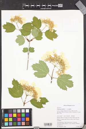 OSC-V-260559_lg.jpg |
 | Adoxaceae 12. Viburnum opulus L. var. opulus U.S.A., Oregon, Clackamas County: Oregon City. 45.347575° N, 122.531381° W Datum: WGS 84. Coordinate Source: Specimen Label. Farm border. Reproductive state: Flowers. HPSU: 18989 Jeffrey T. Lesh 268May 25, 2017 |  HPSU_018989.jpg |
 | Adoxaceae 13. Viburnum opulus L. var. opulus U.S.A., Washington, Snohomish County: Silver Creek Park. Growing next to boardwalk and bridge near wetlands. Elev. 87 m. 47.83103° N, 122.20367° W Georeferenced by Johnathon Rutledge. Coordinate Source: GPS. Tree Cover (90%): Salix sithensis, S. lasiandra, Populus trichocarpa, Thuja plicata, Pseudotsuga menziesii, Abeis grandis, and Alnus rubra. Shrub Cover (85%): Physocarpus capitatus, Cornus sericea, and Rubus bifrons. Emergent Cover (75%): Carex stipata, Polystichum munitum, Ranunculus repens, Phalaris arundinacea, and assorted grasses. Soil is dark in color with high organic content. Highly saturated, earthy scent. Woody shrub. Approximately 3m in height. Leaves are green in color, grow opposite, palmate, 3-veined, 3-lobed. Plant is part of shrub canopy layer. Fruit is present. Berries are red to orange or yellow in color. Reproductive state: Fruits. UWB: 000882; UWB 100778 Johnathon Rutledge 21Sep 16, 2017 |  UWB 100778.jpg |
 | Adoxaceae 14. Viburnum opulus L.United States of America, Oregon, Multnomah: Oaks Bottom Wildlife Refuge: Collected off of the Mosquito Hollow Trail. Near the riverside of the Springwater Corridor. Elev. 120 45.483526°, -122.65349°. Datum: WGS84. HOYT: 2017-244/1 Samantha Sharka Aug 30, 2017With Alex Martin |
 | Adoxaceae 15. Viburnum opulus L. var. opulus U.S.A., Washington, Pierce County: JBLM, Shannon Marsh 47.06697° N, 122.6162° W Datum: WGS84. Coordinate Source: GPS. One shrub with Symphoricarpos albus, Crataegus gaylussacia, Lonicera involucrata, Populus trichocarpa, Spiraea douglasii, Symphyotrichum sspicatus, Salix scouleri, Salix sitchensis Peter Dunwiddie PWD-17-469Jun 23, 2017With Peter Zika, Rod Gilbert WTU: 461189; WTU-V-117358 |  WTU-V-117358.jpg |
 | Adoxaceae 16. Viburnum opulus L. var. opulus U.S.A., Idaho, Bonner County: University of Idaho Extension Land, southeast of Sandpoint Airport and directly west of Highway 95; property southeast of intersection with N Boyer Ave and E Mt View Rd. Approximately 75 acres. Elev. 638 m. 48.292253° N, 116.554057° W Datum: WGS 84. Coordinate uncertainty: 310 meters. Georeferenced by Sarah J Jacobs. Coordinate Source: Digital Map. Disturbed forest and openings along waterway primarily dominated by Populus trichocarpa, Thuja plicata, Abies grandis, and Acer glabrum. Area includes abandoned agricultural fields, wooded areas, swampy flats, and drier meadows. ID: 174153; ID179524 David C. Tank 2016-002May 20, 2016With Sarah J. Jacobs, Hannah E. Marx, Baptiste R. Journaux, Diego F. Morales-Briones |  ID179524.jpg + 1 more image |
 | Adoxaceae 17. Viburnum opulus L. var. americanum AitonU.S.A., Washington, Pend Oreille County: Along Le Clerc Road North beside the Pend Oreille River. Elev. 2100 ft. 48° 35.793\' N, 117° 20.813\' W Coordinate Source: GPS. Riparian. Reproductive state: Flowers and Fruits. Origin: Native. Sandie Durand s.n.Jun 9, 2016WTU: 411736; WTU-V-026273 |  WTU-V-026273.jpg |
 | Adoxaceae 18. Viburnum opulus L. ssp. opulus Canada, Ontario: Ottawa, Rideau River trail. Elev. 58 m 45.42684°, -75.669783° Rich riparian soil with a mixture of deciduous shrubs, herbs, grasses, and trees almost all introduced species. Possibly planted, but occurring sporadically along river trail. Uncommon. Late flowering and young fruit. 2 duplicates. BABY-09673 B.A. Bennett 16-0102Jun 7, 2016With Blaney, Sean |
 | Adoxaceae 19. Viburnum opulus L. var. opulus Canada, British Columbia: Okanagan, 3.5 km northwest of Osoyoos Lake, 20 m west of Okanagan River canal dike. Elev. 285 m 49.099167°, -119.54933°. Alluvial meadow field, with Bromus inermis, Rosa woodsii. Densely clustered multi-stemmed shrub 4.5 m tall, leaves turning red, abundant ripe fruit; native to Eurasia. UBC: V251443 Frank Lomer 10357Sep 29, 2016 |
 | Adoxaceae 20. Viburnum opulus L. var. opulus U.S.A., Oregon, Multnomah County: Kelly Butte. 45.4986° N, 122.5569° W Coordinate Source: Specimen Label. Rocky butte with mixed deciduous/coniferous overstory. Associated species: Pseudotsuga, Abies grandis, Crataegus monogyna, Polystichum, Hedera hibernica. One mature tree and several smaller. Reproductive state: Vegetative. HPSU: 19086 Dominic Maze 285Oct 25, 2015 |  HPSU_019086.jpg |
 | Adoxaceae 21. Viburnum opulus L. var. opulus U.S.A., Washington, King County: UW Bothell Campus wetlands. Take paved trail out to boardwalk look-out and look down. Elev. 14 m. 47° 45\' 39" N, 122° 11\' 14.5" W Georeferenced by Sarah Verlinde. Coordinate Source: GPS. Growing on west side of North Creek in sandy bank and reaching sideways over creek. Tree cover (60%): Populus trichocarpa and Alnus rubra. Shrub cover (40%): Salix lasiandra and S. sitchensis. Emergent cover (30%): Phalaris arundinacea and Carex obnupta. Shrub is 2.5m tall. Leaves are medium green, with light green underside and slightly pubescent. New growth branches are light green, older branches and stems are papery and light brown. Glands on stem go inward/concave. Outer flowers/bracts are creamy white to light green (sterile). Inside umbel of flowers is not in bloom. Reproductive state: Flowers. UWB: 000350; UWB 100251 Sarah Verlinde 30May 11, 2015 |  UWB 100251.jpg |
 | Adoxaceae 22. Viburnum opulus L. var. opulus Canada, British Columbia: Okanagan, Penticton, Okanagan Lake, southeast shore, 2 km north-northeast of Penticton Yacht Club and Marina. Elev. 345 m 49.522694°, -119.57633°. Shrubby lakeshore, at water\'s edge, with Crataegus sp., Alnus incana. Two large clumps. UBC: V246580 Frank Lomer 9246May 20, 2015 |
 | Adoxaceae 23. Viburnum opulus L. var. americana Ait.Canada, Northwest Territories: Fort Liard, River Road. Elev. 206 m 60.23871°, -123.48016° Edge of lawn under Betula. Likely planted. No evidence of escaping. 3 m tall. Flowering and in bud. 1 duplicate. BABY-08914 B.A. Bennett 14-0057Jun 22, 2014With S.G. Cannings, R. Belland, J. Doubt |
 | Adoxaceae 24. Viburnum opulus L. var. opulus Canada, British Columbia: Greater Vancouver, Burnaby, Deer Lake, west shore, along boardwalk path. Elev. 22 m 49.236306°, -122.97841°. Boggy ground with Spiraea douglasii, Betula pendula, Pinus contorta, Pteridium aquilinum. 2 m tall weak-stemmed shrub with insect damaged leaves. UBC: V240791 Frank Lomer 8310Jun 10, 2013 |  V240791.jpg |
 | Adoxaceae 25. Viburnum opulus L. var. opulus Canada, British Columbia: Metro Vancouver, Burnaby, Deer Lake, west side. Elev. 21 m 49.237083°, -122.98297°. Boggy lakeshore. Fruits red; petiole glands saucer shaped; scattered plants on the western end of the lake. UBC: V241039 Frank Lomer 8583Sep 4, 2013 |  V241039.jpg |
 | Adoxaceae 26. Viburnum opulus L. var. opulus U.S.A., Oregon, Benton County: Northwest Corvallis; vacant area west of the medical center parking lot and northwest of the end of Satinwood Drive. Elev. 290 ft. UTM Zone 10, 479722E, 4939043N Datum: WGS 84. Moist meadow with scattered shrubs and small trees. With Crataegus monogyna, Malus xdomestica, Rubus bifrons, Schedonorus arundinaceus. Shrub, ca 2 meters tall. Reproductive state: Fruits. WTU: 394813 R. E. Brainerd 2095Oct 23, 2012 |
 | Adoxaceae 27. Viburnum opulus L. var. americanum AitonCanada, British Columbia: North Okanagan, 11 km due southwest of Sicamous, Mara Lake, southwest side. Elev. 348 m 50.738889°, -119.04888°. Wet sites at base of seepy mountain slope. A few plants noted near the lakeshore below the railroad tracks; fully expanded sterile flowers. UBC: V240378 Frank Lomer 7994Jun 12, 2012 |  V240378.jpg |
 | Adoxaceae 28. Viburnum opulus L. var. opulus Canada, British Columbia: Greater Vancouver, Pitt Meadows, Alouette River, south side, between dyke and blueberry field, 230 m west of Harris Road. Elev. 5 m 49.264167°, -122.6925°. Treed border by fence, with poplars and blackberries. Leaves turning orange in drought, mostly badly eaten by bugs, fruit orange, half ripe; single clump, others observed in the general area. UBC: V240497 Frank Lomer 8121Aug 27, 2012 | 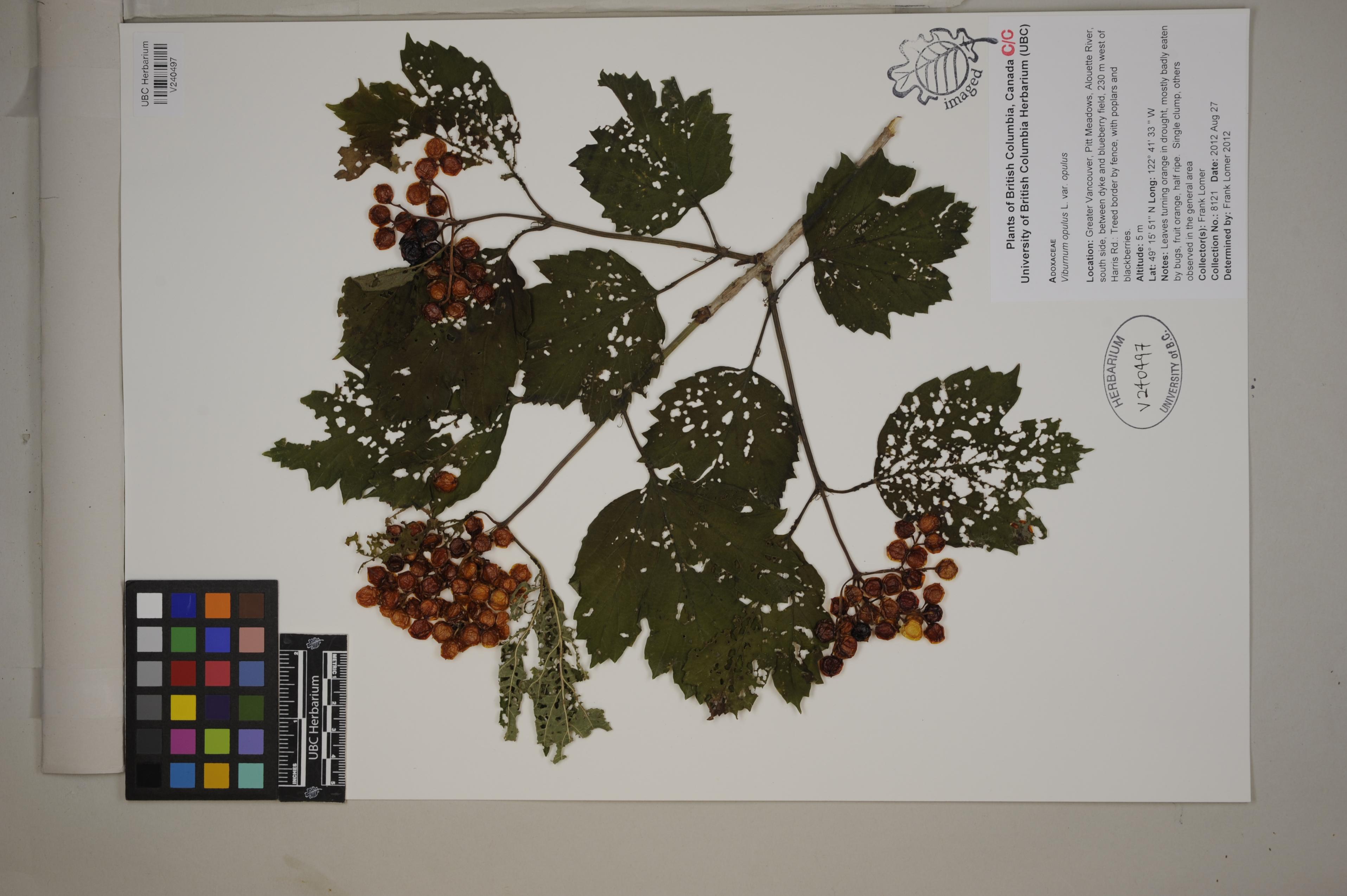 V240497.jpg |
 | Adoxaceae 29. Viburnum opulus L. var. opulus United States, Oregon, Benton: Northwest Corvallis; vacant area west of the medical center parking lot and northwest of the end of Satinwood Drive. Elev. 290 ft. 44.6044°, -123.2555°. Datum: WGS84. Georeferenced by [automated process-OregonFlora/OSU Herb]. Coordinate Source: OrlookId: 102900, StateProvince: Oregon, County: Benton, LocName: UTM Zone 10 479722E 4939043N. OregonFlora 1994-2020 methodology. Moist meadow with scattered shrubs and small trees. HerbariumSpecimenDuplicate: Viburnum opulus https://oregonflora.org Richard E. Brainerd 2095Oct 23, 2012With R.E. Brainerd OSC-V-027580; Accession Number: OSC239522 | 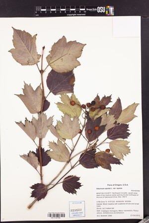 OSC-V-027580_lg.jpg |
 | Adoxaceae 30. Viburnum opulus L.U.S.A., Idaho, Ada County: Kathryn Albertson Park, west side of Boise River in central Boise, Elev. 816 m. 43.62° N, 116.23° W Coordinate Source: Specimen Label. Common scattered lax shrub, flowers white. CIC: 48099 Barbara Ertter 20745Jun 6, 2011 |  CIC048099.jpg |
 | Adoxaceae 31. Viburnum opulus L.United States, Oregon, Hood river: Along Forest Lane; vicinity Cascade Locks. Roadside with shrubs, ferns, forbs, grass, under hardwoods. Common name: Snowball. https://oregonflora.org OSC-V-259392 David Gross 688Jun 5, 2011 | 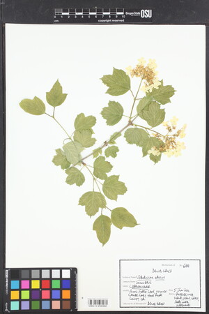 OSC-V-259392_lg.jpg |
 | Adoxaceae 32. Viburnum opulus L. var. americanum AitonCanada, British Columbia: Fraser Valley, Chilliwack, 4 km north of, island in Fraser River, south-central side, 230 m north of dyke at gravel plant on Tower Road. Elev. 12 m 49.205278°, -121.94627°. Alluvial deciduous woods with Cornus stolonifera, Malus fusca, Rubus armeniacus, Symphoricarpos albus; shaded, near base of black cottonwood; not wet, but subject to spring flooding. Single shrub with 7 cm base and rising straight up and bending 5.5 m long; leaf blade bases with peg-like elevated glands; sterile flowers expanded, central fertile flowers not yet open; native in Fraser Valley. UBC: V234638 Frank Lomer 7243May 11, 2010 |
 | Adoxaceae 33. Viburnum opulus L. var. opulus Canada, British Columbia: Fraser Valley, Chilliwack, 4 km north of, island in Fraser River, north-central side, 900 m north of dyke at gravel plant on Tower Road Edge of channel with tire tracks, 100 m from main channel of Fraser. Elev. 14 m 49.211306°, -121.94983°. Alluvial woods; in sandy silt at base of cottonwood clump, with Lonicera involucrata, Solidago lepida, Symphyotrichum ciliolatum. Multi-stemmed shrub, 3.5 m tall; sterile flowers open, fertile flowers still in bud; native to Europe, spread by birds; dozens of small saplings sprouted around base. UBC: V234642 Frank Lomer 7248May 11, 2010 |
 | Adoxaceae 34. Viburnum opulus L. var. opulus Canada, British Columbia: Fraser Valley, island in Fraser River north of Chilliwack, central part, 1.3 km northeast of Young Road and Tower Road. Elev. 12 m 49.206944°, -121.95361°. Shrubby allvial woods near open meadow margin, with Cornus stolonifera, Lonicera involucrata, Alnus rubra. 4 m tall lax shrub with fully expanded sterile flowers. UBC: V234664 Frank Lomer 7273May 18, 2010 | 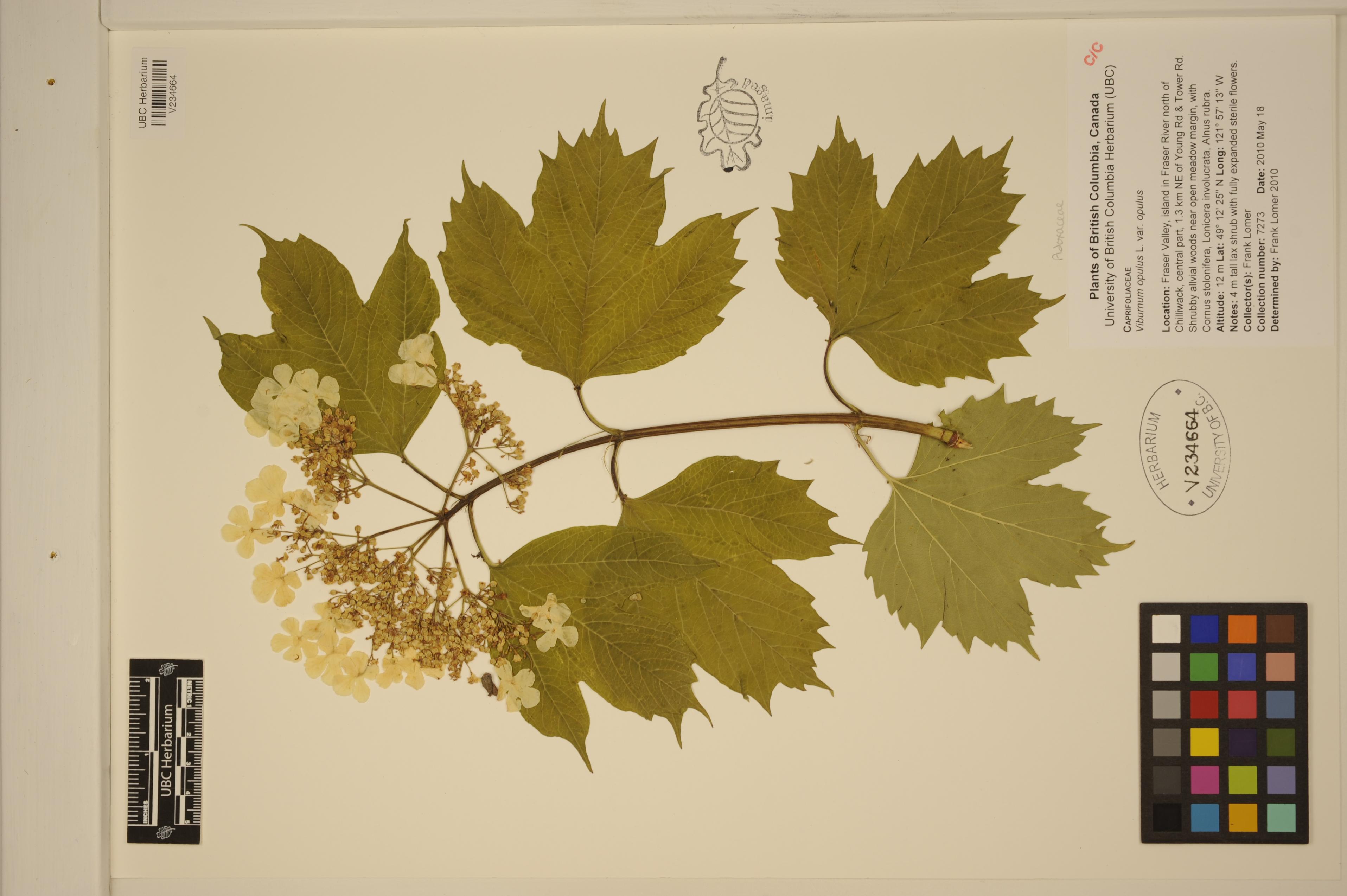 V234664.jpg |
 | Adoxaceae 35. Viburnum opulus L. var. opulus Canada, British Columbia: Greater Vancouver, Burnaby Lake, southeast side, 400 m east of Piper Avenue boardwalk dock. Elev. 13 m 49.24175°, -122.92972°. Lakeshore; in Glyceria maxima monoculture thick floating vegetation mat, with Comarum palustre, Athyrium filix-femina. Clump of 5 stems 1.5 m tall; few plants noted on southern lakeshore, often with numerous saplings around mature plants. UBC: V234669 Frank Lomer 7278May 30, 2010 |
 | Adoxaceae 36. Viburnum opulus L. var. opulus Canada, British Columbia: Greater Vancouver, Burnaby Lake, southeast side, 300 m south of Piper Avenue boardwalk dock. Elev. 14 m 49.239306°, -122.93513°. Lakeshore; in Glyceria maxima monoculture thick floating vegetation mat, with Comarum palustre, Athyrium filix-femina. Cluster of 20 stems, 2 m tall; sterile flowers present; leaf bases with depressed saucer-like glands. UBC: V234670 Frank Lomer 7279May 30, 2010 |
 | Adoxaceae 37. Viburnum opulus L. var. americanum AitonCanada, British Columbia: Fraser Valley, island in Fraser River 4 km north of Chilliwack, 350 m north of most southwest tip of island, 700 m due north of boat launch on Island 22 park on Cartmel Road. Elev. 11 m 49.200667°, -121.97686°. Shrubby rivershore, overhanging water, on eroding clay-silt mud bank, with Rubus armeniacus, Cornus stolonifera. Multi-stemmed shrub with ca. 60 flowering heads with outer ring of sterile flower; leaves with nipple-like glands on extended peduncles at blade base; another shrub seen 30 m away; ca. 5 plants total seen on island in three day survey. UBC: V234674 Frank Lomer 7283May 31, 2010 |
 | Adoxaceae 38. Viburnum opulus L. var. americanum Canada, British Columbia: Fraser Valley, island in Fraser River 4 km north of Chilliwack, 540 m north of most southwest tip of island, 870 m due north of boat launch on Island 22 park on Cartmel Road. Elev. 11 m 49.202083°, -121.97511°. 3 m from riverside, poking up through Rubus armeniacus tangle. 4 m tall shrub; sterile flowers mostly fallen. UBC: V234675 Frank Lomer 7284May 31, 2010 |
 | Adoxaceae 39. Viburnum opulus L. var. americanum AitonCanada, British Columbia: Fraser Valley, island in Fraser 4 km southwest of Agassiz, 700 m south of Hamilton Road and Dyke Road junction, 20 m north of south shore of river. Elev. 14 m 49.21675°, -121.81555°. Thirty-year-old poplar woods in sandy silt; loosely shrubby with Lonicera involucrata, Rubus armeniacus, Cornus stolonifera. Single plant 2 m tall, no flowers; only one seen on the island. UBC: V234787 Frank Lomer 7405Aug 3, 2010 |
 | Adoxaceae 40. Viburnum opulus L. var. americanum AitonCanada, British Columbia: Fraser Valley, Cheam Wetlands Regional Park, Loop Trail. Elev. 43 m 49.195556°, -121.74375°. Trail edge through deciduous woods with Populus trichocarpa, Rhamnus purshiana, Rubus spectabilis. Single plant seen, 2 m tall; several plants reported from area. UBC: V234793 Frank Lomer | Monica Pearson | Carrielynn Victor 7411Aug 11, 2010 |
 | Adoxaceae 41. Viburnum opulus L. var. opulus Canada, British Columbia: Castlegar, 80 m south of Fir Street, 155 m east of 5 Avenue. Elev. 428 m 49.322611°, -117.65494°. Pipeline by meadow clearing along trail, with Symphoricarpos albus, Ligustrum vulgare, Prunus virginiana, Populus tremuloides saplings. Single shrub with several erect shoots and some fruiting branches; one other plant seen in vicinity; arising from seeds spread by birds. UBC: V234853 Frank Lomer 7472Sep 7, 2010 |
 | Adoxaceae 42. Viburnum opulus L. var. opulus Canada, British Columbia: Castlegar, backwater crescent channel of Kootenay River, east of Selkirk College, 330 m due NNW of junction of Rosedale Road and Frank Beinder Way. Elev. 420 m 49.309722°, -117.64638°. Shrubby bank above floodplain. Shrub 4 m tall with orangey red fruit. UBC: V234880 Frank Lomer 7499Sep 8, 2010 |
 | Adoxaceae 43. Viburnum opulus L. var. opulus U.S.A., Idaho, Ada County: Ada Co.: lower Hulls Gulch Reserve in foothills NE of Boise, south end Red-Winged Blackbird Trail (#35A). Elev. 848 m. 43.638° N, 116.197° W Coordinate Source: Specimen Label. riparian woodland of native and naturalized trees on sandy floodplain. Uncommon, large open shrub along creek near bridge, outer flowers enlarged, white. Reproductive state: Flowers. SRP: 50653 Barbara Ertter 19912May 28, 2010 |  SRP050653.jpg |
 | Adoxaceae 44. Viburnum opulus L. var. opulus Canada, British Columbia: Greater Vancouver, Burnaby, Burnaby Lake, southeast side. Elev. 13 m 49.244528°, -122.92563°. Edge of shrubby zone on thickly vegetated lakeshore near Glyceria maxima monoculture mats, with Lonicera involucrata, Malus fusca. Patch of 10; leaves badly eaten by bugs; numerous seedlings in surrounding swampy ground. European garden escape spread by birds. UBC: V230400 Frank Lomer 7064Jul 21, 2009 |
 | Adoxaceae 45. Viburnum opulus L. var. opulus Canada, British Columbia: Greater Vancouver, Burnaby, Burnaby Lake, south shore, 0300 m south southwestof boat dock at foot of Piper Avenue. Elev. 13 m 49.239306°, -122.93763°. Swampy lakeshore in Glyceria maxima mat at shrub zone margin. Two shrubby clumps. Leaves turning red, fruit red. but not yet ripe. UBC: V230462 Frank Lomer | Susanne Sloboda | Terry Taylor 7103Aug 27, 2009 |
 | Adoxaceae 46. Viburnum opulus L.Canada, Manitoba: Spruce Woods Provincial Park, Isputinaw Self-guiding Trail. Elev. 326 m 49.654194°, -99.24972° Shrubby Picea glauca woodlands with Celastrus scandens. Uncommon. 3 duplicates. B.A. Bennett 09-0317Sep 14, 2009With B.A. Ford, J.M. Bowles, J. Gould, D. Punter, M.J. Oldham BABY-06945; Genetic barcoding: CCDB-18327-D8 |  BABY-06945.jpg |
 | Adoxaceae 47. Viburnum opulus L. var. opulus United States, Oregon, Multnomah: Portland Women\'s Forum State Park at Chanticleer Point, forested area northwest of parking lot; 2.4 air km east of Corbett. Elev. 255 m. 45.53445°, -122.26125°. Shrubby understory of moist deciduous forest, northerly aspect. Acer macrophyllum, Alnus rubra, Symphoricarpos albus, Hedera helix, Urtica dioica Fruits yellow. https://oregonflora.org OSC-V-262532 Richard E. Brainerd 1589Aug 14, 2009 | 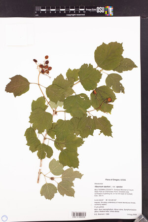 OSC-V-262532_lg.jpg |
 | Adoxaceae 48. Viburnum opulus L. var. opulus U.S.A., Oregon, Benton County: Corvallis. Along bike path south of Circle Drive and north of Harrison Boulevard. Elev. 320 ft. UTM Zone 10, 476142E, 4935612N Datum: NAD 83. Abandoned agricultural field/orchard in dense scrub-shrub along seasonal drainageway. With Crataegus suksdorfii, Rubus armeniacus, Brachypodium sylvaticum. Shrub about 8 meters tall; berries red. Circa 8 individuals nearby, 1-3 meters tall; reproducing and naturalizing. Reproductive state: Fruits. Origin: Introduced. WTU: 390228 R.E. Brainerd 1303Oct 28, 2008 |
 | Adoxaceae 49. Viburnum opulus L. var. opulus Canada, British Columbia: Fraser Valley, Hatzic, east of Mission, 20 m north of Highway 7, 170 m east of Dewdney Trunk Road. Elev. 14 m 49.15°, -122.25277°. Wet field, dense with Phalaris arundinacea. 2 clumps. Leaf stipules with glandular discs. Introduced European garden escape; not native variety. UBC: V227274 Frank Lomer 6612Jun 6, 2008 |
 | Adoxaceae 50. Viburnum opulus L. var. opulus Canada, British Columbia: Fraser Valley, British Columbia: Fraser Valley, Hatzic, E of Mission 20 m N of Highway 7, 170 m E of Dewdney Trunk Road. Elev. 14 ft. 49.15°, -122.25277°. 2 clumps. Leaf stipules with glandular discs. Introduced European garden escape; not native variety. V206684 Frank Lomer 6612Jun 6, 2008 |


