Terrain
Road Map
Satellite
Hybrid
Terrain

 | Melanthiaceae 1. Veratrum viride AitonU.S.A., Idaho, Valley County: Boise National Forest, 14.2 airmiles NE of Cascade. Along trail to summit of ridge about 1.1 miles north of Warm Lake Rd where trailhead lies at Big Creek Summit. Elev. 7600 ft. 44.637179° N, 115.808464° W Datum: WGS 84. Coordinate Source: Field Notes. On weathered granite of batholith with lodgepole pine in mesic coniferous forest with Calamagrostis sp. ,Pyrola dentata and P. picta. CIC: 60538 D. H. Mansfield 24394Jul 29, 2024With E. Daly |
 | Melanthiaceae 2. Veratrum viride Aiton var. eschscholzianum (Roem. & Schult.) Breitung= Veratrum viride Aiton var. eschscholtzianum (Schult. & Schult.f.) Breitung U.S.A., Oregon, Multnomah County: Southeast Portland. Powell Butte Park. 500 meters north of Johnson Creek. Elev. 250-480 ft. 45.480265°, -122.51135°. Datum: WGS 84. Coordinate uncertainty: 36 meters. Georeferenced by Dominic Maze. Coordinate Source: Digital Map. Remnant mature ash swale at south base of butte. High water table. Abundant. 100s of plants. With Erythranthe guttata, Impatiens capensis, Urtica, Acer macrophyllum, Carex obnupta. Reproductive state: Flowers. Origin: Native. HPSU: 23489 Dominic Maze 1745Jun 8, 2021 |  HPSU_023489.jpg |
 | Melanthiaceae 3. Veratrum viride Ait.U.S.A., Washington, Grays Harbor County: Wetlands near 3 Peaks. Elev. 3225 ft. 47.49024° N, 123.5794° W Datum: WGS 84. Coordinate uncertainty: 500 meters. Coordinate Source: GPS. Mid elevation mixed coniferous forest. With Callitropsis nootkatensis, Tsuga mertensiana, Abies amabilis. Uncommon. Drooping inflorescence. In sandy loam soil. Reproductive state: Flowers. Origin: Native. Regina Johnson 2021-097Aug 15, 2021WTU: 431519; WTU-V-093766 |  WTU-V-093766.jpg |
 | Melanthiaceae 4. Veratrum viride AitonUnited States, Washington, Grays Harbor: Wetlands near Three Peaks. Elev. 3225 ft 47.49024°, -123.5794°. Datum: WGS84. Mid elevation mixed coniferous forest. In sandy loam. Callitropsis nootkatensis, Tsuga mertensiana, Abies amabilis Uncommon. Drooping inflorescence. https://intermountainbiota.org WS: 398106; WS002795 Regina Johnson 2021-097Aug 15, 2021 |  WS002795.JPG |
 | Melanthiaceae 5. Veratrum viride Aiton var. eschscholzianum (Roem. & Schult.) Breitung= Veratrum viride Aiton var. eschscholtzianum (Schult. & Schult.f.) Breitung U.S.A., Idaho, Boundary County: Kaniksu National Forest, Selkirk Mountains, Smith Creek Road, Forest Service Road 281, Smith Creek. Site ID: SK-486. Elev. 1315 m. 48.841314° N, 116.704086° W Datum: WGS 84. Coordinate uncertainty: 5 meters. Coordinate Source: GPS. Disturbed old logging site with grass covering of Elymus, Calamagrostis, Phleum with Rubus nutkanus, Heracleum maximum, Acer glabrum and Sambucus racemosa. Flowers green. Reproductive state: Flowers. Origin: Native. ID: 186522; ID192070 Harpo Faust 3433Jul 15, 2020With Whitney Griswold, Ben Legler |  ID192070.jpg |
 | Melanthiaceae 6. Veratrum viride Aiton var. eschscholzianum (Roem. & Schult.) Breitung= Veratrum viride Aiton var. eschscholtzianum (Schult. & Schult.f.) Breitung U.S.A., Idaho, Boundary County: Kaniksu National Forest, Selkirk Mountains, Bog Creek Road off of Forest Service Road 1013, Bog Creek Meadows. Site ID: SK-511. Elev. 1322 m. 48.995915° N, 116.878009° W Datum: WGS 84. Coordinate uncertainty: 5 meters. Coordinate Source: GPS. Flow through peatland dominated by Ligusticum canbyi and Salix sp. with abundant forbs of Dasiphora fruticosa, Pedicularis groenlandica and Calamagrostis canadensis. Reproductive state: Flowers. Origin: Native. ID: 186535; ID192083 Harpo Faust 3601Jul 21, 2020With Whitney Griswold |  ID192083.jpg |
 | Melanthiaceae 7. Veratrum viride Aiton var. eschscholzianum (Roem. & Schult.) Breitung= Veratrum viride Aiton var. eschscholtzianum (Schult. & Schult.f.) Breitung U.S.A., Idaho, Clearwater County: Clearwater National Forest: in cirque 0.4 air km northwest of Goat Lake and 3.7=5 air km southwest of Rhodes Peak.. Site ID: BSL-2265. Elev. 2019 m. 46.662618° N, 114.826037° W Datum: WGS 84. Coordinate uncertainty: 3 meters. Coordinate Source: GPS. Lush, subalpine forb meadow on southeast facing slope, with Hedysarum occidentale, Aconogonon phytolaccifolium, Festuca viridula. Tepals green; inflorescence branches drooping; stems to 1.5 meters tall; plants scattered. Reproductive state: Flowers. ID: 183286; ID188840 Ben Legler 16103Jul 30, 2020With Sara Legler |  ID188840.jpg |
 | Melanthiaceae 8. Veratrum viride Aiton var. eschscholzianum (Roem. & Schult.) Breitung= Veratrum viride Aiton var. eschscholtzianum (Schult. & Schult.f.) Breitung U.S.A., Idaho, Boundary County: Kaniksu National Forest, Selkirk Mountains, Myrtle Lake Trail, Myrtle Lake, southeast lakeshore of Myrtle Lake. Site ID: SK-537. Elev. 1814 m. 48.752613° N, 116.632356° W Datum: WGS 84. Coordinate uncertainty: 5 meters. Coordinate Source: GPS. Rocky moss covered lakeshore dominated by sedges fading into Rhododendron albiflorum and menziesii. Reproductive state: Flowers. Origin: Native. ID: 186536; ID192084 Harpo Faust 3746Aug 3, 2020With Whitney Griswold |  ID192084.jpg |
 | Melanthiaceae 9. Veratrum viride Aiton var. eschscholzianum (Roem. & Schult.) Breitung= Veratrum viride Aiton var. eschscholtzianum (Schult. & Schult.f.) Breitung U.S.A., Idaho, Clearwater County: Clearwater National Forest, proposed Rhodes Peak RNA: on slope west of stream in basin 0.7 km NNE of Rhodes Peak. Site ID: BSL-2328. Elev. 2184 m. 46.681033° N, 114.781505° W Datum: WGS 84. Coordinate uncertainty: 6 meters. Coordinate Source: GPS. Base of rock outcrops on steep, northeast-facing subalpine slope, with Aquilegia flavescens, Arnica latifolia, Anemone occidentalis. Flowers green; inflorescence branches drooping; stems to 1.5 meters tall; plants scattered and uncommon. Reproductive state: Flowers. ID: 182660; ID188214 Ben Legler 16319Aug 15, 2020With Peri Pipkin |  ID188214.jpg |
 | Melanthiaceae 10. Veratrum viride Aiton var. eschscholzianum (Roem. & Schult.) Breitung= Veratrum viride Aiton var. eschscholtzianum (Schult. & Schult.f.) Breitung U.S.A., Washington, King County: Above FS Road NF-7036, Twin Camp Creek drainage, 1.1. air km NNW of Pyramid Peak, W slope of Cascade Range. Elev. 1550 m. 47.1206° N, 121.4111° W On gentle wet slopes, N aspect, full sun, with Sorbus sitchensis, Luzula parviflora, Athyrium filix-femina, Senecio triangularis, Carex mertensii, C. pachystachya, C. laeviculmis, C. nigricans, C. illota, Viola palustris. 2 m tall, lower branches droop, flowers green with yellow anthers; occasional. [Sheet 2 of 2]. Peter F. Zika 30202Aug 9, 2020WTU: 423774; WTU-V-064763 |  WTU-V-064763.jpg |
 | Melanthiaceae 11. Veratrum viride Aiton var. eschscholzianum (Roem. & Schult.) Breitung= Veratrum viride Aiton var. eschscholtzianum (Schult. & Schult.f.) Breitung U.S.A., Washington, King County: Above FS Road NF-7036, Twin Camp Creek drainage, 1.1 air km NNW of Pyramid Peak, W slope of Cascade Range. Elev. 1550 m. 47.1206° N, 121.4111° W Coordinate uncertainty: 200 meters. On gentle wet slopes, N aspect, full sun, with Sorbus sitchensis, Luzula parviflora, Athyrium filix-femina, Senecio triangularis, Carex mertensii, C. pachystachya, C. laeviculmis, C. nigricans, C. illota, Viola palustris. 2 m tall, lower branches droop, flowers green with yellow anthers; occasional. [Sheet 1 of 2]. Peter F. Zika 30202Aug 9, 2020WTU: 423775; WTU-V-064764 |  WTU-V-064764.jpg |
 | Melanthiaceae 12. Veratrum viride AitonU.S.A., Idaho, Valley County: Boise National Forest. Skunk Creek Road, FR 417. Streamside seep. Elev. 2022 m. 44.3782° N, 115.93443° W Datum: WGS 84. Coordinate uncertainty: 4 meters. Streamside seep with Alnus, Salix. Herb to 2 m tall. Corolla green. Sheet 1 of 2. SRP: 72468 J. F. Smith 17027Jul 23, 2020 |  SRP072468.jpg + 1 more image |
 | Melanthiaceae 13. Veratrum viride AitonU.S.A., Idaho, Valley County: Boise National Forest. Skunk Creek Road, FR 417. Streamside seep. Elev. 2022 m. 44.3782° N, 115.93443° W Datum: WGS 84. Coordinate uncertainty: 4 meters. Streamside seep with Alnus, Salix. Herb to 2 m tall. Corolla green. Sheet 2of 2. SRP: 72468 J. F. Smith 17027Jul 23, 2020 |
 | Melanthiaceae 14. Veratrum viride AitonU.S.A., Idaho, Boise County: Boise National Forest. FR 555EC to Deadwood Lookout. 2.1 miles from the gate to lookout. Elev. 2199 m. 44.15422° N, 115.71539° W Datum: WGS 84. Coordinate uncertainty: 3 meters. Rock outcrops north of the road. Herb to 1 m tall. Inflorescence drooping, flowers green. SRP: 72571 J. F. Smith 17130Jul 29, 2020 |  SRP072571.jpg + 1 more image |
 | Melanthiaceae 15. Veratrum viride AitonU.S.A., Idaho, Valley County: Boise National Forest. Skunk Creek Road, FR 417. Streamside seep. Elev. 2022 m. 44.3782° N, 115.93443° W Datum: WGS 84. Coordinate uncertainty: 4 meters. Coordinate Source: Specimen Label. Streamside seep with Alnus, Salix. Herb to 2 m tall. Corolla green. Sheet 2 of 2. Reproductive state: Flowers. J. F. Smith 17027Jul 23, 2020IDS: 2021.004; IDS0075825 |  IDS0075825.jpg |
 | Melanthiaceae 16. Veratrum viride AitonU.S.A., Idaho, Valley County: Boise National Forest. Skunk Creek Road, FR 417. Streamside seep. Elev. 2022 m. 44.3782° N, 115.93443° W Datum: WGS 84. Coordinate uncertainty: 4 meters. Coordinate Source: Specimen Label. Streamside seep with Alnus, Salix. Herb to 2 m tall. Corolla green. Sheet 1 of 2. Reproductive state: Flowers. J. F. Smith 17027Jul 23, 2020IDS: 2021.004; IDS0075826 |  IDS0075826.jpg |
 | Melanthiaceae 17. Veratrum viride Aiton var. eschscholzianum (Roem. & Schult.) Breitung= Veratrum viride Aiton var. eschscholtzianum (Schult. & Schult.f.) Breitung U.S.A., Idaho, Boundary County: Kaniksu National Forest, Selkirk Mountains, Hidden Lake, up the south east drainage of Hidden Lake about .25 mile. Site ID: SK-161. Elev. 1666 m. 48.88125° N, 116.762951° W Datum: WGS 84. Coordinate uncertainty: 10 meters. Coordinate Source: GPS. Open willow and mixed fern dominated drainage with Rhododendron albiflorum, Leptarrhena pyrolifolia and Montia parvifolia. Silica taken. Reproductive state: Flowers. Origin: Native. ID: 180057; ID185234 Harpo Faust 2019-1399Jul 23, 2019With Beau Romeo |  ID185234.jpg |
 | Melanthiaceae 18. Veratrum viride Aiton var. eschscholzianum (Roem. & Schult.) Breitung= Veratrum viride Aiton var. eschscholtzianum (Schult. & Schult.f.) Breitung U.S.A., Idaho, Boundary County: Kaniksu National Forest, Selkirk Mountains, Snow Creek Road, Snow Lake, West shore of Snow Lake. Site ID: SK-206. Elev. 1793 m. 48.6431° N, 116.597096° W Datum: WGS 84. Coordinate uncertainty: 7 meters. Coordinate Source: GPS. Open Rhododendron albiflorum dominated lakeside sub dominated by mixed age Abies lasiocarpa and downed logs transitioning into moist Carex and Parnassia dominated marshy lakeside. Reproductive state: Flowers and Fruits. ID: 180052; ID185229 Harpo Faust 2019-1778Aug 13, 2019With Peri Lee Pipkin, Detto Kennedy |  ID185229.jpg |
 | Melanthiaceae 19. Veratrum viride AitonU.S.A., Idaho, Valley County: East Fork Lake Trail. Elev. 1723-1667 m. 44.92263° N, 115.9323° W Datum: WGS 84. Coordinate uncertainty: 6 meters. Coordinate Source: GPS. Creekside and hills above. Larix, Pseudotsuga, Pinus contorta, Pinus ponderosa forest. Tepals green. Herb to 2 m tall. SRP: 66879 J. F. Smith 15750Jul 12, 2018 |  SRP066879.jpg |
 | Melanthiaceae 20. Veratrum viride Aiton var. eschscholzianum (Roem. & Schult.) Breitung= Veratrum viride Aiton var. eschscholtzianum (Schult. & Schult.f.) Breitung U.S.A., Washington, Columbia County: Blue Mountains: south end of Middle Point Ridge north of Cavalier Spring on north side of hairpin turn in FS Road 46 at head of west fork of Butte Creek. Elev. 1646 m. 46.103555° N, 117.817367° W; T7N R40E S9 SE4 NW4 NW4 Coordinate Source: Specimen Label. Pinus contorta/Abies amabilis forest with abundant downed timber and emerging Salix scouleriana thickets. Soil clay-rich, dry. Understory with Arnica cordifolia, Bromus, Leptosiphon, Hieracium albiflorum, Anaphalis, Vaccinium, occasional Alnus viridis. Flowers green; stems 4 ft tall. Uncommon. Walter Fertig 33051Jul 15, 2018WTU: 423365; WTU-V-061965 |  WTU-V-061965.jpg |
 | Melanthiaceae 21. Veratrum viride Aiton var. eschscholzianum (Roem. & Schult.) Breitung= Veratrum viride Aiton var. eschscholtzianum (Schult. & Schult.f.) Breitung U.S.A., Washington, Columbia County: Blue Mountains: south end of Middle Point Ridge north of Cavalier Spring on north side of hairpin turn in FS Road 46 at head of west fork of Butte Creek. Elev. 1646 m. 46.103555° N, 117.817367° W; T7N R40E S9 SE4 NW4 NW4 Coordinate Source: Specimen Label. Pinus contorta/Abies amabilis forest with abundant downed timber and emerging Salix scouleriana thickets. Soil clay-rich, dry. Understory with Arnica cordifolia, Bromus, Leptosiphon, Hieracium albiflorum, Anaphalis, Vaccinium, occasional Alnus viridis. Flowers green; stems 4 ft tall. Uncommon. Walter Fertig 33051Jul 15, 2018WTU: 423364; WTU-V-061964 |  WTU-V-061964.jpg |
 | Melanthiaceae 22. Veratrum viride Aiton var. eschscholzianum (Roem. & Schult.) Breitung= Veratrum viride Aiton var. eschscholtzianum (Schult. & Schult.f.) Breitung United States, Oregon, Linn: Cascade Range; Willamette National Forest; at the end of N.F. Road 345, ca. two miles northeast of its junction with N.F. Road 2032, at the trailhead to Gordon Meadows. Elev. 1288 44.3647°, -122.31472°. Georeferenced by [automated process-OregonFlora/OSU Herb]. Coordinate Source: OrlookId: 126021, StateProvince: Oregon, County: Linn, LocName: Lat 44.3647 Deg; Lon -122.31472 Deg. OregonFlora 1994-2020 methodology. Dry forested area. HerbariumSpecimenDuplicate: Veratrum viride var. eschscholzianum https://oregonflora.org OSC-V-258784 Richard R. Halse 10437Aug 14, 2018 | 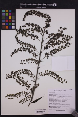 OSC-V-258784_lg.jpg |
 | Melanthiaceae 23. Veratrum viride Aiton var. eschscholzianum (Roem. & Schult.) Breitung= Veratrum viride Aiton var. eschscholtzianum (Schult. & Schult.f.) Breitung United States, Oregon, Linn: Cascade Range; Willamette National Forest; at the end of N.F. Road 345, ca. two miles northeast of its junction with N.F. Road 2032, at the trailhead to Gordon Meadows. Elev. 1288 44.3647°, -122.31472°. Georeferenced by [automated process-OregonFlora/OSU Herb]. Coordinate Source: OrlookId: 126021, StateProvince: Oregon, County: Linn, LocName: Lat 44.3647 Deg; Lon -122.31472 Deg. OregonFlora 1994-2020 methodology. Dry forested area. HerbariumSpecimenDuplicate: Veratrum viride var. eschscholzianum https://oregonflora.org OSC-V-258783 Richard R. Halse 10437Aug 14, 2018 | 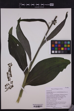 OSC-V-258783_lg.jpg |
 | Melanthiaceae 24. Veratrum viride AitonU.S.A., Idaho, Idaho County: Unnamed, minor peak along ridgeline 1 air mile N of Bruin Mt., 20 air miles N and 1 air mile W of McCall, Id., New Meadows Ranger District, Payette National Forest. Historically glaciated, N-S running ridgeline, granite peak of rocky outcrops interspersed with little saddles of soil. Elev. 8138 ft. 45.193067° N, 116.117433° W Datum: WGS 84. Georeferenced by Grahm Johnson. Coordinate Source: Digital Map. Across W aspect scree fields. Dominant species: Juncus parryi, Phlox diffusa, Aconogonon phytolaccaefolium, Pinus albicaulis, and Abies lasiocarpa. Reproductive state: Flowers and Fruits. Origin: Native. ID: 177664; ID183108 Grahm M Johnson 17-578Aug 17, 2017With Sebastian Mortimer |  ID183108.jpg |
 | Melanthiaceae 25. Veratrum viride AitonU.S.A., Idaho, Valley County: Black Butte, 23 air miles E and 3 air miles N of Big Creek, Id., Frank Church River of No Return Wilderness, Krassel Ranger District, Payette National Forest. Granite peak within a ~20 year old fire scar, a mix of forest and scree fields in all directions. Elev. 8318 ft. 45.178802° N, 114.848477° W Datum: WGS 84. Georeferenced by Grahm Johnson. Coordinate Source: Digital Map. Through open, grassy hillside on E aspect. Dominant species: Pinus albicaulis, Pinus contorta, Poa sp., Carex geyeri, and Linanthastrum nuttallii. Reproductive state: Flowers and Fruits. Origin: Native. ID: 175048; ID180027 Grahm M Johnson 17-373Aug 6, 2017With Sebastian Mortimer, Ty Styhl |  ID180027.jpg |
 | Melanthiaceae 26. Veratrum viride Aiton var. eschscholzianum (Roem. & Schult.) Breitung= Veratrum viride Aiton var. eschscholtzianum (Schult. & Schult.f.) Breitung Canada, Yukon: Kluane National Park, Bates and Alsek confluence, north of. Elev. 757 m 60.146183°, -137.95674°. Lush subalpine meadow with Salix pulchra, Salix richardsonii, Alnus viridis, Geranium erianthum, Senecio triangularis, Valeriana sitchensis, and Carex macrochaeta. Only one seen flowering; park permit KLU-201725041; common; just starting to flower. UBC: V251888 Bruce A. Bennett | C. Wong | S. Davidson | C. Guppy 17-0284Jul 11, 2017 |
 | Melanthiaceae 27. Veratrum viride AitonU.S.A., Idaho, Valley County: Skunk Creek/Wetfoot Creek. Off of Forest Service Road 417J. Elev. 2032-2065 m. 44.37231° N, 115.93208° W Datum: WGS 84. Coordinate uncertainty: 5 meters. Coordinate Source: GPS. Pinus ponderosa, Pseudotsuga menziesii, Pinus contorta, Abies grandis. Understory with Symphoricarpos, Ceanothus, Spiraea, Vaccinium. Streamside. Herb to 2 m tall, inflorescence drooping, corolla green. 2 sheets per collection. SRP: 60308 J. F. Smith 14000Aug 11, 2016 |  SRP060308.jpg + 1 more image |
 | Melanthiaceae 28. Veratrum viride AitonU.S.A., Idaho, Valley County: Skunk Creek/Wetfoot Creek. Off of Forest Service Road 417J. Elev. 2031-2065 m. 44.37231° N, 115.93208° W Datum: WGS 84. Coordinate uncertainty: 5 meters. Coordinate Source: GPS. Pinus ponderosa, Pseudotsuga menziesii, Pinus contorta, Abies grandis. Understory with Symphoricarpos, Ceanothus, Spiraea, Vaccinium. Streamside. Herb to 2 m tall, inflorescence drooping, corolla green, 2 sheets per collection. SRP: 60308 J. F. Smith 14000Aug 11, 2016 |  SRP0603208.jpg |
 | Melanthiaceae 29. Veratrum viride AitonU.S.A., Idaho, Valley County: Skunk Creek/Wetfoot Creek. Off of Forest Service Road 417J. Elev. 2032-2065 m. 44.37231° N, 115.93208° W Datum: WGS 84. Coordinate uncertainty: 5 meters. Coordinate Source: GPS. Pinus ponderos, Pseudotsuga menziesii, Pinus contorta, Abies grandis. Understory with Symphoricarpos, Ceanothus, Spiraea, Vaccinium. Streamside. Herb to 2 m tall, inflorescence drooping, corolla green. 2 of 2 specimens see #IDS0069805. Reproductive state: Flowers. James F. Smith 14000Aug 11, 2016IDS: 2017.006; IDS0069804 |  IDS0069804.jpg |
 | Melanthiaceae 30. Veratrum viride AitonU.S.A., Idaho, Valley County: Skunk Creek/Wetfoot Creek. Off of Forest Service Road 417J. Elev. 2032-2065 m. 44.37231° N, 115.93208° W Datum: WGS 84. Coordinate uncertainty: 5 meters. Coordinate Source: GPS. Pinus ponderos, Pseudotsuga menziesii, Pinus contorta, Abies grandis. Understory with Symphoricarpos, Ceanothus, Spiraea, Vaccinium. Streamside. Herb to 2 m tall, inflorescence drooping, corolla green. 1.of 2 of same specimen see IDS0069804 Reproductive state: Flowers. James F. Smith 14000Aug 11, 2016IDS: 2017.006; IDS0069805 |  IDS0069805.jpg |
 | Melanthiaceae 31. Veratrum viride Ait. var. eschscholzianum (Roemer & Schultes) Breitung= Veratrum viride Aiton var. eschscholtzianum (Schult. & Schult.f.) Breitung Canada, Yukon Territory: South Canol Road, mtn S of 13 km up the Groundhog Mountain road. Elev. 1540 m 61.63271°, -132.85722° Lush mossy subalpine tundra with Valeriana sitchensis, Poa palustris, Chamerion angustifolium, Festuca altaica, and Polemonium acutiflorum. Uncommon. Flowering and with young fruit. BABY-09793 B.A. Bennett 16-0358Jul 16, 2016With R.S. Mulder, Ertter, Barbara, Bennett, Kalie L. |
 | Melanthiaceae 32. Veratrum viride AitonCanada, British Columbia: Fraser Valley Regional District, Chilliwack River Valley, Chipmunk Creek Service Road. Moist subalpine meadow on moderately level ground; associated with Lilium columbianum, Carex sp., Epilobium angustifolium. UBC: V256902 Ben Stormes bjs.2016-0065Sep 3, 2016 |
 | Melanthiaceae 33. Veratrum viride Aiton var. eschscholzianum (Roem. & Schult.) Breitung= Veratrum viride Aiton var. eschscholtzianum (Schult. & Schult.f.) Breitung U.S.A., Washington, Clark County: Yacolt Burn State Forest: Along Grouse Creek ca 100 meters below Tarbell Trail, 0.9 air km east of Larch Mountain summit. Site ID: BSL-1301. Elev. 834 m. 45.716229° N, 122.283785° W Datum: WGS 84. Coordinate uncertainty: 6 meters. Georeferenced by Ben Legler. Coordinate Source: GPS. Wet, boggy openings in forest of Abies procera and Tsuga heterophylla, with Scirpus microcarpus, Carex, Boykinia occidentalis, Menziesia ferruginea, Blechnum spicant, Sphagnum. Stems to 2 meters tall; leaves gradually reduced in size upwards; inflorescence branches drooping; tepals green; plants scattered. Reproductive state: Flowers and Fruits. Ben Legler 13885Sep 12, 2015WTU: 409500; WTU-V-023513 |  WTU-V-023513.jpg |
 | Melanthiaceae 34. Veratrum viride AitonU.S.A., Idaho, Boise County: Forest Service road north from Lowman. Elev. 1658 m. 44° 12.069\' N, 115° 31.449\' W Coordinate Source: GPS. Pinus ponderosa, Pseudotsuga menziesii forest, streamside and open meadows. Corolla green. SRP: 54768 J. F. Smith 12928Aug 9, 2015 |  SRP054768.jpg + 2 more images |
 | Melanthiaceae 35. Veratrum viride AitonU.S.A., Idaho, Idaho County: Warren Wagon Road. Elev. 2035 m. 45° 14.601\' N, 115° 45.72\' W Coordinate Source: GPS. Remnant Pinus contorta, Pseudotsuga menziesii stand amidst burned area. Herb to 1.5 m tall, inflorescence pendent. SRP: 54828 J. F. Smith 12988Aug 22, 2015 |  SRP054828.jpg + 1 more image |
 | Melanthiaceae 36. Veratrum viride Aiton var. eschscholzianum (Roem. & Schult.) Breitung= Veratrum viride Aiton var. eschscholtzianum (Schult. & Schult.f.) Breitung U.S.A., Idaho, Valley County: Payette National Forest. Missouri Ridge area just north of north-facing cirque. Elev. 2318 m. 45.01254° N, 115.35963° W Datum: WGS 84. Coordinate uncertainty: 200 meters. Coordinate Source: GPS. Subalpine meadow with rocky outcropping and small stream; damage from previous wildfire evident everywhere. Uncommon in moist meadow; inflorescence diffuse. Reproductive state: Flowers. Origin: Native. Russ Holmes 2015-20Jul 11, 2015With Don Estberg, David Giblin WTU: 415291; WTU-V-032524 |  WTU-V-032524.jpg |
 | Melanthiaceae 37. Veratrum viride Aiton var. eschscholzianum (Roem. & Schult.) Breitung= Veratrum viride Aiton var. eschscholtzianum (Schult. & Schult.f.) Breitung U.S.A., Idaho, Valley County: South shore of Rainbow Lake, circa 20 air kilometers south-southwest of Yellow Pine. Elev. 2360 m. 44.828436° N, 115.577796° W Datum: WGS 84. Coordinate uncertainty: 10 meters. Coordinate Source: GPS. Peaty and marshy lake shore with meadow bordering lake and subalpine forest; wet soil, with Carex, Antennaria microphylla, Potentilla; lake shallows muddy, dominated by Nuphar polysepala. Tepals greenish; inflorescence branches drooping; stems to 2 meters tall. Reproductive state: Flowers. Origin: Native. S. Legler 2015-72Jul 12, 2015With Ben Legler, Don Estberg, John Bassett WTU: 416574; WTU-V-035920 |  WTU-V-035920.jpg |
 | Melanthiaceae 38. Veratrum viride Aiton var. eschscholtzii (A. Gray) Breitung= Veratrum viride Aiton var. eschscholtzianum (Schult. & Schult.f.) Breitung U.S.A., Oregon, Wallowa County: Umatilla National Forest; along NF Road 62 at Long Meadows Guard Station. Elev. 1224 m. 45.94424° N, 117.61824° W Datum: WGS 84. Coordinate Source: Specimen Label. Open meadow. with Alopecurus, Potentilla, Achillea, Dactylis, Fragaria, Festuca, Lupinus. Perennial, to 1.67 m tall; flowers white. SRP: 58300 Richard R. Halse 9468Jun 17, 2015 |  SRP058300.jpg |
 | Melanthiaceae 39. Veratrum viride AitonU.S.A., Idaho, Idaho County: Warren Wagon Road. Elev. 2035 m. 45° 14.601\' N, 115° 45.72\' W Coordinate Source: GPS. Remnant Pinus contorta, Pseudotsuga menziesii stand amidst burned area. Herb to 1.5 m tall, inflorescence pendent. Reproductive state: Flowers & Fruits. James F. Smith 12988Aug 22, 2015IDS: 2017.005; IDS0068927 |  IDS0068927.jpg |
 | Melanthiaceae 40. Veratrum viride AitonU.S.A., Idaho, Idaho County: Warren Wagon Road. Elev. 2035 m. 45° 14.601\' N, 115° 45.72\' W Coordinate Source: GPS. Remnant Pinus contorta, Pseudotsuga menziesii stand amidst burned area. Herb to 1.5 m tall, inflorescence pendent. Reproductive state: Flowers. James F. Smith 12988Aug 22, 2015IDS: 2017.005; IDS0068926 |  IDS0068926.jpg |
 | Melanthiaceae 41. Veratrum viride Aiton var. eschscholzianum (Roem. & Schult.) Breitung= Veratrum viride Aiton var. eschscholtzianum (Schult. & Schult.f.) Breitung United States, Oregon, Wallowa: Umatilla National Forest; along N.F. Road 62 at Long Meadows Guard Station. Elev. 1224 45.94424°, -117.61824°. Georeferenced by [automated process-OregonFlora/OSU Herb]. Coordinate Source: OrlookId: 1607, StateProvince: Oregon, County: Wallowa, LocName: Lat 45.94424 Deg; Lon -117.61824 Deg. OregonFlora 1994-2020 methodology. Open meadow. HerbariumSpecimenDuplicate: Veratrum viride var. eschscholzianum | herbariumSpecimenDuplicate: Veratrum viride var. eschscholzianum https://oregonflora.org Richard R. Halse 9468Jun 17, 2015OSC-V-037428; Accession Number: OSC248869 | 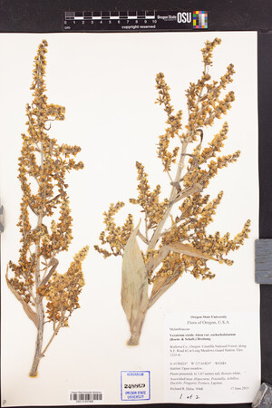 OSC-V-037428_lg.jpg |
 | Melanthiaceae 42. Veratrum viride Aiton var. eschscholzianum (Roem. & Schult.) Breitung= Veratrum viride Aiton var. eschscholtzianum (Schult. & Schult.f.) Breitung United States, Oregon, Jefferson: Cascade Range; Mt. Hood National Forest; along N. F. Road 4220 at Horseshoe Lake. Elev. 1628 44.77635°, -121.78624°. Georeferenced by [automated process-OregonFlora/OSU Herb]. Coordinate Source: OrlookId: 109022, StateProvince: Oregon, County: Jefferson, LocName: Lat 44.77635 Deg; Lon -121.78624 Deg. OregonFlora 1994-2020 methodology. At base of steep talus slope. HerbariumSpecimenDuplicate: Veratrum viride var. eschscholzianum https://oregonflora.org Richard R. Halse 9597Aug 3, 2015OSC-V-037426; Accession Number: OSC248874 | 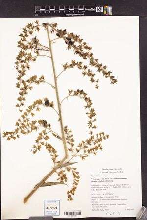 OSC-V-037426_lg.jpg |
 | Melanthiaceae 43. Veratrum viride Aiton var. eschscholzianum (Roem. & Schult.) Breitung= Veratrum viride Aiton var. eschscholtzianum (Schult. & Schult.f.) Breitung United States, Oregon, Jefferson: Cascade Range; Mt. Hood National Forest; along N. F. Road 4220 at Horseshoe Lake. Elev. 1628 44.77635°, -121.78624°. Georeferenced by [automated process-OregonFlora/OSU Herb]. Coordinate Source: OrlookId: 109022, StateProvince: Oregon, County: Jefferson, LocName: Lat 44.77635 Deg; Lon -121.78624 Deg. OregonFlora 1994-2020 methodology. At base of steep talus slope. HerbariumSpecimenDuplicate: Veratrum viride var. eschscholzianum https://oregonflora.org Richard R. Halse 9597Aug 3, 2015OSC-V-037425; Accession Number: OSC248875 | 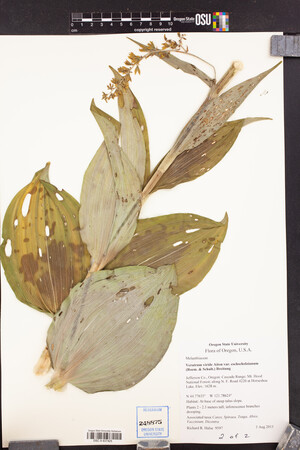 OSC-V-037425_lg.jpg |
 | Melanthiaceae 44. Veratrum viride Aiton var. eschscholzianum (Roem. & Schult.) Breitung= Veratrum viride Aiton var. eschscholtzianum (Schult. & Schult.f.) Breitung United States, Oregon, Wallowa: Umatilla National Forest; along N.F. Road 62 at Long Meadows Guard Station. Elev. 1224 45.94424°, -117.61824°. Georeferenced by [automated process-OregonFlora/OSU Herb]. Coordinate Source: OrlookId: 1607, StateProvince: Oregon, County: Wallowa, LocName: Lat 45.94424 Deg; Lon -117.61824 Deg. OregonFlora 1994-2020 methodology. Open meadow. HerbariumSpecimenDuplicate: Veratrum viride var. eschscholzianum | herbariumSpecimenDuplicate: Veratrum viride var. eschscholzianum https://oregonflora.org Richard R. Halse 9468Jun 17, 2015OSC-V-037427; Accession Number: OSC248870 | 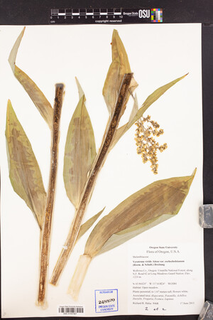 OSC-V-037427_lg.jpg |
 | Melanthiaceae 45. Veratrum viride Ait. var. eschscholzianum (Roemer & Schultes) Breitung= Veratrum viride Aiton var. eschscholtzianum (Schult. & Schult.f.) Breitung Canada, Yukon Territory: Haines Road, km 150. Elev. 1004 m 60.03262°, -136.86295° 25° slope with granitic sand and boulders. West-facing. With Calamagrostis canadensis, Betula glandulosa, Geranium erianthum, Cystopteris montana, Heracleum maximum, and Chamerion angustifolium. Growing to 5\' tall. Originally identified as subspecies eschscholtzii which is considered to be a synonym by the Flora of North America Editorial Committee (2002). Common. In fruit. BABY-09020 B.A. Bennett 14-0603Aug 31, 2014With R.S. Mulder, S.L. Bennett, K.L. Bennett |
 | Melanthiaceae 46. Veratrum viride W. Ait.Canada, British Columbia: Rocky Mountains; Muskwa Ranges; Wahthinli Mountain: ridges and basins 3-4 km SE of summit. Elev. 1817 m 57.686417°, -124.24855°. Coordinate Source: Global Positioning System. Conservation Status:CDC: Not Listed. V215740 Kendrick Marr 14-0729aAug 1, 2014With Richard Hebda; Erica Wheeler; William MacKenzie |
 | Melanthiaceae 47. Veratrum viride W. Ait.Canada, British Columbia: Rocky Mountains; Muskwa Ranges; Mount Bedeux: slopes and basin W of summit. Elev. 1948 m 57.81575°, -124.90902°. Coordinate Source: Global Positioning System. Conservation Status:CDC: Not Listed. V216065 Kendrick Marr 14-1048Aug 4, 2014With Richard Hebda; Erica Wheeler; William MacKenzie |
 | Melanthiaceae 48. Veratrum viride W. Ait.Canada, British Columbia: Rocky Mountains; Muskwa Ranges; Paul River: mountains 4-6 km E of upper Paul R. Elev. 1766 m 57.456167°, -125.00213°. Coordinate Source: Global Positioning System. Conservation Status:CDC: Not Listed. V216291 Kendrick Marr 14-1263Aug 6, 2014With Richard Hebda; Erica Wheeler; William MacKenzie |
 | Melanthiaceae 49. Veratrum viride Aiton ssp. eschscholtzii (A. Gray) Á. Löve & D. Löve= Veratrum viride Aiton var. eschscholtzianum (Schult. & Schult.f.) Breitung Canada, Yukon: Mount Merrill. Elev. 1333 m 60.09164°, -124.73057°. Open area in subalpine draw with Abies lasiocarpa, Betula glandulosa, Chamerion angustifolium, Artemisia norvegica, Cornus canadensis, Senecio triangularis, and Equisetum pratense. Several clumps found; none flowering. UBC: V251799 Bruce A. Bennett | S.G. Cannings | R. Belland | J. Doubt 14-0104Jun 24, 2014 |
 | Melanthiaceae 50. Veratrum viride AitonU.S.A., Idaho, Idaho County: Lava Ridge Trail (#149) ca 1/3 way between Big Dave Creek trailhead and escarpment, Payette National Forest ca 24 airmiles north of McCall; near first volcanic outcrops encountered. Elev. 2300 m. 45.246° N, 116.132° W Coordinate Source: Specimen Label. edge of dry drainage; open subalpine fir forest on basalt. Common but few with inflorescences. Reproductive state: Flowers. CIC: 45807 Barbara Ertter 21608Aug 21, 2013With Christopher Davidson |  CIC045807.jpg |


