Terrain
Road Map
Satellite
Hybrid
Terrain

 | Brassicaceae 1. Sisymbrium officinale (L.) Scop.U.S.A., Washington, San Juan County: North Beach Road on Orcas Island. Elev. 10 ft. 48.71397° N, 122.90634° W Datum: WGS 84. Coordinate Source: Digital map. North Beach Public Access parking lot; growing with Ambrossia chamissonis, Poa bulbosa, Poa annua, and Matricaria discoidea. Flowers yellow; fruits ascending. Reproductive state: Flowers and Fruits. Origin: Introduced. Jeff Walker 1465May 14, 2022WTU: 460145; WTU-V-115862 |  WTU-V-115862.jpg |
 | Brassicaceae 2. Sisymbrium officinale (L.) Scop.U.S.A., Washington, Pierce County: JBLM, CTA-F 47.063411° N, 122.571777° W Datum: WGS84. Coordinate Source: GPS. About 40 plants in open gravel in 20m x 3m at edge of tempory road. Area recieves considerable disturbance from bull dozer training. With Hypericum perforatum, Lupinus bicolor, adn Tifolium dubium Reproductive state: In flower and fruit. Origin: Introduced. WTU Rod Gilbert RG 22-07Jun 6, 2022 |
 | Brassicaceae 3. Sisymbrium officinale (L.) Scop.U.S.A., Oregon, Benton County: Corvallis, along SW 3rd Street just south of Marys River Bridge. Elev. 75 m. Wiht Robinia, Alopecurus, Schedonorus. To 1.5 m tall; petals pale yellow. SRP: 79189 Richard R. Halse 10994May 22, 2022 |  SRP079189.jpg |
 | Brassicaceae 4. Sisymbrium officinale (L.) Scop.U.S.A., Oregon, Multnomah County: Green Street Facility (Asset # STCH APN228 APN227) near NE Cully Blvd and NE Alberta St. 45.558972°, -122.59803°. Georeferenced by Deanna Michinski. Species growing in engineered stormwater swale. Specimen with small yellow flowers. Reproductive state: Flowers & Fruits. Origin: Introduced. HPSU: 25956 Liam M. Gerry 436Oct 25, 2022 |  HPSU_025956.jpg |
 | Brassicaceae 5. Sisymbrium officinale (L.) Scop.U.S.A., Oregon, Multnomah County: Green Street Facility near 13600 NE Whitaker Way. 45.557112°, -122.52242°. Georeferenced by Deanna Michinski. Species growing in engineered stormwater swale overgrown by grasses and introduced, weedy species. Flowers minute, yellow. Individuals growing up to 1.5 feet in height. Reproductive state: Flowers. Origin: Introduced. HPSU: 25957 Liam M. Gerry 256May 3, 2022 |  HPSU_025957.jpg |
 | Brassicaceae 6. Sisymbrium officinale (L.) Scop.U.S.A., Oregon, Benton County: Irish Bend County Park on the Willamette River, ca. 5.5 airmiles NE of Monroe, end of Irish Bend Road. Elev. 81 m. 44.360803° N, 123.2201° W Sand and gravel of river shore with Verbascum, Xanthium, Artemisia, Salix, Raphanus, Senecio. Petals yellow. SRP: 76357 Richard R. Halse 10789Jun 24, 2021 |  SRP076357.jpg |
 | Brassicaceae 7. Sisymbrium officinale (L.) Scop.Canada, British Columbia: Vancouver, University of British Columbia, Morris and Helen Belkin Art Gallery, 1825 Main Mall, Vancouver, BC V6T 1Z2. Musqueam Territory. Elev. 79 m 49.268056°, -123.25611°. Grown out lawn. Collected as part of the art installation, Fireweed Fields, by artist Holly Schmidt. UBC: V253832 Linda Jennings Lipsen FF15Jun 24, 2021 |  V253832.jpg |
 | Brassicaceae 8. Sisymbrium officinale (L.) Scop.United States, Oregon, Benton: Irish Bend County Park, on the Willamette River, ca 5.5 air miles NE of Monroe, at the end of Irish Bend Road. Elev. 81 44.360803°, -123.2201°. Sand and gravel of river shore. HerbariumSpecimenDuplicate: Sisymbrium officinale Petals yellow. https://intermountainbiota.org WS: 400212; WS008528 Richard R. Halse 10789Jun 24, 2021 |  WS008528.JPG |
 | Brassicaceae 9. Sisymbrium officinale (L.) Scop.United States, Oregon, Benton: Irish Bend County Park, at the end of Irish Bend Road, ca. 5.5 air miles NE of Monroe, on the Willamette River.; river shore. Elev. 81 m. 44.360803°, -123.2201°. Georeferenced by collector. Sand and gravel of river shore. HerbariumSpecimenDuplicate: Sisymbrium officinale | herbariumSpecimenDuplicate: Sisymbrium officinale Petals yellow. https://oregonflora.org OSC-V-267642 Richard R. Halse 10789Jun 24, 2021 | 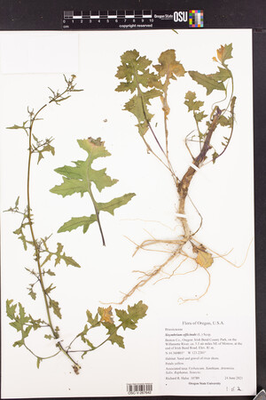 OSC-V-267642_lg.jpg |
 | Brassicaceae 10. Sisymbrium officinale (L.) Scop.United States, Oregon, Benton: Irish Bend County Park, on the Willamette River, ca. 5.5 air miles N.E. of Monroe; at the end of Irish Bend Road. Elev. 81 m. 44.360803°, -123.2201°. Georeferenced by collector. Sand and gravel of river shore. HerbariumSpecimenDuplicate: Sisymbrium officinale | herbariumSpecimenDuplicate: Sisymbrium officinale Petals yellow. https://oregonflora.org OSC-V-267643 Richard R. Halse 10789Jun 24, 2021 | 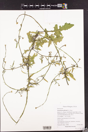 OSC-V-267643_lg.jpg |
 | Brassicaceae 11. Sisymbrium officinale (L.) Scop.U.S.A., Washington, Kitsap County: Silverdale waterfront in historic old town area. Elev. 1 m. 47.64338° N, 122.69809° W Datum: WGS 84. Coordinate uncertainty: 100 meters. Coordinate Source: GPS. Gravelly strand above high tide line with Potentilla anserina common. Scattered in disturbed soil near boat ramp; petals yellow; annual. Reproductive state: Flowers and Fruits. Origin: Introduced. David Giblin 6673May 9, 2019WTU: 425280; WTU-V-069162 |  WTU-V-069162.jpg |
 | Brassicaceae 12. Sisymbrium officinale (L.) Scop.U.S.A., Washington, Jefferson County: Northwest side of Hood Canal Bridge near Tidelands State Park. Elev. 0 m. 47.0679° N, 122.63516° W Datum: WGS 84. Coordinate uncertainty: 24 meters. Georeferenced by David Giblin. Coordinate Source: Digital Map. Disturbed roadside edge of parking area with Rubus bifrons and Rumex crispus. Common; annual; flowers yellow; plants to 0.8 meters tall. Reproductive state: Flowers and Fruits. Origin: Introduced. David Giblin 5878May 13, 2016WTU: 408870; WTU-V-022284 |  WTU-V-022284.jpg |
 | Brassicaceae 13. Sisymbrium officinale (L.) Scop.U.S.A., Washington, King County: Lake Forest Park. 40th Place Northeast circa 1 mile north of Lake Forest Park Towne Center. Elev. 98 m. 47.76851° N, 122.28439° W Datum: WGS 84. Coordinate Source: GPS. Roadside. Annual; yellow flowers; to 1 meter tall. Reproductive state: Flowers and Fruits. Origin: Introduced. Richard G. Olmstead 2016-12May 22, 2016WTU: 419557; WTU-V-042663 |  WTU-V-042663.jpg |
 | Brassicaceae 14. Sisymbrium officinale (L.) Scop.Canada, British Columbia: Harrison Lake, Cascade Bay campground. Elev. 70 m 49.43°, -121.77°. Weedy at edges of gravel logging road. UBC: V247879 Jamie D. Fenneman 2013-67May 31, 2013 |
 | Brassicaceae 15. Sisymbrium officinale (L.) Scop.U.S.A., Washington, Skagit County: Vendovi Island. 48.6094° N, 122.6065° W Datum: WGS 84. Coordinate uncertainty: 500 meters. Coordinate Source: Digital map. Lawn area and around buildings. Occasional on upper beach end, near sheds. Reproductive state: Flowers & Fruits. Origin: Introduced. Nisa Karimi NK-2011-217Sep 11, 2011WTU: 404088; WTU-V-012266 |  WTU-V-012266.jpg |
 | Brassicaceae 16. Sisymbrium officinale (L.) Scop.U.S.A., Washington, Skagit County: Vendovi Island. Near cove on north side of island. In general vicinity of house. Elev. 16-65 ft. 48° 36\' 46.44" N, 122° 36\' 50.4" W Datum: WGS 84. Coordinate uncertainty: 50 meters. Coordinate Source: Digital map. Open, mowed area around house and outbuildings. A handful of very small plants in weedy corner off lawn. Reproductive state: Flowers. Origin: Introduced. Peter Dunwiddie 2011-80Jun 2, 2011WTU: 404317; WTU-V-012382 |  WTU-V-012382.jpg |
 | Brassicaceae 17. Sisymbrium officinale (L.) Scop.U.S.A., Washington, Skagit County: South End of Pass Lake in Deception Pass State Park. 48.41707°, -122.64389°. Datum: WGS 84. Coordinate uncertainty: 500 meters. Georeferenced by WTU Staff. Coordinate Source: GeoLocate. Growing at the edge of the parking lot on the South end of Pass Lake in Deception Pass State Park. Flowers Yellow. Reproductive state: Flowers. Origin: Introduced. WTU: 381638 Jeff Walker 494Jul 12, 2010 |
 | Brassicaceae 18. Sisymbrium officinale (L.) Scop.U.S.A., Washington, Snohomish County: East Warm Beach Camp Ground, Stanwood. 48.189167°, -122.34375°. Datum: WGS 84. Coordinate uncertainty: 380 meters. Georeferenced by Maria Yousoufian. Coordinate Source: Digital map. Disturbed soil near rock pile. Reproductive state: Flowers and Fruits. Origin: Introduced. WTU: 401275; WTU-V-8498 Clayton Haberman s.n.Aug 9, 2010 |  WTU-V-8498.jpg |
 | Brassicaceae 19. Sisymbrium officinale (L.) Scop.U.S.A., California, Alameda County: Albany, west base of Albany Hill along Pierce Street 37.895°, -122.30472°. Georeferenced by SRP Staff. Coordinate Source: GNIS. Edge of eucalyptus forest understory. Locally common, flowers yellow Reproductive state: Flowers. SRP: 34985 B. Ertter 19828May 8, 2010 |  SRP034985.jpg |
 | Brassicaceae 20. Sisymbrium officinale (L.) Scop.U.S.A., Idaho, Franklin County: Jay Wilde ranch; 7188 East Birch Creek Road; 1/4 mile east, 1/4 mile north of house. Elev. 5380 ft. 42° 13.511\' N, 111° 41.649\' W Open S-facing slope; Growing along edge of field with mixed grasses and forbs; Quartzite substrata. Reproductive state: Vegetative. Origin: Introduced. Jay Wilde 123Jul 9, 2009IDS: 2010.009; 2010.09.023; IDS0024453 |  IDS0024453.jpg |
 | Brassicaceae 21. Sisymbrium officinale (L.) Scop.Canada, British Columbia, Vancouver Island: Victoria: Between Tyee Road and Galloping Goose Trail. Elev. 5 m 48.434444°, -123.38°. Occasional. Conservation Status:CDC: Not Listed. V197295 Kendrick Marr 6598Jun 18, 2007 |
 | Brassicaceae 22. Sisymbrium officinale (L.) Scop.Canada, British Columbia, Vancouver Island: Port Alberni: Shopping Center at Johnston and Broughton Roads. Elev. 63 m 49.2675°, -124.78305°. No flowers; occasional. Conservation Status:CDC: Not Listed. V197420 Kendrick Marr 6880Sep 7, 2007 |
 | Brassicaceae 23. Sisymbrium officinale (L.) Scop.Canada, British Columbia, Vancouver Island: Port Alberni: Agricultural field; corner of River Road and Mary Street. Elev. 8 m 49.262778°, -124.83222°. Petals yellow. Conservation Status:CDC: Not Listed. V197650 Kendrick Marr 6869Sep 6, 2007 |
 | Brassicaceae 24. Sisymbrium officinale (L.) Scop.Canada, British Columbia, Vancouver Island: Port Alberni: Airport Road- S side of Somass River. Elev. 7 m 49.255278°, -124.83555°. Conservation Status:CDC: Not Listed. V197657 Kendrick Marr 6980Sep 8, 2007 |
 | Brassicaceae 25. Sisymbrium officinale (L.) Scop.Canada, British Columbia, Vancouver Island: Campbell River: Landfill; Organic Waste (wood, gardens) Elev. 165 m 50.006944°, -125.34861°. Petals yellow; occasional. Conservation Status:CDC: Not Listed. V197695 Kendrick Marr 7057Sep 8, 2007 |
 | Brassicaceae 26. Sisymbrium officinale (L.) Scop.Canada, British Columbia, Vancouver Island: Campbell River: Landfill; Organic Waste (wood, gardens) Elev. 165 m 50.006944°, -125.34861°. Occasional. Conservation Status:CDC: Not Listed. V198040 Kendrick Marr 7079Sep 8, 2007 |
 | Brassicaceae 27. Sisymbrium officinale (L.) Scop.Canada, British Columbia, Vancouver Island: Victoria; Clover Point: Clover Point. Elev. m 48.403333°, -123.34861°. Petals yellow. Conservation Status:CDC: Not Listed. V198127 Kendrick Marr 6740Jun 27, 2007 |
 | Brassicaceae 28. Sisymbrium officinale (L.) Scop.Canada, British Columbia, Vancouver Island: Nanaimo: Harmac-corner of Wave Place and Maughan Road. Elev. 41 m 49.133333°, -123.86527°. Occasional. Conservation Status:CDC: Not Listed. V198148 Kendrick Marr 7231Sep 24, 2007 |
 | Brassicaceae 29. Sisymbrium officinale (L.) Scop.Canada, British Columbia, Vancouver Island: Victoria; View Royal: View Royal area; Galloping Goose Trail, under highway overpass near Craigflower Creek. 48.458333°, -123.4625°. Coordinate Source: Source. Conservation Status:CDC: Not Listed. V194355 Richard Baxter RB06-48Mar 18, 2006 |
 | Brassicaceae 30. Sisymbrium officinale (L.) Scop.Canada, British Columbia: Vancouver Island, Victoria, Fernwood, 2640 Avebury Road. Elev. 50 m 48.4373°, -123.3428° Garden weed. Thin gravelly soil in Quercus garryana rocky outcrop. Throughout Victoria. Common. 1 duplicate. B.A. Bennett 06-0022Jun 11, 2006With H. Guest BABY-05678; Genetic barcoding: CCDB-18327-G3 |
 | Brassicaceae 31. Sisymbrium officinale (L.) Scop.U.S.A., Washington, Snohomish County: Stanwood Senior Center, Stanwood. 48.245076°, -122.33322°. Datum: WGS 84. Coordinate uncertainty: 301 meters. Georeferenced by Ibro Polovina. Coordinate Source: Digital Map. Weed, disturbed soil. Sheet 2 of 2. Reproductive state: Flowers. Origin: Introduced. WTU: 401255; WTU-V-8479 Clayton Haberman s.n.Apr 26, 2005 |  WTU-V-8479.jpg |
 | Brassicaceae 32. Sisymbrium officinale (L.) Scop.U.S.A., Washington, Snohomish County: Stanwood Senior Center, Stanwood. 48.245256°, -122.33356°. Datum: WGS 84. Coordinate uncertainty: 300 meters. Georeferenced by Ibro Polovina. Coordinate Source: Digital Map. Weed, disturbed soil. Sheet 1 of 2. Reproductive state: Fruits. Origin: Introduced. WTU: 401257; WTU-V-8480 Clayton Haberman s.n.Apr 26, 2005 |  WTU-V-8480.jpg |
 | Brassicaceae 33. Sisymbrium officinale (L.) Scop.U.S.A., Washington, Snohomish County: Senior Center, Stanwood. 48.245405°, -122.33348°. Datum: WGS 84. Coordinate uncertainty: 300 meters. Georeferenced by Ibro Polovina. Coordinate Source: Digital Map. Weed, disturbed soil. Reproductive state: Flowers and Fruits. Origin: Introduced. WTU: 401256; WTU-V-8481 Clayton Haberman s.n.May 10, 2005 |  WTU-V-8481.jpg |
 | Brassicaceae 34. Sisymbrium officinale (L.) Scop.U.S.A., Oregon, Curry County: Miller Bar on Chetco River 10.5 mi NE of Brookings N bank. Elev. 60 m. 42° 8\' 14.4" N, 124° 10\' 47.2" W Prunella, Leucanthemum, Rumex, Salix, Alnus, Sonchus, Rubus. SRP: 30655 R. R. Halse 6765Jun 14, 2005 |  SRP030655.jpg |
 | Brassicaceae 35. Sisymbrium officinale (L.) Scop.United States, Oregon, Curry: Siskiyou National Forest; at Miller Bar on the Chetco River, ca. 10.5 miles northeast of Brookings along the North Bank Chetco River Road. Elev. 60 42.137333°, -124.17977°. Georeferenced by [automated process-OregonFlora/OSU Herb]. Coordinate Source: OrlookId: 59091, StateProvince: Oregon, County: Curry, LocName: Lat 42 Deg 8 Min 14.4 Sec; Lon -124 Deg 10 Min 47.2 Sec. OregonFlora 1994-2020 methodology. HerbariumSpecimenDuplicate: Sisymbrium officinale | herbariumSpecimenDuplicate: Sisymbrium officinale | herbariumSpecimenDuplicate: Sisymbrium officinale | herbariumSpecimenDuplicate: Sisymbrium officinale. https://oregonflora.org Richard R. Halse 6765Jun 14, 2005OSC-V-024294; Accession Number: OSC210092 | 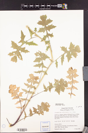 OSC-V-024294_lg.jpg |
 | Brassicaceae 36. Sisymbrium officinale (L.) Scop.United States, Oregon, Curry: Siskiyou National Forest; at Miller Bar on the Chetco River, ca. 10.5 miles northeast of Brookings along the North Bank Chetco River Road. Elev. 60 42.137333°, -124.17977°. Georeferenced by [automated process-OregonFlora/OSU Herb]. Coordinate Source: OrlookId: 59091, StateProvince: Oregon, County: Curry, LocName: Lat 42 Deg 8 Min 14.4 Sec; Lon -124 Deg 10 Min 47.2 Sec. OregonFlora 1994-2020 methodology. HerbariumSpecimenDuplicate: Sisymbrium officinale | herbariumSpecimenDuplicate: Sisymbrium officinale | herbariumSpecimenDuplicate: Sisymbrium officinale | herbariumSpecimenDuplicate: Sisymbrium officinale. https://oregonflora.org Richard R. Halse 6765Jun 14, 2005OSC-V-024295; Accession Number: OSC210093 | 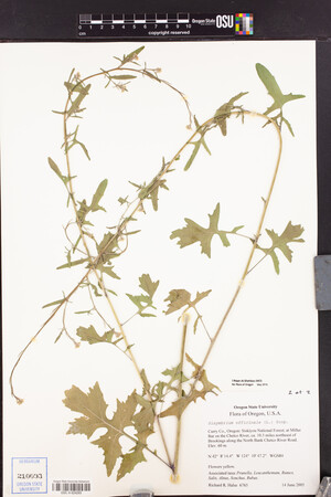 OSC-V-024295_lg.jpg |
 | Brassicaceae 37. Sisymbrium officinale (L.) Scop.U.S.A., Washington, Island County: Whidbey Island, Ebey\'s Landing State Park, along the bluff north of the parking lot. Elev. 60 ft. 48° 11.641\' N, 122° 42.592\' W At crest of bluff, edge of trail and hayfield. Abundant Bromus rigidus. Reproductive state: Flowers. Origin: Introduced. WTU: 355614 Peter W. Dunwiddie PWD 13Apr 30, 2004 |
 | Brassicaceae 38. Sisymbrium officinale (L.) Scop.U.S.A., Washington, Island County: Whidbey Island, Ebey\'s Landing; at beach-side parking lot on Hill Road. Elev. 7 ft. 48° 11.56\' N, 122° 42.44\' W Weedy gravel parking area bordering gravelly beach and driftwood. Flowers yellow; common weed. Reproductive state: Flowers. Origin: Introduced. WTU: 355976 Ben Legler 1715Jun 4, 2004 |
 | Brassicaceae 39. Sisymbrium officinale (L.) Scop.Canada, British Columbia: Greater Vancouver Regional District, Surrey, area between 148th and 146th Streets and 57th and 58th Avenues. Elev. 68 m 49.107778°, -122.81361°. Vacant lot, cleared April 2004. Upright herb with taproot. See label for more. UBC: V221558 Helen Kennedy 5864Sep 3, 2004 |
 | Brassicaceae 40. Sisymbrium officinale (L.) Scop.U.S.A., Oregon, Jackson County: Bear Creek, Collection site A Edge. Reproductive state: flowers & fruits. Origin: Non-native. SOC: 17976 Heinz s.n.May 15, 2004With Himmel, Lanigan, Pitkin |  SOC17976.jpg |
 | Brassicaceae 41. Sisymbrium officinale (L.) Scop.U.S.A., Montana, Lake County: St. Ignatius vicinity. 47.317901°, -114.09588°. Datum: WGS 84. Coordinate uncertainty: 1596 meters. Georeferenced by Maria Yousoufian. Coordinate Source: Digital Map. Several in pasture. Reproductive state: Fertile. MONT: 77934 Jack Stivers s.n.Sep 5, 2002 |  MONT020927.jpg + 1 more image |
 | Brassicaceae 42. Sisymbrium officinale (L.) Scop.U.S.A., Washington, San Juan County: Fairgrounds, Argyle Road, Friday Harbor, San Juan Island, Puget Sound. Elev. 100 ft. 48° 31.6\' N, 123° 1\' W; T35N R3W S13 Sunny disturbed ground, with Geranium molle, Capsella, Cardamine hirsuta. Yellow flowers, biennial, fruits appressed, valves 3-nerved, common. Reproductive state: Flowers & Fruits. Origin: Introduced. WTU: 369513 Peter F. Zika 15957Apr 22, 2001 |
 | Brassicaceae 43. Sisymbrium officinale (L.) Scop.U.S.A., Washington, Snohomish County: Tulare Beach. 48.101763°, -122.34320°. Datum: WGS 84. Coordinate uncertainty: 650 meters. Georeferenced by Maria Yousoufian. Coordinate Source: GeoLocate. Garden weed. Reproductive state: Flowers and Fruits. Origin: Introduced. WTU: 401251; WTU-V-8475 Clayton Haberman s.n.Sep 6, 2000 |  WTU-V-8475.jpg |
 | Brassicaceae 44. Sisymbrium officinale (L.) Scop.U.S.A., Oregon, Lane County: Clear Lake Road, about a mile south of Canary Road. Elev. 36 m. 43.917667°, -124.084000° Origin: N. NY: 01157860 D. E. Atha May 7, 2000 |
 | Brassicaceae 45. Sisymbrium officinale (L.) Scop.U.S.A., Arkansas, Washington County: Lawns and open areas around the stockyards at the Washington County Fairgrounds on the University of Arkansas Farms west of Ark. 112 in Fayetteville. Sec. 50 Reproductive state: Flowers & Fruits. SRP: 26462 R. Dale Thomas 165666May 20, 2000With Eric Sundell & Carl Amason |  SRP026462.jpg |
 | Brassicaceae 46. Sisymbrium officinale (L.) Scop.U.S.A., Oregon, Jackson County: Homestead at 692 B Street, Ashland Elev. 1900 ft. T39S R1E S9 SW1/4 of NE1/4 42.196293°, -122.70538°. Datum: WGS 84. Coordinate uncertainty: 30 meters. Georeferenced by Arnie Peterson. Coordinate Source: Digital Map. Herbaceous, naturalized home garden plot. Hedge Mustard. Reproductive state: flowers & fruits. SOC: 21620 James T. Duncan 1519Jun 13, 2000 |  SOC21620.jpg |
 | Brassicaceae 47. Sisymbrium officinale (L.) Scop.U.S.A., Oregon, Jackson County: Edge of east shore of southwest arm of Emigrant Reservoir. Elev. 2240 ft. T39S R2E S29 SW1/4 of SE1/4 42.148164°, -122.61033°. Datum: WGS 84. Coordinate uncertainty: 280 meters. Georeferenced by Arnie Peterson. Coordinate Source: Digital Map. Grassy herbland, disturbed edge of reservoir. Hedge Mustard. Reproductive state: flowers & fruits. SOC: 21621 James T. Duncan 1520May 8, 2000 |  SOC21621.jpg |
 | Brassicaceae 48. Sisymbrium officinale (L.) Scop.U.S.A., Washington, Pierce County: On Hwy 410, 2 miles south of the White River Entrance gate, Mt. Rainier National Park. [Mount Rainier National Park] Elev. 3000 ft. 46.886403°, -121.67400°. Datum: WGS 84. Coordinate uncertainty: 5000 meters. Georeferenced by WTU Staff. Coordinate Source: GeoLocate. Among low grasses and herbs on the sunny roadside. Reproductive state: Flowers & Fruits. Origin: Introduced. WTU: 339145 David Biek 18Aug 20, 1999 |
 | Brassicaceae 49. Sisymbrium officinale (L.) Scop.United States, Oregon, Benton: McDonald State Forest, about 2.3 air miles NW of Corvallis; along Road 6020 near its junction with Road 6021. Elev. 158 44.61401°, -123.32274°. Datum: NAD83. Georeferenced by [automated process-OregonFlora/OSU Herb]. Coordinate Source: OrlookId: 9759, StateProvince: Oregon, County: Benton, LocName: 11S 05W 17. OregonFlora 1994-2020 methodology. Roadside area. HerbariumSpecimenDuplicate: Sisymbrium officinale | herbariumSpecimenDuplicate: Sisymbrium officinale https://oregonflora.org Richard R. Halse 5656Aug 22, 1999OSC-V-024292; Accession Number: OSC193768 | 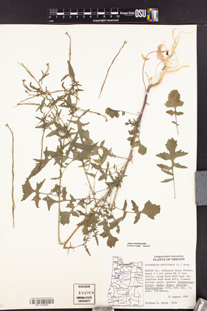 OSC-V-024292_lg.jpg |
 | Brassicaceae 50. Sisymbrium officinale (L.) Scop.U.S.A., Idaho, Kootenai County: Near Dakota of Hwy 95. In pasture next to cattle loading/unloading dock. Sent for identification by ITD. IDE: 2004; ID163031 Greg s.n.Jul 20, 1998 |  ID163031.jpg |


