Terrain
Road Map
Satellite
Hybrid
Terrain

 | Salicaceae 1. Salix sitchensis Sanson ex Bong. var. sitchensis U.S.A., Oregon, Benton County: Corvallis: Willamette Park. Elev. 188 ft. 44.55076° N, 123.24996° W Datum: NAD84. Coordinate uncertainty: 4 meters. By small oxbow pond in riparian forest. Straggly shrub growing out over pond. iNaturalis observation 2090281427. SRP: 84902 Barbara L. Wilson 21542Apr 24, 2024 |  SRP084902.jpg |
 | Salicaceae 2. Salix sitchensis Sanson ex Bong.U.S.A., Washington, Whatcom County: Mt. Baker-Snoqualmie National Forest. Church Mountain false summit area along ridgeline from where cable is anchored eastward to summit block. Elev. 1845 m. 48.92703° N, 121.87615° W Datum: WGS 84. Coordinate uncertainty: 200 meters. Coordinate Source: GPS. Rocky, steep, exposed ridgeline with Dasiphora fruticosa, Phlox diffusa, and Juniperus communis common. Uncommon; single shrub at ridgeline to 1 meter tall. Reproductive state: Fruits. Origin: Native. Erik Ertsgaard 23-156Aug 22, 2023With Inthone Chao, Nick Gjording, David Giblin WTU: 457500; WTU-V-110355 |  WTU-V-110355.jpg |
 | Salicaceae 3. Salix sitchensis Sanson ex Bong.United States, Washington, Whatcom: North Cascades Ecoregion, south shore of Highwood Lake, Heather Meadows, on Mount Baker Highway, NW lower slopes of Mount Shuksan. T39N R9E S18 SE4 SE4. Elev. 4030 ft 48.86405°, -121.67525°. Datum: WGS84. Georeferenced by Fertig. Marsh edged by Salix sitchensis and dominated by Carex kelloggii, Scirpus microcarpus, and Calamagrostis. Soil moist, muddy loam-clay.; Loam-clay. HerbariumSpecimenDuplicate: Salix sitchensis Shrub 6 ft tall with sessile pistillate catkins. Capsules hairy, scales brown. https://intermountainbiota.org WS: 402938; WS017670 Walter Fertig 35832Jul 29, 2023 |  WS017670.JPG |
 | Salicaceae 4. Salix sitchensis Sanson ex Bong.U.S.A., Idaho, Valley County: Payette National Forest. Crater Lake. Wet, west-facing seep along trail to lake. Elev. 2350 m. 45.04408° N, 115.42057° W Datum: WGS 84. Coordinate uncertainty: 4 meters. Dodecatheon, Valeriana, Erythranthe, Osmorhiza occidentalis, Thalictrum. Shrub to 1 m tall. SRP: 77945 J. F. Smith 18463Jul 8, 2022With Paul Allen, Trista Crook, Teague Scott, Elizabeth Mandala |  SRP077945.jpg |
 | Salicaceae 5. Salix sitchensis Sanson ex Bong.United States, Washington, Lewis: Pacific Northwest Coast ecoregion: Boistfort Valley, banks of Stillman Creek, north of Lost Valley Road, ca 3 miles south of Clinton. T12N R4W S2 SE4. Elev. 250 ft 46.547099°, -123.13916°. Alnus rubra riparian forest on muddy terrace bank with abundant leaf litter, woody downfall, and hummocks. With Salix sitchensis, Rubus bifrons, Equisetum arvense, Equisetum hyemale, and Cardamine. HerbariumSpecimenDuplicate: Salix sitchensis Staminate and pistillate trees. https://intermountainbiota.org WS: 399999; WS008281 Walter Fertig 35324Apr 7, 2022 |  WS008281.JPG |
 | Salicaceae 6. Salix sitchensis Sanson ex Bong.U.S.A., Valley County: Payette National Forest. Crater Lake. 45.04408° N, 115.42057° W Datum: WGS 84. Coordinate Source: Specimen Label. Wet, west-facing seep along trail to lake Dodecatheon, Valeriana, Erythranthe, Osmorhiza occidentalis, Thallictrum. Shrub to 1 m tall. CIC: 60198 J.F. Smith 18463Jul 8, 2022With with Paul Allen, Trista Crook, Teague Scott, Elizabeth Mandala |  CIC060198.jpg |
 | Salicaceae 7. Salix sitchensis Sanson ex Bong.U.S.A., Alaska, Kenai Peninsula County: Seward Hwy; next to Seward Hwy, small road/ parking circle electronic maintenance 60.804537° N, 149.18465° W Datum: unknown. Coordinate Source: Specimen Label. Precumbent shrub, 4m long, catkins like S. sitchensis but without shiny lower surface UAAH: 20206 N. Wagner NW22.052Jun 15, 2022With M. Wagner |
 | Salicaceae 8. Salix sitchensis Sanson ex Bong.U.S.A., Alaska, Kenai Peninsula County: Ninilchik; down in town Elev. 0 m. 60° 3.246\' N, 151° 39.847\' W Datum: unknown. Coordinate Source: Specimen Label. Near seashore Shrub, lower leaf side matte, no hairs, dark bracts, catkins "naked" UAAH: 20207 N. Wagner NW22.055Jun 16, 2022With M. Wagner |
 | Salicaceae 9. Salix sitchensis Sanson ex Bong.U.S.A., Alaska, Kenai Peninsula County: Ninilchik; in town Elev. 0 m. 60° 3.251\' N, 151° 39.83\' W Datum: unknown. Coordinate Source: Specimen Label. Near seashore Shrub, 2m (cut down), many shoots, leaves egg-shaped (like walnut tree), lower leaf side dull green UAAH: 20208 N. Wagner NW22.054Jun 16, 2022With M. Wagner |
 | Salicaceae 10. Salix sitchensis Sanson ex Bong.U.S.A., Alaska, Kenai Peninsula County: Seward Hwy; next to Seward Hwy, small road/parking circle electronic maintenance. 60.804398° N, 149.184989° W Datum: unknown. Coordinate Source: Specimen Label. Precumbent shrub, untypically small leaves, but shiny hairs on lower leaf surface UAAH: 20209 N. Wagner NW22.051Jun 15, 2022With M. Wagner |
 | Salicaceae 11. Salix sitchensis Sanson ex Bong.U.S.A., Alaska, Matanuska-Susitna County: Susitna North; Parks Highway, north of Susitna North, campground on lake shore, next to way to campground Elev. 100 m. 62° 8.402\' N, 150° 3.387\' W Datum: unknown. Coordinate Source: Specimen Label. Shrub, ca 3-5m, female UAAH: 20210 N. Wagner NW22.018Jun 12, 2022With M. Wagner |
 | Salicaceae 12. Salix sitchensis Sanson ex Bong.U.S.A., Alaska, Kenai Peninsula County: Seward Hwy; next to Seward Hwy, small road/parking circle electronic maintenance 60.804398° N, 149.184989° W Datum: unknown. Coordinate Source: Specimen Label. Shrub, precumbent, ca 1.2-1.5m, catkins with black bracts UAAH: 20211 N. Wagner NW22.049Jun 15, 2022With M. Wagner |
 | Salicaceae 13. Salix sitchensis Sanson ex Bong.U.S.A., Alaska, Matanuska-Susitna County: Susitna North; Parks Hwy, north of Susitna North Elev. 100 m. 62° 8.422\' N, 150° 3.364\' W Datum: unknown. Coordinate Source: Specimen Label. Campground on lake shore, many willow species Shrub, female catkins almost dropping UAAH: 20212 N. Wagner NW22.023Jun 12, 2022With M. Wagner |
 | Salicaceae 14. Salix sitchensis Sanson ex Bong.U.S.A., Alaska, Matanuska-Susitna County: Susitna North; Parks Hwy, north of Susitna North Elev. 100 m. 62° 8.402\' N, 150° 3.387\' W Datum: unknown. Coordinate Source: Specimen Label. Campground on lake shore Shrub, ca 5m UAAH: 20213 N. Wagner NW22.017Jun 12, 2022With M. Wagner |
 | Salicaceae 15. Salix sitchensis Sanson ex Bong.U.S.A., Oregon, Benton County: Irish Bend County Park on the Willamette River, ca. 5.5 air miles NE of Monroe, at the end of Irish Bend Road. Elev. 78 m. 44.360803° N, 123.2201° W River bank, sand and gravel with Physocarpus, Symphoricarpos, Rubus, Populus, Salix. shrub 3 meters tall; flowers pistillate. SRP: 76322 Richard R. Halse 10629Mar 26, 2021 |  SRP076322.jpg |
 | Salicaceae 16. Salix sitchensis Sanson ex Bong.U.S.A., Oregon, Benton County: Irish Bend County Park on the Willamette River, ca. 5.5 air miles NE of Monroe, at the end of Irish Bend Road. Elev. 78 m. 44.360803° N, 123.2201° W River bank, sand and gravel with Symphoricarpos, Physocarpus, Populus, Rubus. Shrub 3 meters tall; flowers staminate. SRP: 76323 Richard R. Halse 10628Mar 26, 2021 |  SRP076323.jpg |
 | Salicaceae 17. Salix sitchensis SansonU.S.A., Washington, San Juan County: Blakely Island. 48.55231° N, 122.78503° W Datum: WGS84. Coordinate Source: GPS. In Carex obnupta swamp, with Gaultheria shallon, Malus fusca, Picea sitchensis, Pinus contorta, Salix lasiandra, and Salix scouleriana. 5m tall trees. Reproductive state: Flowering. Origin: Native. Peter Dunwiddie PWD-21-43May 20, 2021With Peter Zika WTU: 461399; WTU-V-117916 |  WTU-V-117916.jpg |
 | Salicaceae 18. Salix sitchensis Sanson ex Bong. var. sitchensis U.S.A., Oregon, Wheeler County: Rock Creek Trail, Ochoco National Forest. Rock Creek bridge. Elev. 4426 ft. 44.35809° N, 119.78001° W Growing out of shallow, fast-moving water with Alnus and Cornus sericeus. COCC: 6551 Cindy Roché 2021-28Jul 30, 2021With Robert Korfhage |  COCC6551.jpg |
 | Salicaceae 19. Salix sitchensis Sanson ex Bong.United States, Oregon, Benton: Irish Bend County Park, on the Willamette River, ca 5.5 miles NE of Monroe, at the end of Irish Bend Road,. Elev. 78 44.360803°, -123.2201°. River bank; sand and gravel. HerbariumSpecimenDuplicate: Salix sitchensis Shrub, 3 meters tall; flowers staminate. https://intermountainbiota.org WS: 400051; WS008325 Richard R. Halse 10628Mar 26, 2021 |  WS008325_1708641238_lg.jpg |
 | Salicaceae 20. Salix sitchensis Sanson ex Bong.United States, Oregon, Benton: Irish Bend County Park, on the Willamette River, ca 5.5 miles NE of Monroe, at the end of Irish Bend Road. Elev. 78 44.360803°, -123.2201°. River bank; sand and gravel. HerbariumSpecimenDuplicate: Salix sitchensis Shrub, 3 meters tall; flowers pistillate. https://intermountainbiota.org WS: 400050; WS008392 Richard R. Halse 10629Mar 26, 2021 |  WS008392_1687449636_lg.jpg |
 | Salicaceae 21. Salix sitchensis Sanson ex Bong. var. sitchensis United States, Oregon, Wheeler: Rock Creek Trail, Ochoco National Forest. Rock Creek bridge. Elev. 4426 feet 44.35809°, -119.78001°. Growing out of shallow, fast-moving water. Alnus, Cornus sericeus https://oregonflora.org OSC-V-267427 Cindy T. Roché 2021-28Jul 30, 2021With Robert Korfhage | 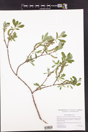 OSC-V-267427_lg.jpg |
 | Salicaceae 22. Salix sitchensis Sanson ex Bong.United States, Oregon, Lincoln: Lincoln City: south of beach access stairs at west end of 26th Street. Elev. 54 feet 44.984136°, -124.01391°. Sidewalk crack. INaturalist observation #7780390. https://oregonflora.org OSC-V-267756 Barbara L. Wilson 2021Jul 15, 2021 | 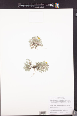 OSC-V-267756_lg.jpg |
 | Salicaceae 23. Salix sitchensis Sanson ex Bong.United States, Oregon, Benton: Irish Bend County Park, on the Willamette River, ca. 5.5 air miles NE of Monroe, at the end of Irish Bend Road. Elev. 78 m 44.360803°, -123.2201°. River bank, sand and gravel. Symphoricarpos, Physocarpus, Populus, Rubus Shrub 3 meters tall; flowers staminate. https://oregonflora.org OSC-V-268910 Richard R. Halse 10628Mar 26, 2021 | 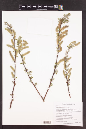 OSC-V-268910.jpg |
 | Salicaceae 24. Salix sitchensis Sanson ex Bong.United States, Oregon, Benton: Irish Bend County Park, on the Willamette River, ca. 5.5 air miles NE of Monroe, at the end of Irish Bend Road. Elev. 78 m 44.360803°, -123.2201°. River bank, sand and gravel. Symphoricarpos, Cornus, Rubus, Salix, Populus Shrub 2 meters tall; flowers staminate. https://oregonflora.org OSC-V-268858 Richard R. Halse 10661Apr 28, 2021 | 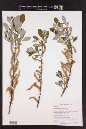 OSC-V-268858.jpg |
 | Salicaceae 25. Salix sitchensis Sanson ex Bong.United States, Oregon, Benton: Irish Bend County Park, on the Willamette River, ca. 5.5 air miles NE of Monroe, at the end of Irish Bend Road. Elev. 78 m 44.360803°, -123.2201°. River bank, sand and gravel. Physocarpus, Symphoricarpos, Populus, Salix hookeriana, Salix lasiandra, Salix lasiolepis Shrub 3 meters tall; flowers pistillate. https://oregonflora.org OSC-V-268886 Richard R. Halse 10638Apr 16, 2021 | 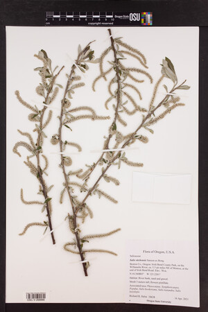 OSC-V-268886.jpg |
 | Salicaceae 26. Salix sitchensis Sanson ex Bong.United States, Oregon, Benton: Irish Bend County Park, on the Willamette River, ca. 5.5 air miles NE of Monroe, at the end of Irish Bend Road. Elev. 78 m 44.360803°, -123.2201°. River bank, sand and gravel. Physocarpus, Symphoricarpos, Rubus, Populus, Salix Shrub 3 meters tall; flowers pistillate. https://oregonflora.org OSC-V-268887 Richard R. Halse 10629Mar 26, 2021 | 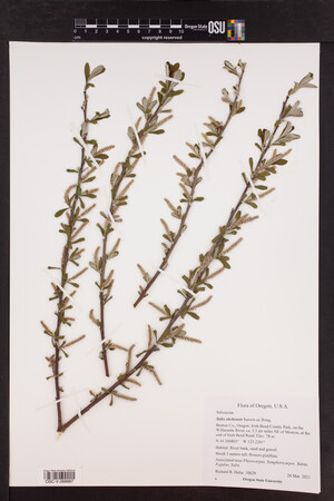 OSC-V-268887.jpg |
 | Salicaceae 27. Salix sitchensis Sanson ex Bong.United States, Oregon, Benton: Irish Bend County Park, on the Willamette River, ca. 5.5 air miles NE of Monroe, at the end of Irish Bend Road. Elev. 78 m 44.360803°, -123.2201°. River bank, sand and gravel. Symphoricarpos, Physocarpus, Rubus, Populus, Salix lasiandra, Salix sessilifolia Shrub 4 meters tall; flowers pistillate. https://oregonflora.org OSC-V-268857 Richard R. Halse 10660Apr 28, 2021 | 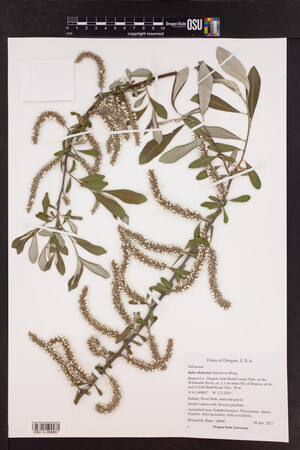 OSC-V-268857.jpg |
 | Salicaceae 28. Salix sitchensis Sanson ex Bong. var. sitchensis U.S.A., Idaho, Boundary County: Kaniksu National Forest: Selkirk Mountains: Upper Priest River valley: east shoulder of FS Road 1013, about 6 km north of junction with road 655. Site ID: SK-402. Elev. 803 m. 48.893731° N, 116.961684° W Datum: WGS 84. Coordinate uncertainty: 8 meters. Coordinate Source: GPS. Roadside ditch with standing water fed by small streams; mossy soil; on edge of old growth Thuja plicata and Tsuga heterophylla forest. Leaves white-hairy beneath; shrubs 2-3 meters tall, in ditch. Reproductive state: Fruits. Origin: Native. ID: 186219; ID191773 Harpo Faust 2755Jun 20, 2020With Ben Legler, Dave Tank |  ID191773.jpg |
 | Salicaceae 29. Salix sitchensis Sanson ex Bong. var. sitchensis U.S.A., Idaho, Bonner County: Priest Lake State Forest, Selkirk Mountains, Caribou Creek, off East Shore Road. Site ID: SK-408. Elev. 779 m. 48.770748° N, 116.833534° W Datum: WGS 84. Coordinate uncertainty: 10 meters. Coordinate Source: GPS. Creekside rocky beach dominated by deciduous riparian cover of Salix and Alnus, adjacent to Mesic Forest. Shrub to 2m, multi branching from base. Reproductive state: Fruits. Origin: Native. ID: 186220; ID191774 Harpo Faust 2772Jun 22, 2020With Whitney Griswold |  ID191774.jpg |
 | Salicaceae 30. Salix sitchensis Sanson ex Bong. var. sitchensis U.S.A., Idaho, Bonner County: Priest Lake State Forest, Selkirk Mountains, Moose Lake, off East Shore Road. Site ID: SK-413. Elev. 799 m. 48.701031° N, 116.827595° W Datum: WGS 84. Coordinate uncertainty: 6 meters. Coordinate Source: GPS. Lakeside deciduous riparian opening at waters edge dominated by Willows, Spirea douglasii and Populus trichocarpa with abundant sedges. Highly disturbed. Reproductive state: Fruits. Origin: Native. ID: 186221; ID191775 Harpo Faust 2817Jun 23, 2020With Whitney Griswold |  ID191775.jpg |
 | Salicaceae 31. Salix sitchensis Sanson ex Bong. var. sitchensis U.S.A., Idaho, Bonner County: Priest Lake State Forest, Selkirk Mountains, Baldy Mountain Road, about 1 mile southeast of Bald Mountain, National Forest Service Road 2601. Site ID: SK-419. Elev. 1635 m. 48.332281° N, 116.702916° W Datum: WGS 84. Coordinate uncertainty: 12 meters. Coordinate Source: GPS. South sloped rocky seep dominated by Sorbus sitchensis with Valeriana sitchensis, Osmorhiza occidentalis, Hieracium scouleri and Artemisia ludoviciana. 2m shrub. Reproductive state: Flowers. Origin: Native. ID: 186218; ID191772 Harpo Faust 2855Jun 24, 2020With Whitney Griswold |  ID191772.jpg |
 | Salicaceae 32. Salix sitchensis Sanson ex Bong. var. sitchensis U.S.A., Idaho, Boundary County: Kaniksu National Forest, Selkirk Mountains, Smith Creek Road, Road 281, overlooking Smith Creek. Site ID: SK-432. Elev. 1113 m. 48.918844° N, 116.679339° W Datum: WGS 84. Coordinate uncertainty: 4 meters. Coordinate Source: GPS. Wet and weedy roadside ditch with lots of organic material and moss layer with Athryium filix-femina, Fragaria virginiana, Equisetum arvense and Rubus nutkana. Multi stemmed shrub to 2m. Reproductive state: Fruits. Origin: Native. ID: 186222; ID191776 Harpo Faust 2976Jun 30, 2020With Whitney Griswold |  ID191776.jpg |
 | Salicaceae 33. Salix sitchensis Sanson ex Bong. var. sitchensis U.S.A., Idaho, Bonner County: Priest Lake State Forest, Selkirk Mountains, Bugle Creek Road, about 2 air miles directly north of Caribou Hill. Site ID: SK-454. Elev. 1281 m. 48.834494° N, 116.837046° W Datum: WGS 84. Coordinate uncertainty: 5 meters. Coordinate Source: GPS. Moist roadside ditch with Thuja plicata and Acer glabrum overstory with Salix, Mertensia, Thalictrum and Aconitum densely covering roadside. Multi stemmed shrub about 5 feet tall. Reproductive state: Flowers. Origin: Native. ID: 186217; ID191771 Harpo Faust 3189Jul 8, 2020With Whitney Griswold |  ID191771.jpg |
 | Salicaceae 34. Salix sitchensis Sanson ex Bong. var. sitchensis U.S.A., Idaho, Boundary County: Priest Lake State Forest, Selkirk Mountains, Lion Creek Road, Old road that switchbacks up to Lookout Mountain. Site ID: SK-458. Elev. 1405 m. 48.762872° N, 116.753904° W Datum: WGS 84. Coordinate uncertainty: 5 meters. Coordinate Source: GPS. Wet disturbed clearing amidst creek tributary and forest edge with peat moss ground cover with Antennaria, Castilleja hispida, and Hieracium. Multi stemmed shrub to 2m. Reproductive state: Flowers. Origin: Native. ID: 186223; ID191777 Harpo Faust 3249Jul 9, 2020With Whitney Griswold |  ID191777.jpg |
 | Salicaceae 35. Salix sitchensis Sanson ex Bong.U.S.A., Oregon, Clackamas County: Peach Cove Fen, 3 mi NNE of Canby. Elev. 135 ft. 45.300518° N, 122.674652° W; T03S, R01E, N 1/2 Sec. 22. Datum: WGS 84. Coordinate uncertainty: 106 meters. Coordinate Source: Digital Map. On floating fen mat. With Spiraea douglasii, Sphagnum squarrosum, Menyanthes trifoliata. HPSU: 22506 Patrick Hendrix s.n.Sep 25, 2020 |  HPSU_022506.jpg |
 | Salicaceae 36. Salix sitchensis Sanson ex Bong.United States, Washington, Grays Harbor: Pacific Coast Range: South Olympic Mountain Range, along USFS Road 2312, 1 mile NW of summit of Three Peaks, plateau 1.5 miles N of Wynochee River and divide between North Fork West Branch Wynochee and South Fork Chikamin Creek, 4 miles N of Lake Wynochee. T23N R8W S16 NE4 NW4 NE4 NW4. Elev. 3190ft 47.49038°, -123.57726°. Abandoned roadbed in second growth Callitropsis nootkatensis thicket with Salix sitchensis. HerbariumSpecimenDuplicate: Salix sitchensis Pistillate shrub 5 ft tall. https://intermountainbiota.org WS: 401002; WS009246 Walter Fertig; Regina Johnson 34752Jul 24, 2020With Steve Ness, & Mary McCallum |  WS009246_1708619952_lg.jpg |
 | Salicaceae 37. Salix sitchensis Sanson ex Bong. var. sitchensis United States, Washington, Grays Harbor: Pacific Coast Range: Preacher Slough Trail (old railroad bed) along south boundary of Chehalis River Surge Plain Natural Area Preserve, 3 air miles SW of Montesano. T17N R8W S22 SE4 NE4 SE4. Elev. 20 ft 46.941461°, -123.65727°. Datum: WGS84. River edge in Phalaris arundinacea marsh with scattered Salix hookeriana, Salix sitchensis, Physocarpus capitatus, and Rosa nutkana var. nutkana. HerbariumSpecimenDuplicate: Salix sitchensis var. sitchensis Shrub 5 ft tall. Uncommon. https://intermountainbiota.org WS: 400904; WS009319 Walter Fertig 34452May 10, 2020 |  WS009319_1716303477_lg.jpg |
 | Salicaceae 38. Salix sitchensis Sanson ex Bong.United States, Oregon, Washington: Along Gales Creek. Elev. 64m 45.5476°, -123.1801°. Datum: WGS84. Riparian scrub; Wet sand. Spiraea douglasii, Lonicera involucrata, Physocarpus capitatus https://oregonflora.org OSC-V-268943 George Kral 790Apr 26, 2020 | 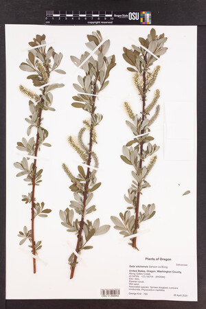 OSC-V-268943.jpg |
 | Salicaceae 39. Salix sitchensis Sanson ex Bong. var. sitchensis U.S.A., Idaho, Boundary County: Kaniksu National Forest, Selkirk Mountains, Forest Service road 291 off Pack River Valley Road, below Dodge Peak. Site ID: SK-97. Elev. 1223 m. 48.557782° N, 116.557917° W Datum: WGS 84. Coordinate uncertainty: 10 meters. Coordinate Source: GPS. Open wet meadow dominated by Willows, Alder and Spiraea adjacent to Hemlock/Cedar moist forest, dominant species: Alopecurus, Geum, Senecio triangularis, Ranunculus, Platanthera. Reproductive state: Fruits. Origin: Native. ID: 182065; ID187619 Harpo Faust 2019-790Jul 2, 2019With Peri Lee Pipkin |  ID187619.jpg |
 | Salicaceae 40. Salix sitchensis Sanson ex Bong. var. sitchensis U.S.A., Idaho, Boundary County: Kaniksu National Forest, Selkirk Mountains, Forest Service Road 433, Smith Ridge. Site ID: SK-94. Elev. 1057 m. 48.927446° N, 116.658464° W Datum: WGS 84. Coordinate uncertainty: 20 meters. Coordinate Source: GPS. Moist, moss covered roadside drainage surrounded by Hemlock, Abies, Spruce with mid-story of Alder, Rubus, and Willow. Multi stemmed shrub to 2 m. Silica taken. Reproductive state: Fruits. Origin: Native. ID: 182024; ID187578 Harpo Faust 2019-752Jul 1, 2019With Peri Lee Pipkin |  ID187578.jpg |
 | Salicaceae 41. Salix sitchensis Sanson ex Bong.U.S.A., Oregon, Multnomah County: Gresham, 100 meters NW of SW 7th Street and SW 4th Street. 45.4945° N, 122.4402° W Coordinate Source: Specimen Label. Riparian wetland on Johnson Creek. Female, mature shrub to 6 meters. Reproductive state: Flowers. HPSU: 19960 Jeffrey T. Lesh 1088Apr 12, 2019 |
 | Salicaceae 42. Salix sitchensis Sanson ex Bong. var. sitchensis U.S.A., Washington, Skamania County: Gifford Pinchot National Forest, Confluence of Green Fork of the East Fork Lewis River and East Fork Lewis River near East Fork Lewis River Trailhead. 45.8305° N, 122.1546° W Datum: WGS 84. Georeferenced by Jeffrey Lesh. Coordinate Source: Digital Map. Riverbank embankment at bridge. With Alnus rubra. Around 8 meters tall. Reproductive state: Fruits. Origin: Native. HPSU: 19977 Jeffrey T. Lesh 1107May 10, 2019 |
 | Salicaceae 43. Salix sitchensis Sanson ex Bong.United States, Washington, King: North Cascades Ecoregion: Middle Fork Snoqualmie Natural Resources Conservation Area, north bank of Upper Granite Lake, ca 7.5 air miles ESE of North Bend. T23N R9E S26 SE4 NE4 NE4. Elev. 3060ft 47.452°, -121.612°. East shore of lake in community of Salix sitchensis and Sphagnum on banks adjacent to Tsuga heterophylla and Spiraea douglasii forest. HerbariumSpecimenDuplicate: Salix sitchensis Common. Shrub 5 ft tall. https://intermountainbiota.org WS: 400600; WS008934 Walter Fertig; Stacy Kinsell 34321Aug 16, 2019With Janka Hobbs, Julia Bent, & Collette Maclean |  WS008934_1689024641_lg.jpg |
 | Salicaceae 44. Salix sitchensis Sanson ex Bong.United States, Washington, Thurston: Puget Trough: Olympia, north side of Capitol Lake, Olympia, south of 5th Street and east of Deschutes Avenue. T18N R2W S47. Elev. 20ft 47.043425°, -122.90814°. Datum: WGS84. Willow thicket on shore of lake, with Salix sitchensis, Acer macrophyllum, and Alnus rubra. HerbariumSpecimenDuplicate: Salix sitchensis Pistillate shrub, 6 ft tall. https://intermountainbiota.org WS: 401041; WS009207 Walter Fertig 33487Apr 12, 2019 |  WS009207_1689632884_lg.jpg |
 | Salicaceae 45. Salix sitchensis Sanson ex Bong.U.S.A., Washington, Snohomish County: North Creek Regional Park. Take boardwalk north west out toward Peat Pond. 47° 50.102\' N, 122° 13.212\' W Georeferenced by Mahleah Grant. Coordinate Source: GPS. Growing in saturated soil along boardwalk in partial shade. Tree cover (0%). Shrub cover (80%): Salix lasiandra, Salix sitchensis. Emergent cover (100%): Alisma trivale, Athyrium filix-femina, Glyceria elata, Spiraea douglasii, Galium sp., Hippuris vulgaris, Myosotis scorpiodes, and Impatiens capensis. Shrub forming, multi-trunk. Mature trunks with many different lichens. Green leaves with soft silver underside. Reproductive state: Vegetative. UWB: 000874; UWB 100909 Mahleah Grant 20Jul 22, 2018With Sarah Verlinde |  UWB 100909.jpg |
 | Salicaceae 46. Salix sitchensis Sanson ex Bong. var. sitchensis United States, Washington, Grays Harbor: Pacific Coast Range, 15 Overlake Lane, McCleary, 0.5 miles S of WA Hwy 8, ca 18 miles W of Olympia. Elev. 340ft 47.046122°, -123.27964°. Datum: WGS84. Georeferenced by Fertig. Alnus rubra-Salix sitchensis thicket by road above small pond. HerbariumSpecimenDuplicate: Salix sitchensis var. sitchensis Staminate shrubs 10 ft tall; pistillate shrubs 4 ft tall. Bracts yellow, with brown rounded tips, flowers emerging before the leaves. https://intermountainbiota.org WS: 402617; WS016414 Walter Fertig 32287Apr 8, 2018 |  WS016414.JPG |
 | Salicaceae 47. Salix sitchensis Sanson ex Bong.United States, Oregon, Multnomah: West side of Multnomah Channel. 45.6797°, -122.8722°. Floodplain backwater swamp. https://oregonflora.org OSC-V-263834 George Kral 758Mar 29, 2018 | 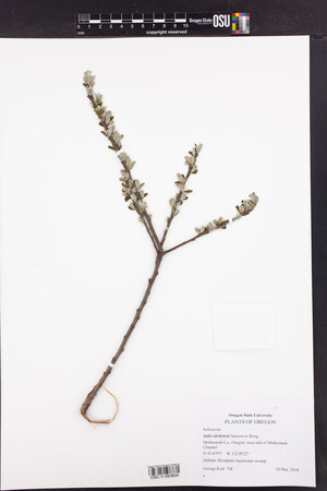 OSC-V-263834_lg.jpg |
 | Salicaceae 48. Salix sitchensis Sanson ex Bong.U.S.A., Oregon, Lane County: Prairie Mountain in the Coast Range ca. 7.5 air miles south of Alsea; along Prairie Mountain Road (14-8-34) ca. 5.1 miles south of its junction with State Hwy 501. Elev. 855 m. 44.28145° N, 123.57086° W Datum: WGS 84. Coordinate Source: Specimen Label. with Rubus, Cytisus, Alnus, Fragaria, Lupinus, Sambucus. Shrub 3-4 m tall. SRP: 63991 Richard R. Halse 9982May 29, 2017 |  SRP063991.jpg |
 | Salicaceae 49. Salix sitchensis Sanson ex Bong.U.S.A., Alaska: Tongass National Forest, Petersburg Ranger District, mainland, Oasis Glacier Elev. 175 m. 57.193664° N, 132.634109° W Datum: WGS 84. Coordinate Source: GPS. Moraine. UAAH: 12562 Joni Johnson JJ2017021Jul 13, 2017 |  UAAH_012562.jpg |
 | Salicaceae 50. Salix sitchensis Sanson ex Bong.U.S.A., Oregon, Clackamas County: Carver, Clackamas River 1 kilometer downstream of Carver Bridge. 45.400358° N, 122.507937° W Coordinate Source: Specimen Label. Floodplain/Riparian. Reproductive state: Fruits. Origin: Native. HPSU: 20657 Jeffrey T. Lesh 280May 31, 2017With Lindsey Karr, Chris Hagel |


