Terrain
Road Map
Satellite
Hybrid
Terrain

 | Rosaceae 1. Physocarpus capitatus (Pursh) KuntzeU.S.A., Washington, Pierce County: Tahoma Woods administration area, S of Route 706, 6.2 air km ESE of Alder Lake, Mount Rainier National Park, Cascade Range. Elev. 410 m. 46.753° N, 122.1239° W Coordinate Source: Specimen label. Nisqually River floodplain, dry ground, shaded, over volcanics, with Alnus rubra, Urtica dioica, Phalaris arundinacea, Athyrium filix-femina. 1.5 m tall shrubs. Study #: MORA-00326 Permit #: MORA-2024-SCI-0004 NPS Accession #: MORA-1332 NPS Catalog #: MORA 29920 Reproductive state: Vegetative. Origin: Native. Peter F. Zika 31974Aug 9, 2024WTU: 461772; WTU-V-118888 |  WTU-V-118888.jpg |
 | Rosaceae 2. Physocarpus capitatus (Pursh) KuntzeU.S.A., Idaho, Latah County: Clearwater National Forest, Palouse Ranger District, Forest Road 447, along Palouse River. About 1.12 miles east of junction with Forest Road 768. Elev. 2756 ft. 46.953428° N, 116.624009° W Mature mesic coastal disjunct forest. Thuja plicata and Tsuga heterophylla overstory. Understory comprised of Physocarpus capitatus, Asarum caudatum, Acer glabrum, Pteridium aquilinum, Equisetum arvense (?), Maianthemum stellatum, and Adenocaulon bicolor. Mature riparian stand is surrounded by extensive logged Ponderosa - Douglas-fir forest. 3 carpels per fruit. Reproductive state: Fruits. Origin: Native. ID: 192603; ID198201 Daniel Turck 2023-102Aug 7, 2023 |
 | Rosaceae 3. Physocarpus capitatus (Pursh) KuntzeU.S.A., Idaho, Latah County: Clearwater National Forest, Palouse Ranger District, Forest Road 768 along Little Sand Creek. About 1 mile south of junction with Forest Road 447. Elev. 2801 ft. 46.932981° N, 116.631728° W Datum: WGS 84. Georeferenced by Dan Turck. Coordinate Source: Digital Map. Open riparian habitat in mixed mesic forest. Surrounding forests are predominantly comprised of Thuja plicata, Tsuga heterophylla, and Larix occidentalis. Riparian vegetation dominated by Alnus sp. and Physocarpus capitatus. 3 carpels per fruit. Reproductive state: Fruits. Origin: Native. ID: 192604; ID198202 Daniel Turck 2023-101Aug 7, 2023 |  ID198202.jpg |
 | Rosaceae 4. Physocarpus capitatus (Pursh) KuntzeU.S.A., Idaho, Latah County: Clearwater National Forest, Palouse Ranger District, Laird Park Campground. Plants located the beginning of Jim E. Dewey Trail, just south of small concrete dam at swimming hole. Elev. 2668 46.942203° N, 116.651471° W Young Abies grandis forest. Understory dominated by Alnus sp., Crategus douglasii, and Physocarpus capitatus. 3 carpels per fruit. Reproductive state: Fruits. Origin: Native. ID: 192602; ID198200 Daniel Turck 2023-100Aug 7, 2023 |  ID198200.jpg |
 | Rosaceae 5. Physocarpus capitatus (Pursh) KuntzeU.S.A., Washington, Mason County: Cushman Bluff on Lake Cushman Road, below Mt. Rose. Elev. 760 ft. 47.49421° N, 123.2811° W Datum: WGS 84. Coordinate Source: GPS. South-facing rock bluff with mossy seepy crevices, in lowland mixed coniferous forest along Lake Cushman. With Pseudotsuga menziesii, Arbutus menziesii, Acer macrophyllum. Common. On rock face in moist ledges and crevices. Reproductive state: Flowers. Origin: Native. Regina Johnson 2022-091Jun 17, 2022WTU: 432542; WTU-V-099297 |  WTU-V-099297.jpg |
 | Rosaceae 6. Physocarpus capitatus (Pursh) KuntzeUnited States, Washington, Mason: Cushman Bluff on Lake Cushman Road, below Mount Rose. Elev. 760 ft 47.49421°, -123.2811°. South-facing rock bluff with mossy seepy crevices, in lowland mixed coniferous forest along Lake Cushman. Pseudotsuga menziesii, Arbutus menziesii, Acer macrophyllum Common. On rock face in moist ledges and crevices. https://intermountainbiota.org WS: 402091; WS014650 Regina Johnson 2022-091Jun 17, 2022 |  WS014650.JPG |
 | Rosaceae 7. Physocarpus capitatus (Pursh) KuntzeU.S.A., Washington, Lewis County: Willapa Hills trail at Ceres Hill Road. Elev. 250 ft. 46.61282° N, 123.16529° W Datum: WGS 84. Coordinate Source: GPS. Lowland riparian zone between commercial timber and agriculture. Silt loam soil. Common. With Cornus sericea, Fraxinus latifolia, Populus trichocarpa, Acer macrophyllum. Reproductive state: Flowers. Origin: Native. Regina Johnson 2021-020May 30, 2021WTU: 431496; WTU-V-093789 |  WTU-V-093789.jpg |
  | Rosaceae 8. Physocarpus capitatus (Pursh) KuntzeU.S.A., Washington, Grays Harbor County: Tidally influenced alder forest located off Peel’s Slough of the Chehalis River near Montesano. 47.958772° N, 123.634956° W Invalid coordinates (located outside county bounds). Saturated, part sun, fresh water tidal surge plain wetland/riparian shrub-forest. Sparse, shrub, fibrous, erect. Patricia Johnson NWC21-WA-10037-Q12Jun 8, 2021WTU: 426812; WTU-V-074111 |  WTU-V-074111.jpg |
 | Rosaceae 9. Physocarpus capitatus (Pursh) KuntzeU.S.A., Washington, Whatcom County: Within the floodplain and along a side channel of the Nooksack River. South of Maple Falls. 48.900481° N, 122.117391° W Datum: WGS 84. Coordinate uncertainty: 2000 meters. Georeferenced by Jim Duemmel. Coordinate Source: Digital Map. Forested wetland/riparian area within the floodplain; dry at surface; part sun. Sparse, shrub, erect; flower white, 5-lobed. Reproductive state: Fruits. Origin: Native. Patricia Johnson NWC21-WA-10283-Q48Aug 19, 2021WTU: 459692; WTU-V-113508 |  WTU-V-113508.jpg |
 | Rosaceae 10. Physocarpus capitatus (Pursh) KuntzeU.S.A., Oregon, Benton County: Irish Bend County Park on the Willamette River, ca. 5.5 air miles NE of Monroe, at the end of Irish Bend Road. Elev. 78 m. 44.364347° N, 123.220537° W Forested area with Tanacetum, Cornus, Populus, Symphoricarpos, Crataegus, Rubus. Shrub 3 meters tall; petals white. SRP: 76372 Richard R. Halse 10720May 26, 2021 |  SRP076372.jpg |
 | Rosaceae 11. Physocarpus capitatus (Pursh) KuntzeUnited States, Oregon, Benton: Irish Bend County Park, on the Willamette River, at the end of Irish Bend Road, ca 5.5 air miles NE of Monroe. Elev. 78 44.364347°, -123.22053°. Georeferenced by collector. Forested area. HerbariumSpecimenDuplicate: Physocarpus capitatus Shrub, 3 meters tall; petals white. https://intermountainbiota.org WS: 400047; WS008329 Richard R. Halse 10720May 26, 2021 |  WS008329_1690405989_lg.jpg |
 | Rosaceae 12. Physocarpus capitatus (Pursh) KuntzeUnited States, Oregon, Benton: Irish Bend County Park, at the end of Irish Bend Road, on the Willamette River, ca. 5.5 air miles NE of Monroe. Elev. 78 m 44.364347°, -123.22053°. Forested area. Tanacetum, Cornus, Populus, Symphoricarpos, Crataegus, Rubus Shrub 3 meters tall; petals white. https://oregonflora.org OSC-V-268876 Richard R. Halse 10720May 26, 2021 | 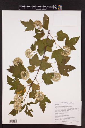 OSC-V-268876.jpg |
 | Rosaceae 13. Physocarpus capitatus (Pursh) KuntzeU.S.A., Washington, Clark County: Camas. Property along Lacamas Creek south of intersection of Northeast Ingle Road and Northeast Goodwin Road and north of Northwest Alexandra Lane. Elev. 200 ft. 45.639894°, -122.45432°. Datum: WGS 84. Georeferenced by Dominic Maze. Coordinate Source: Digital Map. Forested wetland and prairie remnant complex along creek. With creek side channels and vernal pools. Emergent and on recently exposed soils under moderate canopy. Reproductive state: Flowers. Origin: Native. HPSU: 22632 Dominic Maze 1596May 19, 2020 |  HPSU003106.jpg |
 | Rosaceae 14. Physocarpus capitatus (Pursh) KuntzeU.S.A., Oregon, Sherman County: At Jones Canyon Recreation Site along Lower Deschutes River Access Road. Elev. 556 ft. 45° 18.485\' N, 120° 57.446\' W Coordinate Source: Specimen label. Along shoreline of river with heavy cover of tall shrubs. Pacific ninebark. Reproductive state: Flowers. Origin: Native. David Gross 1851May 15, 2020WTU: 457281; WTU-V-110129 |  WTU-V-110129.jpg |
 | Rosaceae 15. Physocarpus capitatus (Pursh) KuntzeU.S.A., Oregon, Columbia County: Columbia Botanical Gardens. St. Helens. Elev. 50 ft. 45.87468°, -122.80410°. Datum: WGS 84. Coordinate uncertainty: 44 meters. Georeferenced by Dominic Maze. Coordinate Source: Digital Map. Large undeveloped parcel consisting of Bretz gravels, scoured basalt, cliffs and wetland complex. Occasional in open shallow-soil areas near Cytisus. Reproductive state: Flowers. Origin: Native. HPSU: 24178 Dominic Maze 1984May 1, 2020With Cyrene Maze, Zane Maze |
 | Rosaceae 16. Physocarpus capitatus (Pursh) KuntzeU.S.A., Washington, Klickitat County: Brown\'s Island, 45 acre island 4.75 miles upriver from The Dalles Dam. Elev. 164 ft. 45.65522° N, 121.036437° W Georeferenced by Crystal Shin. Coordinate Source: Google Earth. Several scattered shrubs in thickets at east end of island. Shrub to 4m tall. Reproductive state: Flowers. Origin: Native. WTU Peter Dunwiddie PWD-19-11May 7, 2019With Kathryn Beck |
 | Rosaceae 17. Physocarpus capitatus (Pursh) KuntzeU.S.A., Alaska: [locality and coordinates withheld; status in Alaska: S2 (Imperiled; ACCS)] Stream side habitat. Assoc. species: Carex mertensii, Tsuga heterophylla, Thuja plicata UAAH: 15083 L. Grevstad s.n.Jun 26, 2019 |  |
 | Rosaceae 18. Physocarpus capitatus (Pursh) KuntzeU.S.A., Alaska: [locality and coordinates withheld; status in Alaska: S2 (Imperiled; ACCS)] Stream side habitat. Assoc. species: Carex mertensii, Tsuga heterophylla, Thuja plicata UAAH: 15084 L. Grevstad s.n.Jun 26, 2019 |  |
 | Rosaceae 19. Physocarpus capitatus (Pursh) KuntzeU.S.A., Washington, Grays Harbor County: Olympic National Forest. West Fork Humptulips River. Forest Service Road 2204. Along River corridor where Pete\'s Creek Trail and West Fork Trail intersect. Elev. 200 m. 47.44733° N, 123.72636° W Datum: WGS 84. Coordinate uncertainty: 50 meters. Coordinate Source: Digital map. Cobbly riverbank and adjacent upland dominated by Alnus rubra, Acer macrophyllum, and Salix sitchensis. Scattered in floodplain; multi-stemmed shrub to 3 meters tall. Reproductive state: Fruits. Origin: Native. David Giblin 7128Aug 27, 2019WTU: 426131; WTU-V-071152 |  WTU-V-071152.jpg |
 | Rosaceae 20. Physocarpus capitatus (Pursh) KuntzeU.S.A., Washington, Klickitat County: At Klickitat River crossing on Glenwood-Goldendate Highway. 45.937124°, -121.11877°. Datum: WGS 84. Coordinate uncertainty: 500 meters. Georeferenced by Dan Post. Coordinate Source: Digital Map. In ponderosa pine / Oregon white oak forest with grass and forbs. Pacific ninebark. Reproductive state: Flowers. Origin: Native. David Gross 1642Jun 10, 2019WTU: 426367; WTU-V-071351 |  WTU-V-071351.jpg |
 | Rosaceae 21. Physocarpus capitatus (Pursh) KuntzeU.S.A., Oregon, Columbia County: East shore of Sauvie Island, Willow Bar. 45.728555°, -122.76769°. Datum: WGS 84. Georeferenced by Dominic Maze. Coordinate Source: Digital Map. Sandy stabilized soils under canopy. Fairly infrequent with Elaeagnus, Populus, Rubus armeniacus, and Carex arenaria Reproductive state: Fruits. Origin: Native. HPSU: 20724 Dominic Maze 1024Nov 11, 2019 |
 | Rosaceae 22. Physocarpus capitatus (Pursh) KuntzeUnited States, Washington, King: North Cascades Ecoregion: Middle Fork Snoqualmie Natural Resources Conservation Area, NW shore of lower Granite Lakes, ca 8 air miles SE of North Bend. T23N R9E S26 NE4 NE4. Elev. 2960 ft 47.452283°, -121.61216°. Narrow wet meadow along rocky edge of lake and stream with downed logs and rim of Vaccinium membranaceum, Alnus sinuata, Xerophyllum tenax, and Physocarpus capitatus. Surrounded by Tsuga heterophylla, Thuja plicata, and Abies amabilis forest. HerbariumSpecimenDuplicate: Physocarpus capitatus Three carpels per fruit. Common shrub. https://intermountainbiota.org WS: 411895; WS037095 Walter Fertig 34284Aug 15, 2019 |  WS037095.JPG |
 | Rosaceae 23. Physocarpus capitatus (Pursh) KuntzeU.S.A., Washington, Clallam County: Olympic National Forest. Klahowya Campground on Sol Duc River. Elev. 239 m. 48.06784° N, 124.11311° W Datum: WGS 84. Coordinate uncertainty: 100 meters. Coordinate Source: Field notes. Riverside edge with Alnus rubra, Acercircinatum, and Symphoricarpos albus common. Scattered on riverbank; upright and spreading shrub to 2.5 meters tall. Reproductive state: Fruits. Origin: Native. David Giblin 6269Aug 28, 2018WTU: 419840; WTU-V-043591 |  WTU-V-043591.jpg |
 | Rosaceae 24. Physocarpus capitatus (Pursh) KuntzeU.S.A., Alaska, Prince of Wales-Outer Ketchikan County: [locality and coordinates withheld; status in Alaska: S2 (Imperiled; ACCS)] Elev. 7 m. Hemlock forest, lake edge, organic soil, full shade. UAAH: 15321 Justin Fulkerson JRF18-50Jun 27, 2018With Karen Dillman |  |
 | Rosaceae 25. Physocarpus capitatus (Pursh) KuntzeUnited States, California, Shasta: Along Baker Road, about 1/4 mile from Blackberry Creek, about 1.8 miles (air) from Pit-4 Powerhouse, 3.3 miles (air0 from Pit-4 Dam, 5.5 miles (air) from town of Big Bend, 40.1 miles (air) northeast of Redding. Elev. 2430 feet 40.968139°, -121.82533°. On damp soil, on the sides of a small wet drainage. Uncommon; normal stems, from a shrub 5 feet tall. https://oregonflora.org OSC-V-263969 Lowell Ahart; John Dittes 21,764Jun 7, 2018With Josephine Guardino | 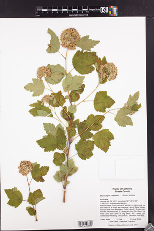 OSC-V-263969_lg.jpg |
 | Rosaceae 26. Physocarpus capitatus (Pursh) KuntzeU.S.A., Washington, Thurston County: Scatter Creek North Unit Elev. 200 m. 46.84056° N, 123.00258° W Datum: WGS 84. Coordinate Source: GPS. Occasional and scattered in Quercus garryana-Pseudotsuga menziesii woodland at edge of prairie, with Symphoricarpos albus. Shrub 4 m tall. Flowers white, ovaries 2-3, anthers red Reproductive state: Flowers. Origin: Native. WTU Peter Dunwiddie PWD-17-388Jun 9, 2017With Peter Zika |
 | Rosaceae 27. Physocarpus capitatus (Pursh) KuntzeU.S.A., Washington, Thurston County: Scatter Creek North Unit Elev. 200 m. 46.84056° N, 123.00258° W Datum: WGS 84. Coordinate Source: GPS. Occasional and scattered in Quercus garryana-Pseudotsuga menziesii woodland at edge of prairie, with Symphoricarpos albus. Shrub 4 m tall. Flowers white, ovaries 2-3, anthers red Reproductive state: Flowers. Origin: Native. WTU: 461561 Peter Dunwiddie PWD-17-388Jun 9, 2017With Peter Zika |  WTU-V-118166.jpg |
 | Rosaceae 28. Physocarpus capitatus (Pursh) KuntzeU.S.A., Oregon, Jefferson County: East shore of Metolius River, 14.8 air kilometers southeast of Rockpile Mountain. Elev. 860 m. 44.5018° N, 121.6331° W Coordinate Source: Specimen Label. In partly shaded riparian thickets on riverbank, under old growth forest, over volcanics, with Alnus, Pseudotsuga, Pinus ponderosa. Common 2 meter tall shrubs. Reproductive state: Flowers. Origin: Native. Peter F. Zika 28070Jul 9, 2016WTU: 409907; WTU-V-023911 |  WTU-V-023911.jpg |
 | Rosaceae 29. Physocarpus capitatus (Pursh) KuntzeU.S.A., Washington, Thurston County: Near north shore of an unnamed pond, north of Route 101 near Evergreen Parkway Northwest, 1.8 air kilometers northwest of Simmons Lake. Elev. 50 m. 47.0435° N, 122.9724° W Coordinate Source: Specimen Label. Thickets in full sun or partial shade, with Spiraea douglasii, Crataegus douglasii, Rubus ursinus. Occasional shrubs 2.5 meters tall. Reproductive state: Flowers. Origin: Native. Peter F. Zika 27987Jun 28, 2016WTU: 414048; WTU-V-029517 |  WTU-V-029517.jpg |
 | Rosaceae 30. Physocarpus capitatus (Pursh) KuntzeU.S.A., Washington, Pierce County: JBLM, TA 18, Recondo2, Nisqually River. Elev. 57 m. 46.97445° N, 122.59055° W Datum: WGS 84. Coordinate Source: GPS. A single 3-m tall shrub in sandy ground immediately adjacent to the river. Origin: Native. Peter W. Dunwiddie PWD 16-146Jun 2, 2016With Sarah Krock, Rod Gilbert WTU: 445893; WTU-V-104148 |  WTU-V-104148.jpg |
 | Rosaceae 31. Physocarpus capitatus (Pursh) KuntzeUnited States, Oregon, Tillamook or Yamhill: From Hwy 101, travel east on Long Prairie Road for ~3 miles to Blimp Ave, turn right on Blimp Ave and on ~ 1000 ft turn left on Officer Row Rd.; travel another ~1000 ft to native plant nursery; collection site is locted NE end of nursery. 45.424056°, -123.79472°. Georeferenced by [automated process-OregonFlora/OSU Herb]. Coordinate Source: OrlookId: 109727, StateProvince: Oregon, County: Tillamook or Yamhill, LocName: Lat 45 Deg 25 Min 26.6 Sec; Lon -123 Deg 47 Min 41 Sec. OregonFlora 1994-2020 methodology. None. https://oregonflora.org OSC-V-254234 Kurt Heckeroth; Miller ORO80-51Jul 14, 2016With M., Heckeroth, K. | 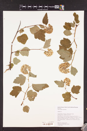 OSC-V-254234_lg.jpg |
 | Rosaceae 32. Physocarpus capitatus (Pursh) KuntzeCanada, British Columbia: Regional District of Alberni-Clayoquot, Vancouver Island, Sproat Lake Community Forest. Edge of secondary growth conifer forest; growing with Cornus nuttallii, Amelanchier alnifolia, Alnus rubra, Pseudotsuga menziesii, Thuja plicata, Taxus brevifolia. UBC: V256879 Ben Stormes bjs.2016-0034Aug 28, 2016 |
 | Rosaceae 33. Physocarpus capitatus (Pursh) KuntzeU.S.A., Alaska: [locality and coordinates withheld; status in Alaska: S2 (Imperiled; ACCS)] Elev. 5 m. Beach forest ecotone, growing under Tsuga heterophylla, Thuja plicata and Picea sitchensis. UAAH: 10528 Jill Breeden snJul 20, 2015 |
 | Rosaceae 34. Physocarpus capitatus (Pursh) KuntzeU.S.A., Washington, Snohomish County: Located at Silver Creek Park along walking trail. 47° 50\' N, 122° 12\' 14.3" W Coordinate Source: GPS. Growing along edge of planted lawn in park and bordering creek. Soil is moist. Vegetation consists of Cornus sericea (30%) and planted lawn (50%) Shrub. Height: 2m. Breadth: 1.5m. Flowers beginning to bud, pale pink. Bark is peeling and red on mature growth. Leaves are bright green. Reproductive state: Buds. UWB: 000134; UWB100061 Sarah Verlinde 13May 1, 2015 |  UWB100061.jpg |
 | Rosaceae 35. Physocarpus capitatus (Pursh) KuntzeU.S.A., Washington, King County: UW Bothell Campus Wetlands, take the wood chip trail east to Lake Truly. Site ID: C6. 47° 45\' 54.8" N, 122° 11\' 20.4" W Datum: unknown. Coordinate uncertainty: 5 meters. Georeferenced by Sarah Verlinde. Coordinate Source: GPS. Growing near Lake Truly in full sun. Tree cover (10%): Populus balsamifera and Pseudotsuga menziesii. Shrub cover (15%): Cornus sericea, Spirea douglasii, Rosa pisocarpa. Emergent cover (100%): Carex obnupta, C. stipata, Deschamsia cespitosa. Shrub form, in full bloom with white blossoms with pink stamens. Leaves are chartreuse bright green, and underside is light green. Seed pods are bright pink to red. Red twigs. Reproductive state: Flowers and Fruits. UWB: 000198; UWB 100131 Sarah Verlinde 53May 27, 2015 |  UWB 100131.jpg |
 | Rosaceae 36. Physocarpus capitatus (Pursh) KuntzeU.S.A., Washington, King County: UW Bothell Campus wetlands. Take paved trail to SSG Conservatory. Located about halfway there on right. Elev. 9 m. 47° 45\' 44.68" N, 122° 11\' 30.09" W Coordinate uncertainty: 6 meters. Georeferenced by Sarah Verlinde. Coordinate Source: GPS. Growing in wetland along path, soil is not regularly saturated. Tree cover (40%): Populus trichocarpa and Salix lasiandra. Shrub cover (70%): S. sitchensis and Cornus sericea. Emergent cover (80%): Phalaris arundinacea, assorted emergent plants and grasses. Spreading shrub, almost 3m tall, breadth: 1.3m. In full bloom, flowers are white (five petals) with yellow centers, white stamen and gray-yellow anthers. Leaves are a darker green. Reproductive state: Flowers. UWB: 000467; UWB 100183 Sarah Verlinde 44May 11, 2015 |  UWB 100183.jpg |
 | Rosaceae 37. Physocarpus capitatus (Pursh) KuntzeU.S.A., Idaho, Bonner County: White Island, Area 5. Clark Fork River Delta Restoration. Elev. 2065 ft. 48.148377° N, 116.237696° W; UTM Zone 11, 556701E, 5333073N Coordinate Source: Specimen Label. Forested wetland, shoreline. Associated species: Populus balsamifera ssp. triocarpa, Prunus virginiana, Mohonia repens. Reproductive state: Flowers. ID: 170216; ID175486 Derek S. Antonelli 2189Aug 11, 2014 |  ID175486.jpg |
 | Rosaceae 38. Physocarpus capitatus (Pursh) KuntzeU.S.A., Washington, Cowlitz County: Island Park Recreation Area on north side of Lewis River along Highway 503. Elev. 14 m. 45.93921° N, 122.68172° W Datum: WGS 84. Coordinate uncertainty: 100 meters. Georeferenced by Maria Yousoufian. Coordinate Source: GPS. Riverbank with silty and gravelly areas; island in middle of river with Phalaris arundinacea and Lotus corniculatus. Shrubs to 2 meters tall; plants fruiting. Reproductive state: Fruits. Origin: Native. Cathy Maxwell 13-61Aug 28, 2013WTU: 409296; WTU-V-023275 |  WTU-V-023275.jpg |
 | Rosaceae 39. Physocarpus capitatus (Pursh) KuntzeU.S.A., Washington, Whatcom County: Ross Lake National Recreation Area: in narrow slot canyon at south base of Seahpo Peak and 0.5 miles north of Sulphide Creek. Site ID: BSL-0951. Elev. 574 m. 48.797006° N, 121.55573° W Datum: WGS 84. Coordinate uncertainty: 20 meters. Georeferenced by Ben Legler. Coordinate Source: GPS. Rocky, flood-scoured avalanche chute terminating in waterfalls at upper end and grading into loose boulder deposits below; with young Tsuga heterophylla, Menziesia ferruginea, Vaccinium ovalifolium. Shrubs to 2 meters tall, scattered along base of rock wall. Leaf material removed for RADseq analysis by Megan Ruffley at WTU, February 2016. Reproductive state: Fruits. Ben Legler 12934Sep 1, 2013WTU: 403967; WTU-V-012958 |  WTU-V-012958.jpg |
 | Rosaceae 40. Physocarpus capitatus (Pursh) KuntzeCanada, British Columbia: Abbotsford. Road beside the Sumas River. UBC: V244994 Anna Maria Csergo 112Aug 19, 2013 |
 | Rosaceae 41. Physocarpus capitatus (Pursh) KuntzeU.S.A., Washington, Whatcom County: (locality not given). Elev. 574 m. 48.797006° N, 121.55573° W Rocky, flood-scoured avalanche chute terminating in waterfalls at upper end and grading into loose boulder deposits below; with young Tsuga heterophylla, Menziesia ferruginea, Vaccinium ovalifolium. Mounted pressed specimen. Shrubs to 2 meters tall, scattered along base of rock wall. NOCA 30811 Ben Legler 12934Sep 1, 2013 |  NOCA00030811.JPG |
 | Rosaceae 42. Physocarpus capitatus (Pursh) KuntzeUnited States, Washington, Cowlitz: Island Park Recreation Area on north side of Lewis River along Highway 503. 45.93921°, -122.68172°. Riverbank with silty and gravelly areas; island in middle of river. Shrubs to 2 meters tall; plants fruiting. Associated taxa: Phalaris arundinaceae and Lotus corniculatus. Uncertainty: 100 m., Datum: WGS 84. https://intermountainbiota.org WS: 390062 Cathy Maxwell 13-61Aug 28, 2013 |
 | Rosaceae 43. Physocarpus capitatus (Pursh) KuntzeUnited States, Oregon, Benton: Bellfountain Rd. None. https://oregonflora.org Aaron I. Liston 1365May 15, 2012With Aaron Liston OSC-V-060015; Accession Number: OSC242330 | 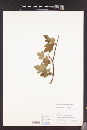 OSC-V-060015_lg.jpg |
 | Rosaceae 44. Physocarpus capitatus (Pursh) KuntzeUnited States, Oregon, Washington: Cooper Mountain. Elev. 500 ft. 45.446389°, -122.87638°. Georeferenced by [automated process-OregonFlora/OSU Herb]. Coordinate Source: OrlookId: 125287, StateProvince: Oregon, County: Washington, LocName: Lat 45.446389 Deg; Lon -122.876389 Deg. OregonFlora 1994-2020 methodology. Dry, rocky prairie and open oak woodland. https://oregonflora.org OSC-V-256677 George Kral 359Jun 11, 2012 | 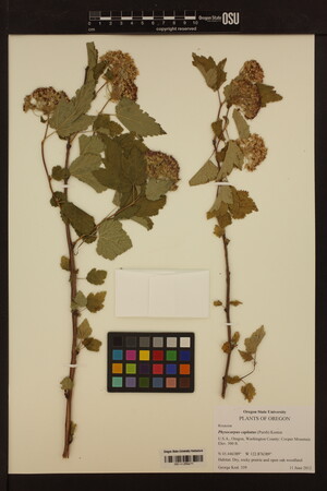 OSC-V-256677_lg.jpg |
 | Rosaceae 45. Physocarpus capitatus (Pursh) KuntzeU.S.A., Oregon, Washington County: Cooper Mountain. Elev. 500 ft. 45.446389° N, 122.876389° W Datum: WGS 84. Coordinate Source: Digital Map. Dry, rocky prairie and open woodland. HPSU: 27789 George Kral 359Jun 11, 2012 |  HPSU_027789.jpg |
 | Rosaceae 46. Physocarpus capitatus (Pursh) KuntzeCanada, British Columbia: Vancouver Island, Comox-Strathcona Regional District, Gosling Lake Forest Recreation Site. Elev. 256 m 50.04487°, -125.50128°. UBC: V237948 Erin R. Manton | K. McGrath 753Jul 19, 2011 | 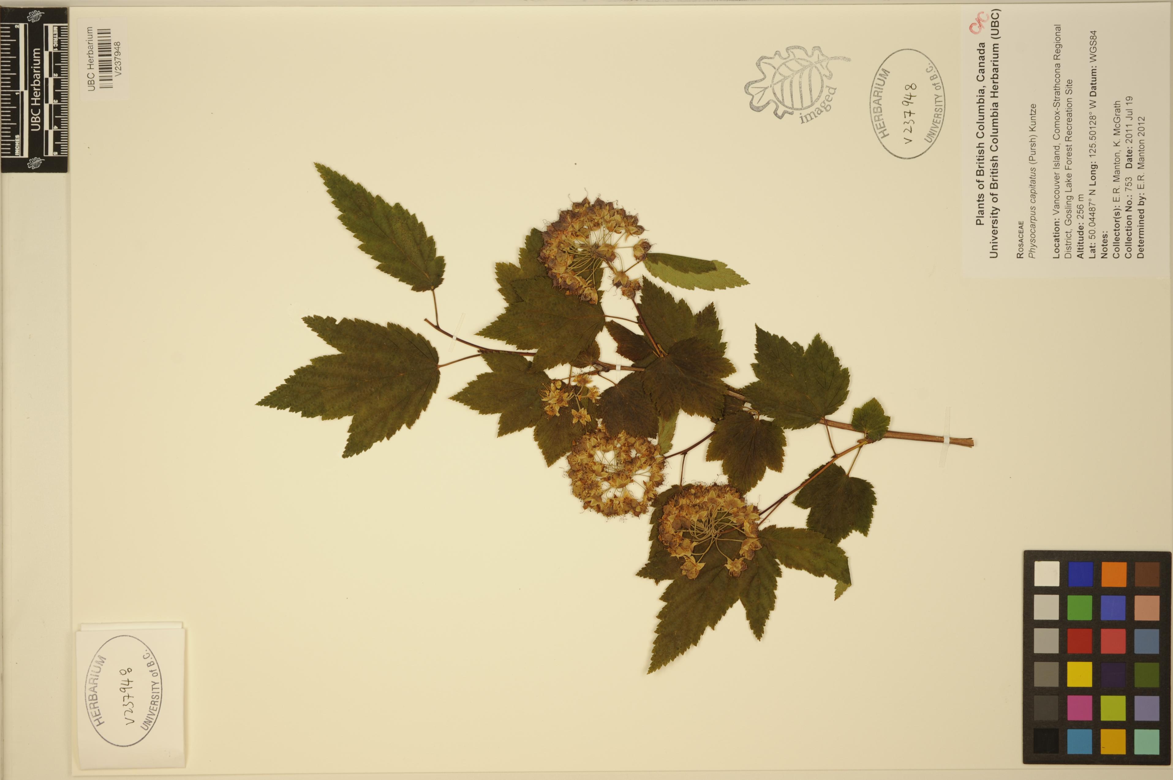 V237948.jpg |
 | Rosaceae 47. Physocarpus capitatus (Pursh) KuntzeU.S.A., Oregon, Clatsop County: Julia Butler Hansen National Wildlife Refuge. Miller Sands Island; northern side of island approximately halfway between east and west ends. Elev. 3 m. 46.252° N, 123.6613° W Datum: WGS 84. Coordinate uncertainty: 100 meters. Georeferenced by Maria Yousoufian. Coordinate Source: Digital map. Freshwater intertidal zone with adjacent Rubus bifrons-Salix columbianum zone and dredge spoils zone; non-native species throughout island. Uncommon in shrub zone; plant to 5 meters tall. Leaf material removed for RADseq analysis by Megan Ruffley at WTU, February 2016. Reproductive state: Fruits. Origin: Native. Kathleen Sayce 10-2Sep 23, 2010With Cathy Maxwell, David Giblin WTU: 396944; WTU-V-019147 |  WTU-V-019147.jpg |
 | Rosaceae 48. Physocarpus capitatus (Pursh) KuntzeUnited States, Oregon, Clatsop: Julia Butler Hansen National Wildlife Refuge; Miller Sands Island; northern side of island approximately halfway between east and west ends. Elev. 3 46.252°, -123.6613°. Georeferenced by [automated process-OregonFlora/OSU Herb]. Coordinate Source: OrlookId: 3891, StateProvince: Oregon, County: Clatsop, LocName: Lat 46.252 Deg; Lon -123.6613 Deg. OregonFlora 1994-2020 methodology. Freshwater intertidal zone with adjacent Rubus bifrons-Salix columbianum zone and dredge spoils zone. Rubus bifrons, Salix columbiana https://oregonflora.org Kathleen Sayce; Kathleen Sayce 10-2Sep 23, 2010With Cathy Maxwell, David Giblin OSC-V-060014; Accession Number: OSC243861 | 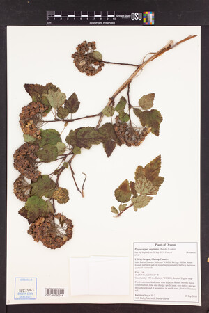 OSC-V-060014_lg.jpg |
 | Rosaceae 49. Physocarpus capitatus (Pursh) KuntzeU.S.A., Washington, Grays Harbor County: Chehalis River, south bank. Elev. 4 m. 46.94756° N, 123.75713° W Saltwater marsh dominated by Carex lyngbyei and Deschampsia cespitosa; adjacent railroad grade. Single shrub in salt marsh; 3 meters tall. Leaf material removed for RADseq analysis by Megan Ruffley at WTU, February 2016. Reproductive state: Fruits. Origin: Native. David Giblin 3145Sep 1, 2009WTU: 393010; WTU-V-019148 |  WTU-V-019148.jpg |
 | Rosaceae 50. Physocarpus capitatus (Pursh) KuntzeU.S.A., Washington, King County: UW Bothell campus near Beardslee Boulevard and 110th Avenue NE. Site ID: F6. Elev. 100 ft. 47° 45\' 46.53" N, 122° 11\' 20.45" W Coordinate Source: GPS. An artificial depression in the restored North Creek wetland on the UWB/CCC campus. About fifteen feet from the main watercourse. Area fairly open; appears to be periodically inundated with water. Reproductive state: Fruits. UWB: 000133; UWB100060 Isah Webb 10Jun 17, 2009 |  UWB100060.jpg |


