Terrain
Road Map
Satellite
Hybrid
Terrain

 | Myricaceae 1. Myrica gale L.U.S.A., Washington: Ocean Shores, WA. Past Ocean Lane, on a trail. Elev. 18 ft. 47° 5\' 41.4" N, 124° 10\' 31.4" W Coordinate uncertainty: 30 meters. Coordinate Source: Google Maps. Specimen was by other same species, on the same trail as specimen 18. Yellow reddish colored inflorescence near the stem of the plant. SRP: 73075 Nicole Crandall 22Apr 16, 2021 |  SRP073075.jpg |
 | Myricaceae 2. Myrica gale L.United States, Washington, Grays Harbor: Pacific Northwest Coast Ecoregion: Carlisle Bog Natural Area Preserve, SW end of Carlisle Bog wetland, 0.5 miles NE of Ocean Beach Road, 2.6 air miles NNW of Copalis Crossing, 4 miles NE of Copalis Beach. T19N R11W S17 NW4 SW4 NW4. Elev. 90 ft 47.13899°, -124.08588°. Edge of Carex obnupta-Carex utriculata marsh and thicket of Spiraea douglasii-Malus fusca bordered by Picea sitchensis-Pinus contorta var. contorta-Tsuga heterophylla forest. HerbariumSpecimenDuplicate: Myrica gale Forms dense thickets along stream. https://intermountainbiota.org WS: 401000; WS009248 Walter Fertig 34876Oct 9, 2020With Regina Johnson |  WS009248_1690916032_lg.jpg |
 | Myricaceae 3. Myrica gale L.United States, Washington, Kitsap: Puget Trough: NE shore of Lake Tahuyna, WA Department of Fish and Wildlife access site on west side of Gold Creek Road, 8 miles west of Bremerton. T24N R1W S17 NE4 SW4 SW4. Elev. 620 ft 47.56775°, -122.83666°. Lakeshore with terrace of mossy soil (not Sphagnum) and Carex obnupta mixed with Myrica gale, Rubus laciniatus, Rubus ursinus, Alnus rubra, Physocarpus capitatus, and Iris pseudacorus. HerbariumSpecimenDuplicate: Myrica gale Pistillate shrub 30 inches tall. Leaves with small, round, yellow glands. https://intermountainbiota.org WS: 401371; WS011083 Walter Fertig 34597Jun 26, 2020With Bridgette Glass |  WS011083.JPG |
 | Myricaceae 4. Myrica gale L.U.S.A., Alaska: Anchorage- Bayshore Pond. 61.129894°, -149.91850°. Datum: WGS 84. Coordinate uncertainty: 4470 meters. Georeferenced by Natalie Konig. Coordinate Source: Digital Map. Wet graminoid-Alder-Willow scrub. Associated species: Carex aquatilis var. dives, Calamagrostis canadensis, Comarum palustre, Alnus sp., Salix fuscescens. 0.5 m tall, in flower. UAAH: 13108 Matthew Carlson MLC 2018-005May 30, 2018With Justin Fulkerson |  UAAH_013108.jpg |
 | Myricaceae 5. Myrica gale L.U.S.A., Alaska: Anchorage- Bayshore Pond. 61.129894°, -149.91850°. Datum: WGS 84. Coordinate uncertainty: 4470 meters. Georeferenced by Natalie Konig. Coordinate Source: Digital Map. Wet graminoid-Alder-Willow scrub. Associated species: Carex aquatilis var. dives, Calamagrostis canadensis, Comarum palustre, Alnus sp., Salix fuscescens. 0.5 m tall, in flower. UAAH: 13109 Matthew Carlson MLC 2018-005May 30, 2018With Justin Fulkerson |  UAAH_013109.jpg |
 | Myricaceae 6. Myrica gale L.U.S.A., Oregon, Multnomah County: [locality and coordinates withheld; status in Oregon: S1? (Critically Imperiled?; OBIC)] Elev. 3050 ft. In fen. HPSU: 24763 Angie Kimpo 2017-20Oct 20, 2017 |  |
 | Myricaceae 7. Myrica gale L.U.S.A., Washington, Snohomish County: North bank of Ebeys Slough ca 0.4 km southwest of mouth of King Creek; Snohomish River estuary. Site ID: BSL-1425. Elev. 2 m. 48.008554° N, 122.144083° W Datum: WGS 84. Coordinate uncertainty: 3 meters. Georeferenced by Ben Legler. Coordinate Source: GPS. Edge of large wetland just above slough and high tide line, with Typha latifolia, Iris pseudacorus, Athyrium filix-femina, and scattered Picea sitchensis. Shrubs to ca 2 meters tall, common in wetland. Reproductive state: Flowers. Ben Legler 14101Jun 4, 2016WTU: 428810; WTU-V-084302 |  WTU-V-084302.jpg |
 | Myricaceae 8. Myrica gale L.U.S.A., Oregon, Multnomah County: [locality and coordinates withheld; status in Oregon: S1? (Critically Imperiled?; OBIC)] Wet, fen soils, sphagnums. Carex aquatilis var. dives, Agrostis scabra, Toefeldia, Drosera ×obovata, D. anglica, Hypericum anagalloides, Myrica gale, Carex inops, Rhycospora. Flowers/fruits. Common and abundant, forming thicks. Aromatic. Reproductive state: Flowers and Fruits. Origin: Native. Dominic Maze 205Jul 27, 2016WTU: 416922; WTU-V-036486 |  |
 | Myricaceae 9. Myrica gale L.U.S.A., Alaska, Anchorage County: Bay Shore Pond, Anchorage Elev. 10 m. 61.12279° N, 149.94334° W Coordinate Source: Specimen Label. Floating graminoid, form, sphagnum wetland. Associated species: Carex lenticularis, Comarum palustre, Sphagnum sp. UAAH: 9766 Matthew Carlson s.n.Jun 9, 2016 |  UAAH_009766.jpg |
 | Myricaceae 10. Myrica gale L.Canada, Yukon Territory: Nahanni Range Road. Elev. 829 m 60.90503°, -129.21951° Creekside with Salix pulchra, S. glauca, S. athabascensis, Carex aquatilis, C. diandra, C. canescens, Populus balsamifera, Equisetum sylvaticum, and Chamerion angustifolium. Common. In fruit. BABY-09302 B.A. Bennett 15-0215Jul 8, 2015With J. Hobbs |
 | Myricaceae 11. Myrica gale L.Canada, Yukon Territory: Tatchun Lake, west end, start of Tatchun Creek. Elev. 555 m 62.28725°, -136.23595° Dominating shoreline with Carex aquatilis, C. utriculata, Alnus viridis, Cornus stolonifera, Comarum palustre, Viburnum edule, Rosa acicularis, and Dasiphora fruticosa. Common. In fruit. BABY-09318 B.A. Bennett 15-0436Aug 1, 2015With R.S. Mulder |
 | Myricaceae 12. Myrica gale L.Canada, British Columbia: Kinbasket Lake, Canoe Reach, south of Valemount. Elev. 755 m 52.76°, -119.16°. Common in saturated peatland around boggy, marshy edges of reservoir; with various Salix spp. Common at site. UBC: V247363 Jamie D. Fenneman 2014-16Jul 13, 2014 |
 | Myricaceae 13. Myrica gale L.U.S.A., Washington, Snohomish County: Kellogg Lake northeast of Sultan. 47.90229° N, 121.760902° W Datum: WGS 84. Coordinate uncertainty: 500 meters. Coordinate Source: Digital map. Small lake ringed by quaking mats of Sphagnum, with Ledum groenlandicum, Kalmia microphylla, Rhynchospora alba, and small conifers; lake shallows with Brasenia, Sparganium, Nuphar, and Myriophyllum. Common shrubs to 1.5 meters tall, on peat. Reproductive state: Fruits. Origin: Native. Ben Legler 12532Sep 6, 2012With David Giblin, Jeff Walker WTU: 415154; WTU-V-032697 |  WTU-V-032697.jpg |
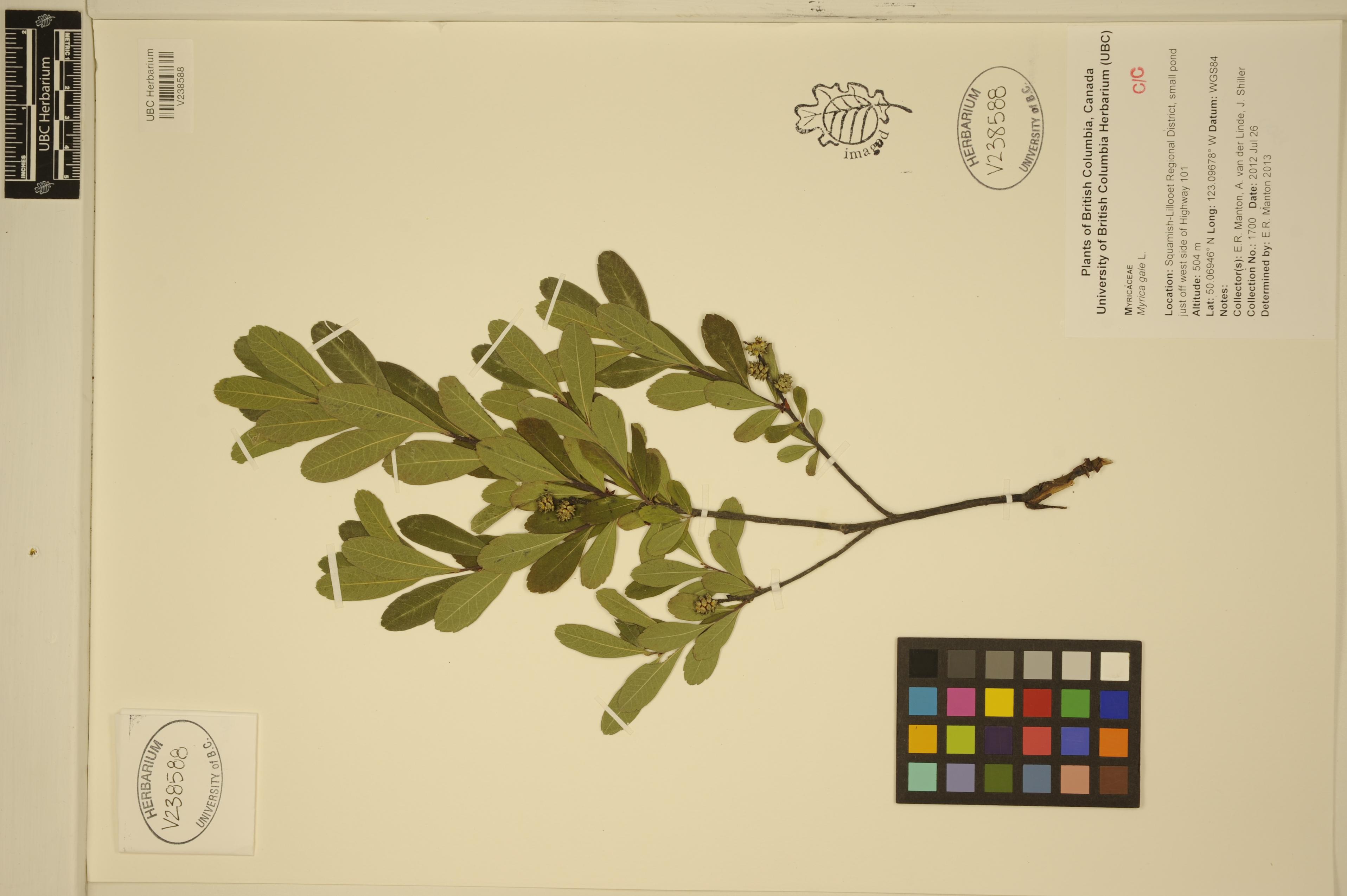
 | Myricaceae 14. Myrica gale L.Canada, British Columbia: Squamish-Lillooet Regional District, small pond just off west side of Highway 99. Elev. 504 m 50.06946°, -123.09678°. UBC: V238588 Erin R. Manton | A. van der Linde | J. Shiller 1700Jul 26, 2012 |  V238588.jpg |
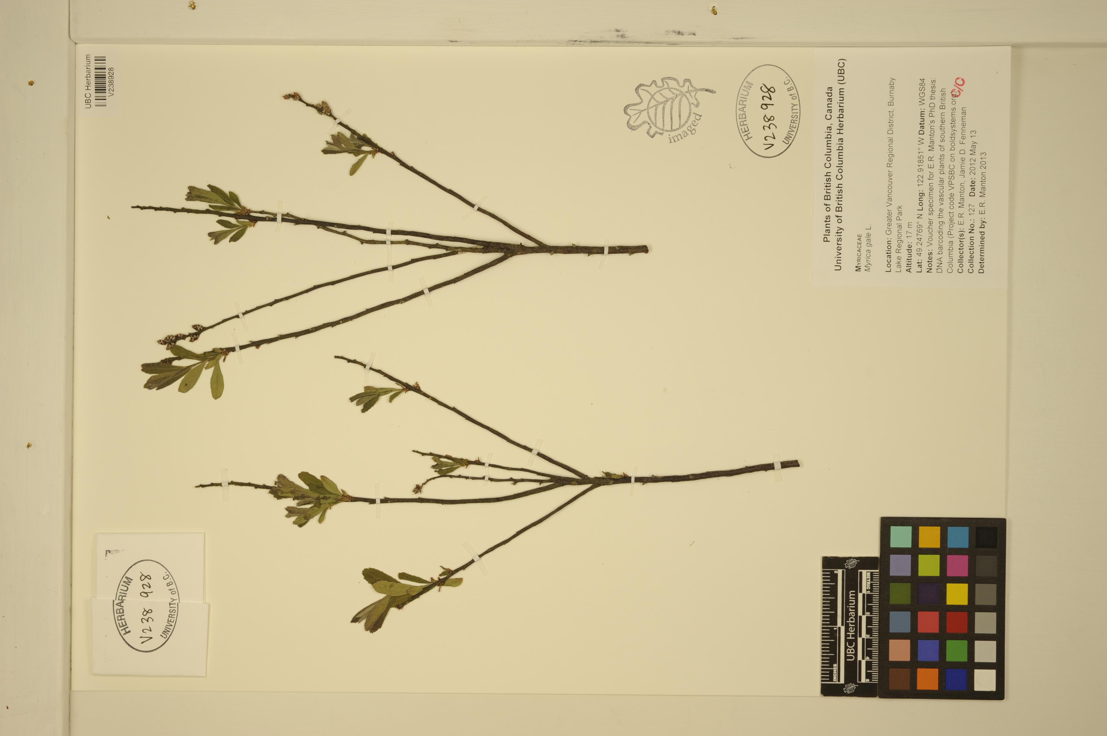
 | Myricaceae 15. Myrica gale L.Canada, British Columbia: Greater Vancouver Regional District, Burnaby Lake Regional Park. Elev. 17 m 49.24769°, -122.91851°. Voucher specimen for Erin R. Manton\'s PhD thesis: DNA barcoding the vascular plants of southern British Columbia (Project code VPSBC on boldsystems.org) UBC: V238928 Erin R. Manton | Jamie D. Fenneman 127May 13, 2012 |  V238928.jpg |
 | Myricaceae 16. Myrica gale L.Canada, Northwest Territories: Nahanni National Park, Fish Trap Creek, between Grainger Gap and Wolverine Gap, Silent Hills. Elev. 205 m 61.37542°, -123.63271° With Ledum groenlandicum, Chamaedaphne calyculata, and Betula glandulosa in Picea mariana and Larix laricina in Rosa acicularis, Vaccinium vitis-idaea, Rubus pubescens, Equisetum arvense, and Cornus canadensis. Only place seen. Locally common. BABY-08206 B.A. Bennett 12-0469Aug 12, 2012With D. McLennan, R. McKillop, D. Tate |
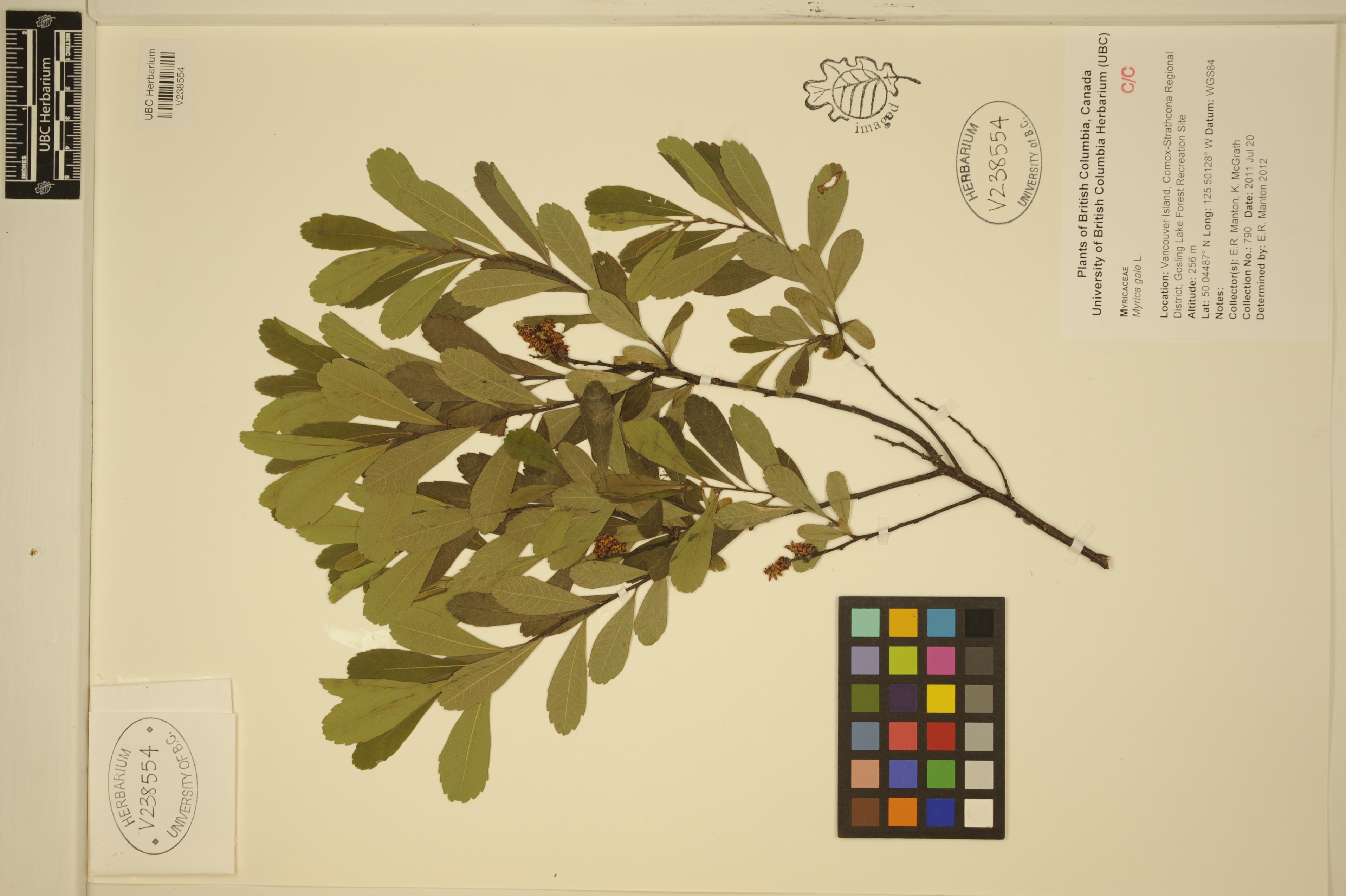
 | Myricaceae 17. Myrica gale L.Canada, British Columbia: Vancouver Island, Comox-Strathcona Regional District, Gosling Lake Forest Recreation Site. Elev. 256 m 50.04487°, -125.50128°. UBC: V238554 Erin R. Manton | K. McGrath 790Jul 20, 2011 |  V238554.jpg |
 | Myricaceae 18. Myrica gale L.Canada, Nova Scotia: Queens County, Ponhook Lake, Grassy Point. Elev. 70 m 44.28951°, -64.87572° Codominant in wetland marshes with Oclemena nemoralis, Juncus canadensis, Vaccinium macrocarpon, Glyceria obtusa, and Schoenoplectus. Common. . 5 duplicates. BABY-07364 B.A. Bennett 10-0452Sep 10, 2010With S. Blaney, M.J. Oldham |
 | Myricaceae 19. Myrica gale L.U.S.A., Washington, Grays Harbor County: Roosevelt Beach. Elev. 2 m. 47.17388° N, 124.19482° W Coordinate Source: Specimen Label. Against base of bluffs in Salix dominated thicket (dryish sand underfoot). Alexander J. Wright 212Aug 10, 2010WTU: 420287; WTU-V-044520 |  WTU-V-044520.jpg |
 | Myricaceae 20. Myrica gale L.United States, Washington, Grays Harbor: Roosevelt Beach: Halfway up eroding red bluffs. 47.1739°, -124.1948°. WS: 384020 Alexander J. Wright 212Aug 10, 2010 |
 | Myricaceae 21. Myrica gale L.Canada, Manitoba: Wapusk National Park. Elev. 30 m 58.43349°, -93.64368° Poor sedge fen dominated by Carex rotundata, Trichophorum caespitosum, and Tomenthytum nitens. Common. 4 duplicates. B.A. Bennett 09-0048Jul 13, 2009With D. McLennan, S. Ponomarenko, H.M. Stewart, R. Sharma, D. Spence BABY-06801; Genetic barcoding: 4 sent to the University of Guelph |
 | Myricaceae 22. Myrica gale L.Canada, Northwest Territories: Inuvik, 1 km N of airstrip. Elev. 54 m 68.3046°, -133.5292° Wet shrub area dominated by Picea mariana, Ledum groenlandicum, Arctostaphylos rubra, Myrica gale, Vaccinium uliginosum, Betula glandulosa, Carex aquatilis, Alnus crispa, Shepherdia canadensis, and Salix glauca. Locally common. 3 duplicates. B.A. Bennett 08-0403Jul 29, 2008With P. Seccombe-Hett BABY-06399; Genetic barcoding: 4 sent to the University of Guelph |
 | Myricaceae 23. Myrica gale L.U.S.A., Washington, Skagit County: Skagit Wildlife Area 2.5 air miles southwest of Conway, along dike leading southwest from boat launch at end of Mann Road. Elev. 10 ft. 48° 19\' 20" N, 122° 22\' 34" W Datum: WGS 84. Coordinate Source: Digital map. Dike under Alnus rubra, surrounded by brushy tidally influenced marshes and old farmland. Dominant shrub in marshes; to 2 meters tall; bark reddish-brown. Reproductive state: Buds. Origin: Native. WTU Ben Legler 3193Feb 24, 2006 |
 | Myricaceae 24. Myrica gale L.Canada, British Columbia: Coast Mountains; Portland Canal; Stewart: Bear River estuary, S of town of Stewart. Elev. 3 m 55.935278°, -130.00166°. Conservation Status:CDC: Not Listed. V196542 Kendrick Marr 06-0229Jul 15, 2006With Richard Hebda; William MacKenzie |
 | Myricaceae 25. Myrica gale L.U.S.A., New Hampshire, Merrimack County: Bow. Elev. 676 ft. 43° 8.05\' N, 71° 34.79\' W Soils from granite breakdown. Oak, maple, birch, beech comm. Reproductive state: Fertile. SRP: 37227 L. C. Higgins 27168May 6, 2006 |  SRP037227.jpg |
 | Myricaceae 26. Myrica gale L.Canada, British Columbia, North Coast: Banks Island; Rawlinson Anchorage: outer coast on NW end of island. Elev. 35 m 53.57°, -130.53611°. Coordinate Source: British Columbia Digital Gazetteer, 1996. Conservation Status:CDC: Not Listed. V193753 Kendrick Marr KM6257aJun 21, 2005With Claudia Copley; Mike McNall |
 | Myricaceae 27. Myrica gale L.U.S.A., Alaska: Bering Glacier Quad: Malaspina COastal Plain, coast E of Tsivat R. Elev. 20 m. 60° 5.866\' N, 142° 54.715\' W Coordinate Source: GPS. In 15cm water ins wamp inland from old beach ridge system, 40cm tall. UAAH: 9805 Marilyn Barker BG05-28Aug 5, 2005With A.R. Batten and J. Magee |  UAAH_009805.jpg |
 | Myricaceae 28. Myrica gale L.U.S.A., Alaska: Kanuti National Wildlife Refuge. Fish Creek Lake. 66.584022° N, 151.450979° W Datum: NAD 83. Coordinate uncertainty: 30 meters. Georeferenced by Brian Heitz. Coordinate Source: GPS. Black spruce forest/bog. Soil: burned duff and fibric humus in top 3cm; silt 7-10cm. Reproductive state: Vegetative. Origin: Native. UAAH: 10177 Helen Cortés-Burns MLC 2005-86Jul 13, 2005With Matthew L. Carlson |  UAAH_010177.jpg |
 | Myricaceae 29. Myrica gale L.Canada, Yukon: Frances Lake. Elev. 751 m Calcareous silty sand, lakeshore. UBC: V253674 Jim Pojar JP04058Jul 28, 2004 |
 | Myricaceae 30. Myrica gale L.United States, New Hampshire, Coos: Errol. Harpers Meadow. VHMG32; submerged peat, in patches with Andromeda glaucophylla, Carex limosa, Chamaedaphne calyculata, Scheuchzeria palustris. Dulichium arundinaceum - Potentilla palustris CT. Shrub ca. 0.8 m tall; fruit. https://intermountainbiota.org WS: 386876 M. Nazaire 753Jun 12, 2003 |
 | Myricaceae 31. Myrica gale L.Canada, British Columbia: Central Coast, southeast corner of Bramham Island, shoreline of large lake. Elev. 0 m 51.055°, -127.53°. Shallow standing water along lakeshore. Slope: flat. Ex: Coastal Ecosystems Research Foundation. UBC: V219362 Eric Lamb | Sarah Martz 2002-213Jun 24, 2002 |
 | Myricaceae 32. Myrica gale L.Canada, British Columbia: Central Coast, south end of Blunden bay, bogs east of point. Elev. 50 ft 51.175°, -127.77666°. Small mound at edge of bag pool. Slope: flat. Ex: Coastal Ecosystems Research Foundation. UBC: V219361 Eric Lamb | Sarah Martz 2002-103Jun 14, 2002 |
 | Myricaceae 33. Myrica gale L.United States, New Hampshire, Coos: Errol. Leonard Marsh. Southern mat; area inundated at time of collection. Growing near upland peninsula. Carex lasiocarpa - Chamaedaphne calyculata CT. Shrub ca. 1 m tall; female fls. https://intermountainbiota.org WS: 386712 M. Nazaire 398May 23, 2002 |
 | Myricaceae 34. Myrica gale L.United States, New Hampshire, Coos: Errol. Leonard Marsh. Southern part of peatland; growing with Chamaedaphne calyculata, Alnus incana ssp. rugosa, and Rhododendron canadense. Nemopanthus mucronatus - Alnus incana CT. Shrub ca. 0.5 m tall; fruit. https://intermountainbiota.org WS: 386765 M. Nazaire 510Jul 4, 2002 |
 | Myricaceae 35. Myrica gale L.U.S.A., Washington, King County: Cascade Mountains of Western Washington. Cedar River Watershed. Little Mountain Bog. Elev. 1600 ft. T22N R9E S27 47.362222°, -121.64388°. Datum: NAD 27. Coordinate uncertainty: 500 meters. Georeferenced by WTU Staff. Coordinate Source: Georeferenced. Marshy and boggy area (actually a fen) surrounded by forested bog. The fen is a mosaic of sedge marsh, sphagnum moss, and open water. Male flowers. Growing in open fen area with Ledum and Kalmia. Reproductive state: Flowers. Origin: Native. WTU: 350675 Clayton J. Antieau 01-27Jun 23, 2001With Nancy Job, Sandra Whiting, Jeffery Walker |
 | Myricaceae 36. Myrica gale L.U.S.A., Washington, King County: Cascade Mountains of Western Washington. Cedar River Watershed. Little Mountain Bog. Elev. 1600 ft. T22N R9E S27 47.362222°, -121.64388°. Datum: NAD 27. Coordinate uncertainty: 500 meters. Georeferenced by WTU Staff. Coordinate Source: Georeferenced. Marshy and boggy area (actually a fen) surrounded by forested bog. The fen is a mosaic of sedge marsh, sphagnum moss, and open water. Female flowers. Growing in open fen area with Ledum and Kalmia. Reproductive state: Fruits. Origin: Native. WTU: 350674 Clayton J. Antieau 01-24Jun 23, 2001With Nancy Job, Sandra Whiting, Jeffery Walker |
 | Myricaceae 37. Myrica gale L.U.S.A., Washington, King County: Cascade Mountains of Western Washington. Cedar River Watershed. Little Mountain Bog. Elev. 1600 ft. 47° 21\' 44" N, 121° 38\' 38" W; T22N R9E S27 Datum: NAD 27. Coordinate uncertainty: 500 meters. Georeferenced by ID Staff. Coordinate Source: Gref. digital map. Marshy and boggy area (actually a fen) surrounded by forested bog. The fen is a mosaic of sedge marsh, sphagnum moss, and open water. Male flowers. Growing in open fen area with Ledum and Kalmia. Reproductive state: Flowers. Origin: Native. ID: 135444; ID077053 Clayton J. Antieau 01-27Jun 23, 2001With Nancy Job, Sandra Whiting, Jeffery Walker |  ID077053.jpg |
 | Myricaceae 38. Myrica gale L.U.S.A., Alaska: Anchorage, Heritage Land Bank 61.163104°, -149.91011°. Datum: WGS 84. Coordinate uncertainty: 9097 meters. Georeferenced by Preston C Villumsen. Coordinate Source: Digital Map. Muskeg, among black spruce, dwarf birch, Labrador tea, horsetail, sphagnum 2ft. bush with fruits Reproductive state: Fruits. UAAH: 16004 Cara Wardlaw-Bailey s.n.Jul 27, 2001 |  UAAH_016004.jpg |
 | Myricaceae 39. Myrica gale L.U.S.A., Oregon, Multnomah County: [locality and coordinates withheld; status in Oregon: S1? (Critically Imperiled?; OBIC)] Brushy area. Common in meadow. Reproductive state: Vegetative. HPSU: 17148 Vernon M. Marttala 5112Jun 6, 2000With Carol Horvath and Jack Poff. |  |
 | Myricaceae 40. Myrica gale L.Germany, Land Schleswig-Holstein: Eider-Sorge-Niederung southwest Christiansholm, an die Erfter Geestinsel im east anschliebend, ca. 2 km east Erfde. Elev. 0.7-3 m Tielener Moor im Zwickel zwischen der Strabe nach Erfde im N und der Sorge im E. Ex: Drescher A. 2001: Dupla plantarum vascularium (2001) - Fritschiana 27: 1-20. Herausgegeben am Institut fur Botanik, Karl Franzens-Universitat Graz (GZU). Ca. 2 km sq. groBes vollig baumfreies atlantisches Hochmoor (Versumpfungsmoor) UBC: V219957 A. Drescher s.n.Nov 1, 1999 |
 | Myricaceae 41. Myrica gale L. var. tomentosa C. DC.= Myrica gale L. Russia, Sakhalin: Kuril Archipelago. Inland from Dobroye Nachalo Bay, on west coast of Iturup. 44° 46.353\' N, 147° 13.069\' E Inundated wetland just east of Lake Lesozavodskoyo. Ringed with forest. Water mostly 6 inches to 1ft deep. Abundant in wetland. Twigs black, leaves dusty green. Foliage aromatic, resinous. Reproductive state: Fruits. Sarah Gage 6335Aug 14, 1999WTU: 459423; WTU-V-113117 |  WTU-V-113117.jpg |
 | Myricaceae 42. Myrica gale L.Canada, British Columbia: Courtenay, Courtenay River estuary. Elev. 1 m 49.682208°, -124.97691°. Above brackish marsh at edge of wet, mixed woods. Several. UBC: V236613 Jamie D. Fenneman V 162May 24, 1998 |
 | Myricaceae 43. Myrica gale L.Canada, Yukon Territory: Ottertail Creek, west of Mt. Martin. Elev. 1475\' 60.1166°, -124.2556° Wetland Carex fen, edge of beaver pond. Node #1. 1 duplicate. BABY-01005 B.A. Bennett 98-0256Jun 16, 1998 |
 | Myricaceae 44. Myrica gale L.Russia, Sakhalin: About 3 km northwest of Yuzuo - Kurilsk, Lake Serebryanoye. 44° 2.9\' N, 145° 48.76\' E Along road to lake. Open Picea forest with boggy understory of Sasa, Ledum, Myrica. Many Picea appear stunted. Leaves fragrant - aromatic. Male and female plants. Female plants in fruit. Sarah Gage 5791Aug 22, 1998WTU: 458635; WTU-V-112159 |  WTU-V-112159.jpg |
 | Myricaceae 45. Myrica gale L.Russia, Sakhalin: Eastern side of Tanfilyeva, inland from Tanfil\'yevka Bay, south of military base. 43° 26.31\' N, 145° 55.97\' E Coordinate Source: GPS. Sandy beach. Male plants, leaves very soft, richly aromatic - fragrant. WTU Sarah Gage 5542Aug 19, 1998 |
 | Myricaceae 46. Myrica gale L.Russia, Sakhalin: Inland from west side of Polonskogo. 43° 37.79\' N, 146° 17.88\' E Coordinate Source: GPS. Marsh (near mid-way between sides of island?) dominated by Phragmites and Carex, with Sphagnum. Female plants; in fruit; leaves fragrantly aromatic. WTU Sarah Gage 5760Aug 21, 1998 |
 | Myricaceae 47. Myrica gale L.Canada, British Columbia: Mudge Lake: ER # 122. NW corner of lake. 50.444722°, -126.60638°. Coordinate Source: Source. Shrub, clumps, .1 to 1m high, 50% cover. See Gen. Comm. Conservation Status:CDC: Not Listed. V179034 David Oppenheim B3Jul 27, 1997With Claire Oppenheim |
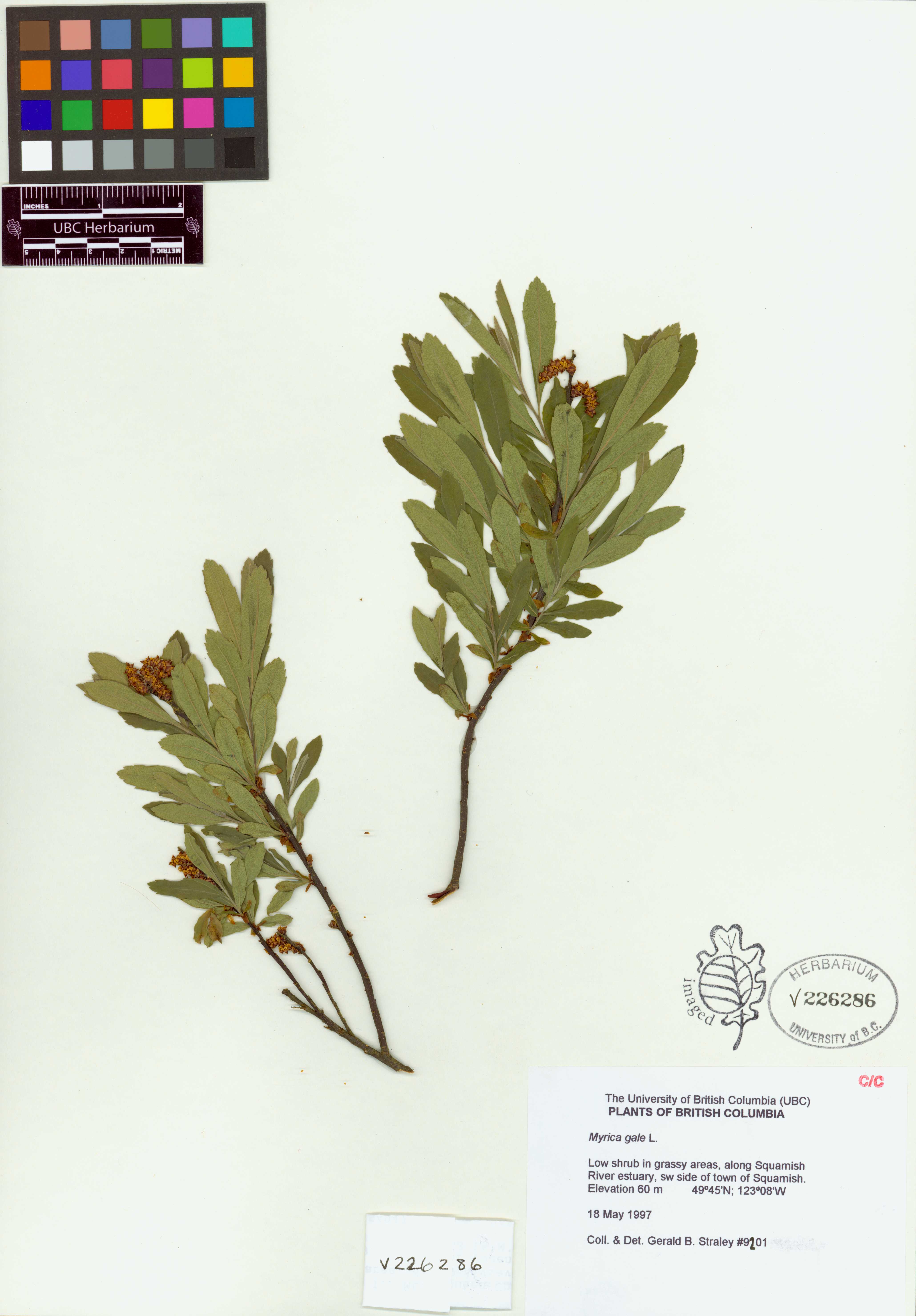
 | Myricaceae 48. Myrica gale L.Canada, British Columbia: Southwest side of town of Squamish, along Squamish River estuary. Elev. 60 m 49.75°, -123.13333°. In grassy areas. Low shrub. UBC: V226286 Gerald B. Straley 9201May 18, 1997 |  V226286.jpg |
 | Myricaceae 49. Myrica gale L.U.S.A., Alaska: Fairbanks Quad: Yukon-Tanana Uplands, Murphy Dome Road NW of Fairbanks, vicinity of Dome Station on ARR. Elev. 180 m. 64° 55\' N, 148° 10\' W Coordinate Source: Specimen Label. Wet lake margin, edge of spruce forest and wet lakeshore vegetation. UAAH: 9808 Carolyn Parker N-3033Aug 10, 1997 |  UAAH_009808.jpg |
 | Myricaceae 50. Myrica gale L.United States, Oregon, Clatsop: [locality and coordinates withheld; status in Oregon: S1? (Critically Imperiled?; OBIC)] Elev. 10 Emergent wetland. Juncus effusus, Potentilla anserina, Lotus corniculatus https://oregonflora.org Scott Sundberg; Scott Sundberg 4071Jun 25, 1997With James Word OSC: Accession Number: OSC194648 |


