Terrain
Road Map
Satellite
Hybrid
Terrain

 | Asteraceae 1. Leucanthemum vulgare Lam.U.S.A., Idaho, Valley County: Boise National Forest, Salmon River Mountains. Jeep trail to Hennessey Meadows, about 2 air-miles SE of Johnson Creek airstrip. Elev. 5884 ft. 44.89712° N, 115.47116° W Datum: WGS 84. Coordinate Source: Field Notes. Roadside on sandy granitic soil within Douglas-fir forest. Occasional. SRP: 79112 Beth Lowe Corbin 2356Jul 9, 2022With Paul Allen, Liz Martin,Wes Bascom, Nyika Campbell |  SRP079112.jpg |
 | Asteraceae 2. Leucanthemum vulgare Lam.U.S.A., Oregon, Multnomah County: Green Street Facility (Asset # STCH AQM124 AQM125) near 13033 SE Holgate Blvd. 45.489769°, -122.52852°. Georeferenced by Deanna Michinski. Species growing in stormwater drainage ditch amongst mowed grasses. Flowers composite with white ray florets. Reproductive state: Flowers. Origin: Introduced. HPSU: 25844 Liam M. Gerry 325Jul 11, 2022 |  HPSU_025844.jpg |
 | Asteraceae 3. Leucanthemum vulgare Lam.U.S.A., Washington, Skamania County: Along Forest Service Road 8800-120, Gifford Pinchot Nat. Forest. Elev. 3447 ft. 46° 5.251\' N, 121° 42.167\' W Weedy roadside opening with grass, forbs. Oxeye daisy. Reproductive state: Fruits. Origin: Introduced. David Gross 2504Aug 29, 2021WTU: 427766; WTU-V-081569 |  WTU-V-081569.jpg |
 | Asteraceae 4. Leucanthemum vulgare Lam.U.S.A., Oregon, Lane County: Willamette National Forest. Sacandaga Campground. Elev. 2400 ft. 43.49633° N, 122.32403° W Growing in gravel bar along river by camp. White rays. Reproductive state: Flowers. Origin: Introduced. Richard G. Olmstead 2021-27Jun 27, 2021WTU: 431801; WTU-V-095626 |  WTU-V-095626.jpg |
 | Asteraceae 5. Leucanthemum vulgare Lam.U.S.A., Washington, Skamania County: Along road N4000 east of Willard. Elev. 2910 ft. 45° 48.64\' N, 121° 36.779\' W Coordinate Source: Specimen label. Roadside with grass, forbs in Douglas-fir forest. Oxeye daisy. Reproductive state: Flowers and Fruits. Origin: Introduced. David Gross 2372Jun 25, 2021WTU: 457271; WTU-V-110119 |  WTU-V-110119.jpg |
 | Asteraceae 6. Leucanthemum vulgare Lam.U.S.A., Idaho, Bonner County: Priest Lake State Forest, Selkirk Mountains, East Shore Road north of Mosquito Bay. Site ID: SK-410. Elev. 805 m. 48.76564° N, 116.836722° W Datum: WGS 84. Coordinate uncertainty: 10 meters. Coordinate Source: GPS. Roadside ditch dominated by Bracken Fern and mixed conifer overstory, adjacent to harvested forest. Reproductive state: Flowers. Origin: Introduced. ID: 187321; ID192874 Harpo Faust 2785Jun 22, 2020With Whitney Griswold |  ID192874.jpg |
 | Asteraceae 7. Leucanthemum vulgare Lam.U.S.A., Idaho, Bonner County: Priest Lake State Forest, Selkirk Mountains, McCormack Meadows. Site ID: SK-417. Elev. 1025 m. 48.298901° N, 116.73576° W Datum: WGS 84. Coordinate uncertainty: 5 meters. Coordinate Source: GPS. Open Sedge and Spirea meadow with sporadic Alders, signs of disturbance from animals and automobiles. Abundant weeds. Reproductive state: Flowers. Origin: Introduced. ID: 187320; ID192873 Harpo Faust 2841Jun 24, 2020With Whitney Griswold |  ID192873.jpg |
 | Asteraceae 8. Leucanthemum vulgare Lam.U.S.A., Idaho, Bonner County: Priest Lake State Forest, Selkirk Mountains, Prater Mountain, South facing slope just below peak. Site ID: SK-424. Elev. 1271 m. 48.301615° N, 116.797632° W Datum: WGS 84. Coordinate uncertainty: 5 meters. Coordinate Source: GPS. South facing post logging successional regrowth of Ceanothus velutinus and Physocarpus malvaceous carpet with sporadic bare ground with sandy soil. Reproductive state: Flowers. Origin: Introduced. ID: 187318; ID192871 Harpo Faust 2885Jun 25, 2020With Whitney Griswold |  ID192871.jpg |
 | Asteraceae 9. Leucanthemum vulgare Lam.U.S.A., Alaska: Kenai Peninsula, Kenai National Wildlife Refuge. Lower Skilak Road, roadside. Elev. 76 m. 60.4745216° N, 150.463396° W Datum: WGS 84. Coordinate Source: GPS. Disturbed roadside ditch adjacent to burned forest. Ruderal species. UAAH: 15131 Justin Fulkerson JRF 20-11Jun 30, 2020With A. Steer, R. Kelty |  UAAH_015131.jpg |
 | Asteraceae 10. Leucanthemum vulgare Lam.U.S.A., Washington, Skamania County: Gifford Pinchot National Forest, Road to Mckinley Ridge. Approximately 2 kms below ridge. Elev. 973 m. 45.79105° N, 122.18034° W Datum: WGS 84. Coordinate uncertainty: 10 meters. Coordinate Source: GPS. South-facing talus slope with Castilleja miniata, Penstemon fruticosus, and Cryptogramma achrostichoides common. Locally common in disturbed roadside edge. Reproductive state: Flowers. Origin: Introduced. David Giblin 7455Jun 24, 2020WTU: 430132; WTU-V-087269 |  WTU-V-087269.jpg |
 | Asteraceae 11. Leucanthemum vulgare Lam.U.S.A., Montana, Carter County: Custer National Forest, Long Pines. One plant growing alongside the Speelmon Cr. Road #3817. West of the intersection with the roads #3117, 3118 and 3119. Approx. 24 miles SE of Ekalaka MT Elev. 4030 ft. 45.6172° N, 104.1732° W; T2S, R61E, Sec. 34, SE1/4 Datum: WGS 84. Georeferenced by Trey Good. Coordinate Source: Specimen Label. One plant growing alongside the Speelmon Cr. Road #3817. With Echinacea angustifolia and Poa pratensis. Flowering. Reproductive state: Flowers. Kurt Hansen 759Jul 1, 2020MONTU: 169317; MONTU000291 |  MONTU000291.jpg |
 | Asteraceae 12. Leucanthemum vulgare Lam.U.S.A., Idaho, Boundary County: Kaniksu National Forest, Selkirk Mountains, Long Canyon Trail. Site ID: SK-90. Elev. 548 m. 48.955717° N, 116.545189° W Datum: WGS 84. Coordinate uncertainty: 20 meters. Coordinate Source: GPS. Heavily disturbed clearing at parking area near active logging site, surrounded by mixed conifer woodland and Poplar, Fern and tall grass midstory, weedy groundcover. Reproductive state: Flowers. Origin: Introduced. ID: 181456; ID187010 Harpo Faust 2019-699Jun 30, 2019With Peri Lee Pipkin, Don Mansfield, Erin Moyer |  ID187010.jpg |
 | Asteraceae 13. Leucanthemum vulgare Lam.U.S.A., Idaho, Boundary County: Kaniksu National Forest: in Boulder Meadows ca 100 meters south of trailhead at end of Forest Service Road 427. Site ID: BSL-1848. Elev. 1234 m. 48.542508° N, 116.223132° W Datum: WGS 84. Coordinate uncertainty: 6 meters. Coordinate Source: GPS. Mesic to wet meadows among Picea engelmannii and Pinus contorta forest, with Danthonia, Ligusticum, Potentilla. Ray flowers white; frequent weed. Reproductive state: Flowers. Origin: Introduced. ID: 181406; ID186706 Rachel Gross 2019-20Jun 29, 2019With Ben Legler, Hannah Gross, Gab Raber, Danielle Trawick |  ID186706.jpg |
 | Asteraceae 14. Leucanthemum vulgare Lam.U.S.A., Idaho, Bonner County: Kaniksu National Forest, Base of Selkirk Mountains, McKinnick Trail just .5 mi northeast of Sandpoint. Site ID: SK-133. Elev. 659 m. 48.310545° N, 116.569167° W Datum: WGS 84. Coordinate uncertainty: 9 meters. Coordinate Source: GPS. Disturbed opening beyond parking lot with Pine, Doug Fir, Alder and Cottonwood, full of weedy grasses and annual forbs. Reproductive state: Flowers. Origin: Introduced. ID: 181490; ID187044 Harpo Faust 2019-1142Jul 12, 2019With Peri Lee Pipkin, Beau Romeo |  ID187044.jpg |
 | Asteraceae 15. Leucanthemum vulgare Lam.U.S.A., Idaho, Boundary County: Priest Lake State Park, Selkirk Mountains, Goblin Knob Trail off of Indian Creek. Site ID: SK-103. Elev. 1200 m 48.65591° N, 116.742632° W Datum: WGS 84. Coordinate uncertainty: 841 meters. Georeferenced by Harpo Faust. Coordinate Source: Digital Map. Weedy open trailside surrounded by young Doug Fir, Western Red Cedar and Maple with Rubus, Leucanthemum and Hieracium. Abundant. Reproductive state: Flowers. Origin: Introduced. ID: 181457; ID187011 Harpo Faust 2019-833Jul 6, 2019With Peri Lee Pipkin, Barbara Wire |  ID187011.jpg |
 | Asteraceae 16. Leucanthemum vulgare Lam.U.S.A., Washington, Grays Harbor County: Olympic National Forest. West Fork Humptulips River. Forest Service Road 2204 approximately 2 km west of Campbell Grove Campground. Elev. 300 m. 47.47363° N, 123.70374° W Datum: WGS 84. Coordinate uncertainty: 100 meters. Coordinate Source: Digital map. Wet ditch along road with Oenanthe sarmentosa, Rubus nutkanus, and Boykinia intermedia common. Locally common on roadside; rays white. Reproductive state: Flowers and Fruits. Origin: Introduced. David Giblin 7112Aug 27, 2019WTU: 425937; WTU-V-070043 |  WTU-V-070043.jpg |
 | Asteraceae 17. Leucanthemum vulgare Lam.U.S.A., Idaho, Boundary County: Kaniksu National Forest: Boulder Meadows ca. 100 m south of trailhead at end of FS Road 427. Elev. 1234 m. 48.542508° N, 116.223132° W Datum: WGS 84. Coordinate uncertainty: 6 meters. Mesic to wet meadows among Picea engelmannii, Pinus contorta forest, with Danthonia, Ligusticum, Potentilla. Ray flowers white; frequent weed. SRP: 73562 Rachel Gross 2019-20Jun 29, 2019With B. Legler, H. Gross, G. Raber, D. Trawick |  SRP073562.jpg |
 | Asteraceae 18. Leucanthemum vulgare Lam.U.S.A., Washington, Clark County: Lacamas Prairie NAP. Elev. 195 ft. 45° 38\' 29.7" N, 122° 27\' 19.3" W Datum: WGS 84. Coordinate uncertainty: 3 meters. Coordinate Source: GPS. Wet prairie remnant. Reproductive state: Flowers. Origin: Introduced. Roger T. George 2019-57May 13, 2019WTU: 427220; WTU-V-076963 |  WTU-V-076963.jpg |
 | Asteraceae 19. Leucanthemum vulgare Lam.U.S.A., Colorado, Gunnison County: Gothic Rocky Mountain Biological Laboratory. Trail near Enders Cabin. Elev. 9600 ft. 38.968557° N, 106.987043° W Datum: WGS 84. Coordinate uncertainty: 30 meters. Georeferenced by Charles F. Williams. Coordinate Source: Specimen Label. Disturbed area. Plants up to 50cm tall. Basal leaves petiolate, pinnately lobed. Cauline leaves sessile, pinnately lobed, auriculate. Flowers solitary, rays white. Inner phyllaries with fringed, hyaline margins. Receptacle naked, florets lacking pappus, ovaries strongly (10>)-ribbed. Population of ~50 individuals. Reproductive state: Flowers & Fruits. A. M. LaRosa snAug 13, 2019IDS: 2022.001; IDS0076573 |  IDS0076573.jpg |
 | Asteraceae 20. Leucanthemum vulgare Lam.U.S.A., Washington, King County: Growing on the north side of UWB/CC Campus, next to the Burke-Gilman Trail. Site ID: F3. Elev. 11 m. 47° 45.752\' N, 122° 11.532\' W Georeferenced by Sarah Verlinde. Coordinate Source: Specimen Label. Disturbed, dry, poor, gravelly soil, mostly sunny area, next to paved trail. Tree cover (<5%): Pseudotgu Emergent cover (100%): Phalaris arundinacea, Gallium sp., Vicia spp.. Erect herb, .6m tall, .3m wide. Leaves are green. Rays are white with a yellow disc. Reproductive state: Flowers. UWB: 000761; UWB 100830 Sarah Verlinde 153May 18, 2018With Sabrina Hassan |  UWB 100830.jpg |
 | Asteraceae 21. Leucanthemum vulgare Lam.U.S.A., Idaho, Blaine County: Caribou Campground, near Big Wood River. Elev. 1997 m. 43.81512° N, 114.42532° W Datum: WGS 84. Coordinate uncertainty: 3 meters. Coordinate Source: GPS. Pseudotsuga menziesii/Pinus contorta forest near river. Rays white. Disk yellow. SRP: 67045 J. F. Smith 15916Aug 8, 2018 |  SRP067045.jpg + 1 more image |
 | Asteraceae 22. Leucanthemum vulgare Lam.United States, Washington, Grays Harbor: Pacific Coast Range: 15 Overlake Lane, McCleary, 0.5 miles S of WA Hwy 8, ca 18 miles W of Olympia. T18N R5W S14 SW4 NW4 NE4 SW4. Elev. 340 ft 47.046943°, -123.28123°. Datum: WGS84. Georeferenced by Fertig. Meadow dominated by Dactylis glomerata, Schedonorus pratensis, Poa pratensis, Festuca, and Agrostis capillaris on loamy soil on N-facing slope. HerbariumSpecimenDuplicate: Leucanthemum vulgare Synonym = Chrysanthemum leucanthemum; Uncommon. https://intermountainbiota.org WS: 402504; WS016069 Walter Fertig 32515May 20, 2018 |  WS016069.JPG |
 | Asteraceae 23. Leucanthemum vulgare Lam.U.S.A., Idaho, Valley County: Boise National Forest. Bear Valley Meadow. Above confluence of Bear Valley Creek and unnamed creek along FS road 582, 1.1 road miles from triangle junction with FS road 579. Elev. 6503 ft. 44.38279° N, 115.37782° W; T12N R9E s10 NW1/4 Datum: WGS 84. Coordinate Source: GPS. Banks of shallow sandy swale ca. 8 m from Pinus contorta forest with Potentilla gracilis, Fragaria virginiana, Senecio, Trifolium longipes, Penstemon attenuatus. SRP: 63282 Alexa C. DiNicola 718Jul 7, 2017With B. J. Ertter |  SRP063282.jpg + 1 more image |
 | Asteraceae 24. Leucanthemum vulgare Lam.U.S.A., Washington, Thurston County: Scatter Creek South Unit. [latitude on printed label is incorrect]. Elev. 200 m. 46.8224° N, 123.02575° W Datum: WGS 84. Coordinate Source: GPS. Abundant and widespread throughout prairie, with Festuca roemeri, Hypochaeris radicata, Cytisus scoparius, Arrhenatherum elatius Reproductive state: Fruits. Origin: Introduced. WTU: 461688 Peter Dunwiddie PWD-17-422Jun 9, 2017With Peter Zika |  WTU-V-118642.jpg |
 | Asteraceae 25. Leucanthemum vulgare Lam.United States, Washington, Whitman: Smoot Hill, Hudson Biological Reserve, just south of top ridge. 46.826008°, -117.22813°. Datum: WGS84. Georeferenced by Fertig. In trees. https://intermountainbiota.org WS: 399423; WS007099 Wade R. Roberts 543Aug 8, 2017 |  WS007099_1681150064_lg.jpg |
 | Asteraceae 26. Leucanthemum vulgare Lam.U.S.A., Idaho, Bonner County: University of Idaho Extension Land, southeast of Sandpoint Airport and directly west of Highway 95; property southeast of intersection with N Boyer Ave and E Mt View Rd. Approximately 75 acres. Elev. 638 m. 48.292253° N, 116.554057° W Datum: WGS 84. Coordinate uncertainty: 310 meters. Georeferenced by Sarah J Jacobs. Coordinate Source: Digital Map. Disturbed forest and openings along waterway primarily dominated by Populus trichocarpa, Thuja plicata, Abies grandis, and Acer glabrum. Area includes abandoned agricultural fields, wooded areas, swampy flats, and drier meadows. ID: 174177; ID179558 David C. Tank 2016-063May 20, 2016With Sarah J. Jacobs, Hannah E. Marx, Baptiste R. Journaux, Diego F. Morales-Briones |  ID179558.jpg |
 | Asteraceae 27. Leucanthemum vulgare Lam.U.S.A., Washington, Pierce County: Joint Base Lewis-McChord, TA 6. 47.04426° N, 122.56155° W Datum: WGS 84. Coordinate Source: GPS. In open prairie, with Festuca roemeri, Toxicoscordion venenosum, Eriophyllum lanatum, Hypochaeris radicata. Common and widespread. Reproductive state: Flowers. Origin: Introduced. Peter Dunwiddie 16-165Jun 2, 2016With Sarah Krock, Rod Gilbert WTU: 417455; WTU-V-037910 |  WTU-V-037910.jpg |
 | Asteraceae 28. Leucanthemum vulgare LamarkCanada, Yukon Territory: North Klondike Highway, 709 km, Dawson east of Leggo Lane. Elev. 332 m 64.039904°, -139.337414° Roadside shoulder. 342. Flowering. 5 duplicates. BABY-09851 Brunner, Greg 1214Jul 28, 2016 |
 | Asteraceae 29. Leucanthemum vulgare Lam.U.S.A., Idaho, Bonner County: University of Idaho Extension Land, southeast of Sandpoint Airport and directly west of highway 95; property southeast of intersection with N Boyer Ave. and E Mt. View Rd. Elev. 638 m. 48.292253° N, 116.554057° W Coordinate Source: Specimen Label. Disturbed forest and openings along waterway primarily dominated by Populus trichocarpa, Thuja plicata, Abies grandis, Acer glabrum. Includes abandoned agricultural fields, wooded areas, swampy flats and drier meadows. SRP: 64974 David C. Tank 2016-063May 20, 2016With S. Jacobs, H. Marx, B. Journaux, D. Moreales-Briones |  SRP064974.jpg |
 | Asteraceae 30. Leucanthemum vulgare Lam.U.S.A., Washington, Pierce County: JBLM, TA 6. Elev. 99 m. 47.04426° N, 122.56155° W Datum: WGS 84. Coordinate Source: GPS. Common and widespread in open prairie, with Festuca roemeri, Toxicoscordion venenosum, Eriophyllum lanatum, Hypochaeris radicata. Origin: Introduced. WTU Peter W. Dunwiddie PWD 16-165Jun 2, 2016With Sarah Krock, Rod Gilbert |
 | Asteraceae 31. Leucanthemum vulgare Lam.U.S.A., Washington, Pierce County: JBLM, TA-5. Elev. 105 m. 47.05059° N, 122.57736° W Datum: WGS 84. Coordinate Source: GPS. Common along forest edge, with Festuca rubra, Prunella vulgaris, Parentucellia viscosa, Trifolium dubium. Loosely cespitose. Origin: Introduced. Peter Dunwiddie PWD-16-273Jun 24, 2016With Rod Gilbert, Sarah Krock, Peter Zika WTU: 445884; WTU-V-104334 |  WTU-V-104334.jpg |
 | Asteraceae 32. Leucanthemum vulgare Lam.U.S.A., Idaho, Shoshone County: Coeur d\'Alene National Forest. Junction of Forest Service Roads 6310 and 3099. Elev. 2900 ft. 47° 52.762\' N, 116° 12.495\' W Datum: WGS 84. Coordinate uncertainty: 200 meters. Coordinate Source: GPS. Riparian corridor and adjacent west-facing rocky outcropping with Heuchera glabra; riparian corridor with Salix sp. and Phalaris arundinacea. Locally common at edge of riparian zone; rays white. Reproductive state: Flowers. Origin: Introduced. Rene Dufour 2016-10Jul 9, 2016WTU: 421547; WTU-V-053234 |  WTU-V-053234.jpg |
 | Asteraceae 33. Leucanthemum vulgare Lam.U.S.A., Idaho, Shoshone County: Coeur d\'Alene National Forest. Junction of Forest Service Roads 6310 and 3099. Elev. 2900 ft. 47° 52.762\' N, 116° 12.495\' W Datum: WGS 84. Coordinate uncertainty: 200 meters. Coordinate Source: GPS. Riparian corridor and adjacent west-facing rocky outcropping with Heuchera glabra; riparian corridor with Salix sp. and Phalaris arundinacea. Locally common at edge of riparian zone; rays white. SRP: 71480 Rene Dufour 2016-10Jul 9, 2016With 9 |  SRP071480.jpg |
 | Asteraceae 34. Leucanthemum vulgare Lam.United States, Washington, Whitman: Smoot Hill, Hudson Biological Reserve. 46.81822°, -117.23795°. Datum: WGS84. Georeferenced by Fertig. Coordinate Source: GeoLocate. https://intermountainbiota.org WS: 399422; WS007098 Wade R. Roberts 231Jun 30, 2016 |  WS007098_1681150183_lg.jpg |
 | Asteraceae 35. Leucanthemum vulgare Lam.United States, Oregon, Benton: Forest Road 800, McDonald Forest. Elev. 219 44.641674°, -123.30609°. Georeferenced by [automated process-OregonFlora/OSU Herb]. Coordinate Source: OrlookId: 109841, StateProvince: Oregon, County: Benton, LocName: Lat 44 Deg 38 Min 30.027 Sec; Lon -123 Deg 18 Min 21.956 Sec. OregonFlora 1994-2020 methodology. Ditch of gravel road in a young stand of Doug firs. Pseudotsuga menziesii, Acer macrophyllum, Rubus laciniatus, Rubus bifrons https://oregonflora.org OSC-V-255756 Alexander Abair 145Oct 12, 2016 | 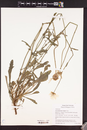 OSC-V-255756_lg.jpg |
 | Asteraceae 36. Leucanthemum vulgare Lam.Canada, Yukon Territory: Watson Lake, Big Horn Hotel. Elev. 675 m 60.06157°, -128.70444° Disturbed gravel with Lepidium ramosissimum, Matricaria discoidea, Chamerion angustifolium, Crepis tectorum, and Capsella bursa-pastoris. Locally common. Flowering. 6 duplicates (DAO). BABY-09340 B.A. Bennett 15-0252Jul 9, 2015With J. Hobbs, G. Rivest |
 | Asteraceae 37. Leucanthemum vulgare Lam.United States, Oregon, Lane: In the Coast Range on top of Prairie Mountain, ca. 7.5 air miles south of Alsea. 44.28016°, -123.5869°. Open rocky bald. Associated taxa: Dianthus, Lotus, Rubus, Anaphalis, Holodiscus, Epilobium. HerbariumSpecimenDuplicate: Leucanthemum vulgare | herbariumSpecimenDuplicate: Leucanthemum vulgare | herbariumSpecimenDuplicate: Leucanthemum vulgare | herbariumSpecimenDuplicate: Leucanthemum vulgare | herbariumSpecimenDuplicate: Leucanthemum vulgare | herbariumSpecimenDuplicate: Leucanthemum vulgare Rays white; disk flowers yellow. WGS84. https://intermountainbiota.org WS: 391600 Richard R. Halse 9245Aug 2, 2014 |
 | Asteraceae 38. Leucanthemum vulgare Lam.United States, Oregon, Lane: In the Coast Range on top of Prairie Mountain, ca. 7.5 air miles south of Alsea. Elev. 1047 44.28016°, -123.5869°. Georeferenced by [automated process-OregonFlora/OSU Herb]. Coordinate Source: OrlookId: 6858, StateProvince: Oregon, County: Lane, LocName: Lat 44.28016 Deg; Lon -123.5869 Deg. OregonFlora 1994-2020 methodology. Open rocky bald. HerbariumSpecimenDuplicate: Leucanthemum vulgare https://oregonflora.org Richard R. Halse 9245Aug 2, 2014OSC-V-067860; Accession Number: OSC244550 | 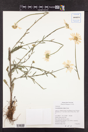 OSC-V-067860_lg.jpg |
 | Asteraceae 39. Leucanthemum vulgare Lam.United States, Oregon, Lane: In the Coast Range on top of Prairie Mountain, ca. 7.5 air miles south of Alsea. Elev. 1047 44.28016°, -123.5869°. Georeferenced by [automated process-OregonFlora/OSU Herb]. Coordinate Source: OrlookId: 6858, StateProvince: Oregon, County: Lane, LocName: Lat 44.28016 Deg; Lon -123.5869 Deg. OregonFlora 1994-2020 methodology. Open rocky bald. HerbariumSpecimenDuplicate: Leucanthemum vulgare https://oregonflora.org Richard R. Halse 9245Aug 2, 2014OSC-V-067859; Accession Number: OSC244549 | 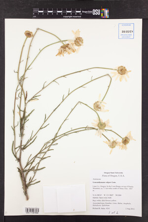 OSC-V-067859_lg.jpg |
 | Asteraceae 40. Leucanthemum vulgare Lam.U.S.A., Idaho, Ada County: Warm Springs Golf Course in east Boise Elev. 830 m. 43.595° N, 116.168° W Coordinate Source: Specimen Label. irrigated berm along bike path. Reproductive state: Flowers. SRP: 50588 Barbara Ertter 21392Jun 28, 2013 |  SRP050588.jpg |
 | Asteraceae 41. Leucanthemum vulgare Lam.U.S.A., Idaho, Boundary County: Bonner\'s Ferry. Nimz Ranch. T63N R1E Sec. 8 48.8259°, -116.3608°. Datum: WGS 84. Coordinate uncertainty: 969 meters. Georeferenced by Robert F. Steinauer. Coordinate Source: GeoLocate. Growing along dike road. Reproductive state: Flowers. Origin: Introduced. EWU: 9511 Kristi L Kimmet 621Jun 14, 2013 |  EWU0009511.jpg |
 | Asteraceae 42. Leucanthemum vulgare Lam.Canada, British Columbia: Iskut: Hiway near Bearpaw Ranch. Elev. 850 m 57.837889°, -129.99411°. Coordinate Source: source: Global Positioning System. Conservation Status:CDC: Not Listed. V214520 Kendrick Marr 13-0457Aug 4, 2013With Erica Wheeler; William MacKenzie |
 | Asteraceae 43. Leucanthemum vulgare Lam.U.S.A., Idaho, Idaho County: Clearwater National Forest: Lochsa River Drainage: Wilderness Gateway Campgrounds, ca 2 mi on Forest Road 198, ca 34.5 air mi NE of Kooskia. Elev. 2100 ft. 46° 20.251\' N, 115° 18.732\' W Old roadbed, mixed coniferous forest. ID: 191159; ID196715 Georgia G. Thomas 152Jun 23, 2013 |  ID196715.jpg |
 | Asteraceae 44. Leucanthemum vulgare Lam.U.S.A., Washington, Chelan County: Wenatchee National Forest: along Potato Creek (Forest Service Road 5380) circa 2.5 road miles up creek from Entiat River Road. Elev. 658 m. 47.806532° N, 120.350571° W Datum: WGS 84. Coordinate uncertainty: 13 meters. Coordinate Source: Digital map. Small flowing creek under riparian forest of Abies grandis and Pseudotsuga menziesii; brushy and herbaceous understory with moist soil. Reproductive state: Flowers. Origin: Introduced. Don Knoke 2262Jun 25, 2012With David Giblin, Ben Legler, Alex Harkness WTU: 410307; WTU-V-024345 |  WTU-V-024345.jpg |
 | Asteraceae 45. Leucanthemum vulgare Lam.U.S.A., Washington, Pend Oreille County: Colville National Forest; along Lost Creek at junction of Forest Service Road 4685 and spur road 550; in wetland circa 100 meters northeast of junction. Elev. 3432 ft. 48.68087° N, 117.52019° W Datum: WGS 84. Coordinate uncertainty: 50 meters. Wet meadow with fen in center, dominated by Sphagnum, Carex spp., Drosera, Alnus sinuata, and Picea engelmannii. Ray flowers white; uncommon in meadow. Reproductive state: Flowers. Origin: Introduced. Karen Peterson 2012-1Jul 20, 2012WTU: 408640; WTU-V-022419 |  WTU-V-022419.jpg |
 | Asteraceae 46. Leucanthemum vulgare Lam.U.S.A., Washington, Pend Oreille County: Colville National Forest. Forest Road 245 circa 5.8 miles above junction of Forest Road 250 and Sullivan Creek Road, on road to Sullivan Mountain. Elev. 5046 ft. 48.86627° N, -117.22564° W Datum: WGS 84. Coordinate uncertainty: 500 meters. Georeferenced by John Bassett. Coordinate Source: Nat. Geog. TOPO!. Rays white; disks yellow. Reproductive state: Flowers. Origin: Native. Melissa Barker 2012-16Jul 21, 2012WTU: 407002; WTU-V-019619 |  WTU-V-019619.jpg |
 | Asteraceae 47. Leucanthemum vulgare Lam.U.S.A., Washington, Yakima County: Okanogan-Wenatchee National Forest. Along Highway 410, about 0.2 road miles southeast of junction with Little Naches River Road. Elev. 755 m. 46.98716° N, 121.09237° W Datum: WGS 84. Coordinate uncertainty: 5 meters. Georeferenced by Maria Yousoufian. Coordinate Source: GPS. Disturbed roadside edge with thin gravelly soil; Centaurea spp. and Cichorium intybus common. Scattered along edge of road; rays white. Reproductive state: Fruits. Origin: Introduced. Alex Harkness 12-137Aug 29, 2012With David Giblin, Ben Legler WTU: 408950; WTU-V-022292 |
 | Asteraceae 48. Leucanthemum vulgare Lam.U.S.A., Washington, Pend Oreille County: Colville National Forest. Slate Creek, 7 miles from State Route 31 along Forest Road 3155. Approximately 1 mile after trail, at road closure. Elev. 4197 ft. 48.96341° N, 117.20316° W Sloping hillside, gravel road. Mixed coniferous montane forest. Abundant in roadside. Reproductive state: Flowers. Origin: Introduced. Katie Parker 6Jul 20, 2012WTU: 408278; WTU-V-022355 |  WTU-V-022355.jpg |
 | Asteraceae 49. Leucanthemum vulgare Lam.Canada, British Columbia: East Kootenay Regional District, Panorama Rd. near Invermere, campsite pulloff near river. Elev. 1153 m 50.44368°, -116.2593°. UBC: V237918 Erin R. Manton | J. Shiller 1578Jul 7, 2012 | 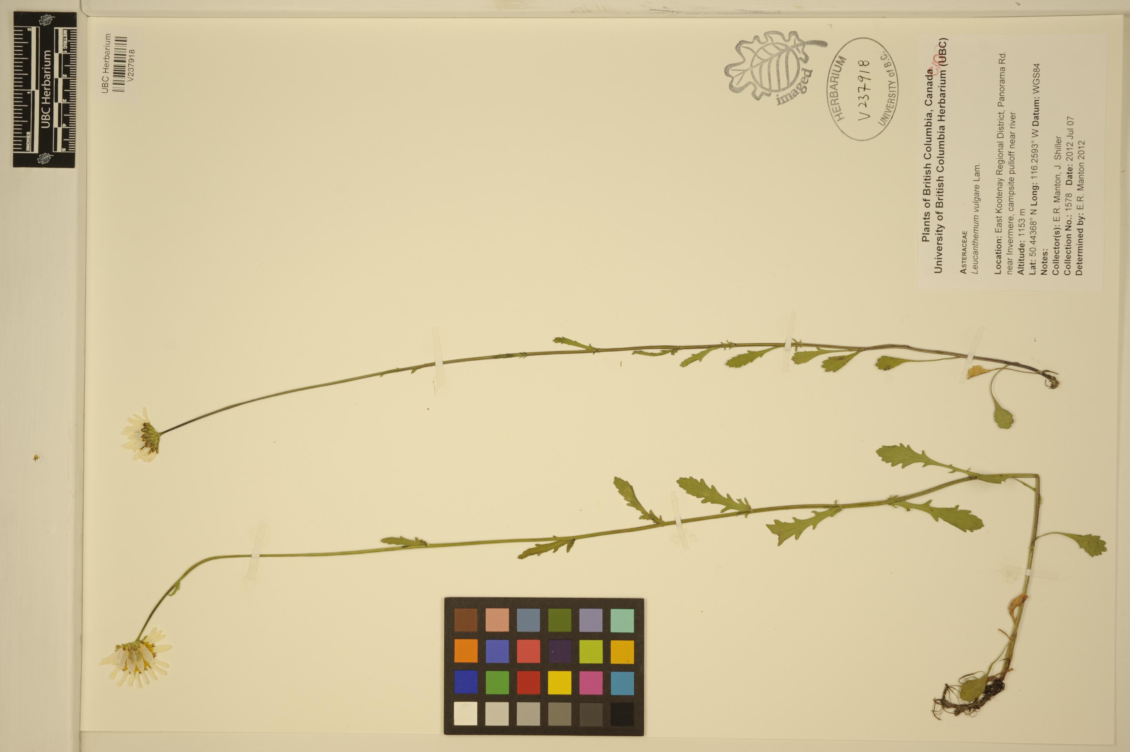 V237918.jpg |
 | Asteraceae 50. Leucanthemum vulgare Lam.Canada, British Columbia: Vancouver Island, Cowichan Valley Regional District, marshy area just off Nitnat Rd. Elev. 205 m 48.91263°, -124.48788°. Marshy area around edge of lake. UBC: V238027 Erin R. Manton | Jamie D. Fenneman 197Jun 27, 2012 | 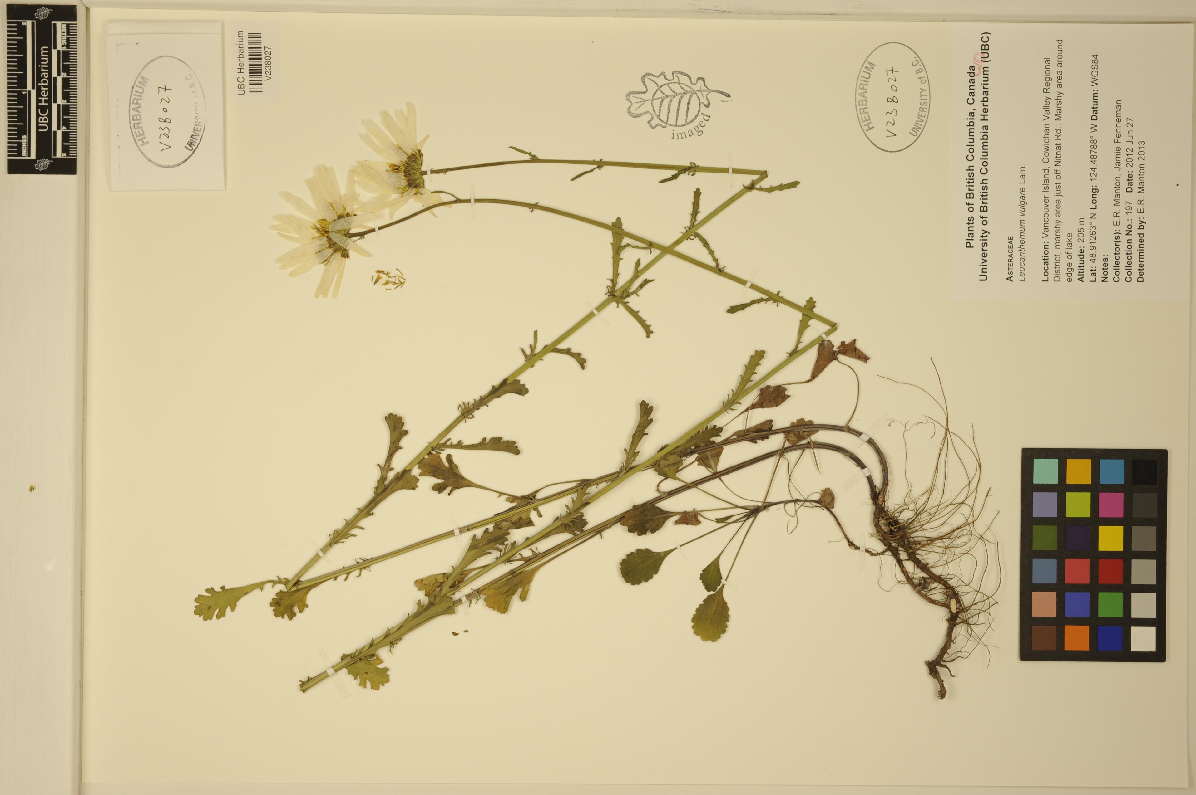 V238027.jpg |


