Terrain
Road Map
Satellite
Hybrid
Terrain

 | Asteraceae 1. Hieracium lachenalii C.C. Gmel.U.S.A., Oregon, Multnomah County: Mt. Hood National Forest, Bull Run Watershed, parking area by Boody Lake. 45.550127° N, 122.004784° W With Eriophyllum lanatum, Hypochaeris radicata. HPSU: 24844 Angie Kimpo 2022-3Aug 4, 2022 |  HPSU_024844.jpg |
 | Asteraceae 2. Hieracium lachenalii C.C. Gmel.U.S.A., Washington, Cowlitz County: Permanent Plot Number: 0. Elev. 565 m. 46.28158° N, 122.35734° W Georeferenced by Dan Post. Coordinate Source: Specimen label. Debris avalanche deposit, sand and unconsolidated rock, nutrient poor soil. Comp. Reference identification for species composition monitoring post 1980 eruption. Reproductive state: Flowers. Origin: Introduced. Virginia H. Dale 2022_1642022WTU: 456802; WTU-V-109890 |  WTU-V-109890.jpg |
 | Asteraceae 3. Hieracium lachenalii C.C. Gmel.U.S.A., Washington, Skamania County: Gifford Pinchot National Forest, Road to Mckinley Ridge. Approximately 2 kms below ridge. Elev. 973 m. 45.79105° N, 122.18034° W Datum: WGS 84. Coordinate uncertainty: 30 meters. Coordinate Source: GPS. South-facing talus slope with Castilleja miniata, Penstemon fruticosus, and Cryptogramma achrostichoides common. Common and abundant throughout area; ligualte flowers yellow. Reproductive state: Flowers and Fruits. Origin: Introduced. David Giblin 7458Jun 24, 2020WTU: 430185; WTU-V-087287 |  WTU-V-087287.jpg |
 | Asteraceae 4. Hieracium lachenalii SuterUnited States, Washington, Skamania: Beacon Rock State Park, along Hardy Falls/Hamilton Mountain trail. Elev. 900 ft 45.639177°, -122.01850°. Datum: WGS84. Georeferenced by Fertig. Trailside. https://intermountainbiota.org WS: 399824; WS008013 Linda Kunze s.n.Jun 18, 2020 |  WS008013.JPG |
 | Asteraceae 5. Hieracium lachenalii SuterUnited States, Washington, Kitsap: Puget Trough: NE shore of Lake Tahuyna, WA Department of Fish and Wildlife access site on west side of Gold Creek Road, 8 miles west of Bremerton. T24N R1W S17 NE4 SW4 SW4. Elev. 620 ft 47.56784°, -122.83592°. Datum: WGS84. Weedy roadside in full sun at edge of Thuja plicata forest. HerbariumSpecimenDuplicate: Hieracium lachenalii First record for Kitsap County?; Ligulate flowers yellow, leaves short petiolate and taper to base. Local on road edge only. https://intermountainbiota.org WS: 401463; WS011625 Walter Fertig 34600Jun 26, 2020With Bridgette Glass |
 | Asteraceae 6. Hieracium lachenalii C.C. Gmel.U.S.A., Oregon, Multnomah County: East of Colton, Larch Mountain Road 300 meters E of Palmer Mill Road. 45.51101° N, 122.201105° W Datum: WGS 84. Georeferenced by Jeffrey Lesh. Coordinate Source: Digital Map. Forested roadside. Common, but limited to roadside for several miles here. With Mianthemum. Reproductive state: Flowers. Origin: Introduced. HPSU: 20258 Jeffrey T. Lesh 1253Aug 25, 2019 |
 | Asteraceae 7. Hieracium lachenalii C.C. Gmel.U.S.A., Washington, Skamania County: Oklahoma Campground. Banks and floodplain of the Little White River. 7 kilometers east-northeast from B Z Corner at terminus of Oklahoma Road. Elev. 1200 ft. 45.87323°, -121.62110°. Datum: WGS 84. Georeferenced by Dominic Maze. Coordinate Source: Digital Map. Disturbed floodplain. Occasional. Reproductive state: Flowers. Origin: Introduced. HPSU: 22206 Dominic Maze 1413Jun 15, 2019With Olivia Duren |  HPSU_022206.jpg |
 | Asteraceae 8. Hieracium lachenalii C.C. Gmel. ssp. pseudopollichiae (Oborny & Zahn) ZahnGermany: Deutschland-Baden-Württemb.-LKr.LÖ: Kirchhausen NE Kirchhausen. MTB: 8212/43 Elev. 731 m. 47° 43\' 10" N, 7° 45\' 26" E Straßenböschung. G. Gottschlich 72168Jun 9, 2019WTU: 422971; WTU-V-059556 |  WTU-V-059556.jpg |
 | Asteraceae 9. Hieracium lachenalii SuterGermany, Rheinland: Pfalz-Lkr.PS: Thaleischweiler Straßengabelung N Rosselmühle Elev. 239 m. 49° 16\' 23" 7° 33\' 22" Straßenböschung unter Bu-Fi-Wald. MTB: 6711/12 Reproductive state: Fruits. G. Gottschlich 71988May 29, 2019WTU: 424080; WTU-V-065343 |  WTU-V-065343.jpg |
 | Asteraceae 10. Hieracium lachenalii SuterU.S.A., Washington, King County: Summit ridge, just south of summit of Kelly Butte, Cascade Range. Elev. 1640 m. 47.167° N, 121.4904° W Coordinate Source: Specimen Label. On steep dry rocky subalpine slope, full sun; with Antennaria microphylla, Xerophyllum tenax, Anaphalis margaritacea, Penstemon serrulatus, Phlox diffusa, Vaccinium scoparium. Yellow rays, cespitose perennial; occasional adventive. Reproductive state: Flowers. Origin: Introduced. Peter F. Zika 29375Aug 6, 2018WTU: 419525; WTU-V-042590 |  WTU-V-042590.jpg |
  | Asteraceae 11. Hieracium lachenalii SuterU.S.A., Washington, Kittitas County: Near Forest Service Road 7036, 1.75 air kilometers north-northwest of Pyramid Peak. Elev. 1415 m. 47.1255° N, 121.4164° W Coordinate Source: Specimen Label. Invalid coordinates (located outside county bounds). On steep dry sunny slope, with Anaphalis margaritacea, Heracleum, Veratrum viride, Epilobium angustifolium. Yellow rays, cespitose perennial, common. Reproductive state: Flowers. Origin: Introduced. Peter F. Zika 29382Aug 6, 2018WTU: 419942; WTU-V-043128 |  WTU-V-043128.jpg |
 | Asteraceae 12. Hieracium lachenalii C.C. Gmel.U.S.A., Oregon, Clackamas County: Mount Hood National Forest. SE of Timothy Lake on Road 570 near junction with trail 534. 45.1127° N, 121.7663° W Datum: WGS 84. Georeferenced by Jeffrey Lesh. Coordinate Source: Digital Map. Forest roadside. Occasionally mowed here. With Centaurea, Lycopodium. Mix of a few green basal leaves to only withered ones. Most with <6 stem leaves. Patchy along 1 mile of road. Reproductive state: Flowers. Origin: Introduced. HPSU: 20139 Jeffrey T. Lesh 1018Aug 1, 2018 |
 | Asteraceae 13. Hieracium lachenalii C.C. Gmel.U.S.A., Oregon, Clackamas County: Brightwood, End of WIldcat Creek Road behind BLM gate. 45.35189° N, 122.04032° W Datum: WGS 84. Georeferenced by Jeffrey Lesh. Coordinate Source: Specimen Label. Forest roadside. Part shade. Dominant cover for 0.5 miles along road. With Alnus, Clinopodium, Rubus ursinus, Rhododendron. Reproductive state: Fruits. Origin: Introduced. HPSU: 20140 Jeffrey T. Lesh 1039Aug 31, 2018 |
 | Asteraceae 14. Hieracium lachenalii C.C. Gmel.U.S.A., Oregon, Clackamas County: Brightwood, End of WIldcat Creek Road behind BLM gate. 45.35189° N, 122.04032° W Datum: WGS 84. Georeferenced by Jeffrey Lesh. Coordinate Source: Specimen Label. Forest roadside. Part shade. Dominant cover for 0.5 miles along road. With Alnus, Clinopodium, Rubus ursinus, Rhododendron. Reproductive state: Fruits. Origin: Introduced. HPSU: 20141 Jeffrey T. Lesh 1039Aug 31, 2018 |
 | Asteraceae 15. Hieracium lachenalii C.C. Gmel.U.S.A., Oregon, Clackamas County: Mt. Talbert. Off West Ridge Trail about 100 meters up hill towards summit. Elev. 620 ft. 45.425411°, -122.55296°. Datum: WGS 84. Georeferenced by Dominic Maze. Coordinate Source: Digital Map. Southwest aspect, disturbed understory with Pseudotsuga, Abies grandis, Melica subulata, Bromus vulgaris, and Acer macrophyllum. Several plants scattered through understory. Reproductive state: Flowers. HPSU: 21051 Dominic Maze 1169May 7, 2018 |  HPSU_021051.jpg |
 | Asteraceae 16. Hieracium lachenalii C.C. Gmel.United States of America, Oregon, Multnomah County: Hoyt Arboretum: Collected downslope on the north side of Steven\'s Pavilion, just off the north side of the connector trail between Fir Trail and Spruce Trails, west side of Fairview Blvd. Common but not dense patches in weedy trailside area. Elev. 780 45.516193°, -122.71630°. Datum: WGS84. HOYT: 2018-222/1 Mandy Tu Jun 6, 2018 |
 | Asteraceae 17. Hieracium lachenalii C.C. Gmel.United States of America, Oregon, Multnomah County: Hoyt Arboretum: Collected downslope on the north side of Steven\'s Pavilion, just off the north side of the connector trail between Fir Trail and Spruce Trails, west side of Fairview Blvd. Common but not dense patches in weedy trailside area. Elev. 780 45.516193°, -122.71630°. Datum: WGS84. HOYT: 2018-223/1 Mandy Tu Jun 22, 2018 |
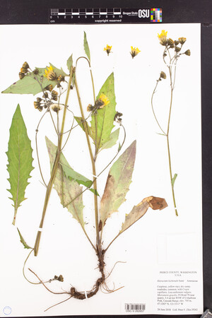
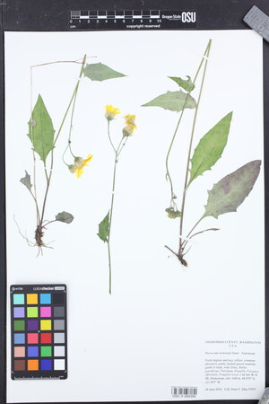
 | Asteraceae 18. Hieracium lachenalii SuterUnited States, Washington, Pierce: FS Road 70 near quarry, 5.4 air km WSW of Colquhoun Peak, Cascade Range. Elev. 745 m 47.1202°, -121.5311°. Dry sunny roadsides. Crepis capillaris, Leucanthemum vulgare, Microsteris gracilis Common; cespitose, yellow rays. https://oregonflora.org OSC-V-262657 Peter F. Zika 29262Jun 26, 2018 |  OSC-V-262657_lg.jpg |
 | Asteraceae 19. Hieracium lachenalii C.C. Gmel.U.S.A., Washington: Camas area, Round Lake. 45.602479° N, 122.397885° W Coordinate Source: Specimen Label. Shallow soils grassy balds. And shaded trailsides throughout area. Still patchy distribution. Reproductive state: Flowers. HPSU: 19798 Dominic Maze 616Jun 11, 2017 |  HPSU_019798.jpg |
 | Asteraceae 20. Hieracium lachenalii SuterUnited States, Washington, Snohomish: Gravel roadside, gentle S slope, 2 air km W of Mt. Dickerman. Elev. 640 m 48.07°, -121.497°. Adventive, partly shaded gravel roadside, gentle S slope. Alnus, Rubus parviflorus, Pteridium, Prunella, Veronica officinalis, Fragaria vesca Common.; fresh stigmas and rays yellow. https://oregonflora.org OSC-V-260356 Peter F. Zika 27977Jun 26, 2016 |  OSC-V-260356_lg.jpg |
 | Asteraceae 21. Hieracium lachenalii C.C. Gmel.U.S.A., Washington, Clark County: Yacolt Burn State Forest: Along Tarbell Trail 0.8 air km northeast of Larch Mountain summit. Site ID: BSL-1299. Elev. 980 m. 45.723179° N, 122.291749° W Datum: WGS 84. Coordinate uncertainty: 6 meters. Georeferenced by Ben Legler. Coordinate Source: GPS. Brushy, north-facing slope over mossy talus and thin soil, with Acer glabrum, A. Circinatum, Prunus emarginata, Oplopanax horridus, and ferns. Flowers yellow; very common weed, well established on trail sides and in open areas throughout forest. Reproductive state: Flowers and Fruits. Ben Legler 13877Sep 12, 2015WTU: 409260; WTU-V-023132 |  WTU-V-023132.jpg |
 | Asteraceae 22. Hieracium lachenalii C.C. Gmel.U.S.A., Washington, Clark County: CRP Elev. 200 ft. 45.60821° N, 122.37225° W Datum: WGS84. powerline easement Josh Wozniak CRP-002May 1, 2015WTU: 458765; WTU-V-112349 |  WTU-V-112349.jpg |
 | Asteraceae 23. Hieracium lachenalii SuterCanada, British Columbia: North side of International Point, Silver Skagit Road on east shore of Ross Lake reservoir, also at Homozeen boat ramp just to south of United States border. Elev. 490 m. 49.0001° N, 121.065° W Coordinate Source: Specimen Label. On dry sunny gravel, with Epilobium angustifolium. Cespitose, yellow flowers, fresh styles dark; occasional. Reproductive state: Flowers and Fruits. Origin: Introduced. Peter F. Zika 26910Sep 9, 2014WTU: 400452; WTU-V-006852 |  WTU-V-006852.jpg |
  | Asteraceae 24. Hieracium lachenalii C.C. Gmel.U.S.A., Washington, Skamania County: Gifford Pinchot National Forest: at Sunset Campground along FS Road 42 adjacent to East Fork Lewis River. Site ID: BSL-0992. Elev. 308 m. 45.818407° N, 122.253735° W Datum: WGS 84. Coordinate uncertainty: 50 meters. Georeferenced by Ben Legler. Coordinate Source: Digital Map. Invalid coordinates (located outside county bounds). Moist duff and mossy soil under Pseudotsuga menziesii adjacent to paved areas. Flowers yellow; plants taprooted, common around parking areas in partly shaded soil under conifers. Reproductive state: Flowers. Ben Legler 13036Jun 28, 2014WTU: 428286; WTU-V-084708 |  WTU-V-084708.jpg |
 | Asteraceae 25. Hieracium lachenalii C.C. Gmel.U.S.A., Washington, Skamania County: Gifford Pinchot National Forest: along Ed\'s Trail ca. 1.75 air km north of Silver Star Mountain. Site ID: BSL-0997. Elev. 1145 m. 45.763167° N, 122.242518° W Datum: WGS 84. Coordinate uncertainty: 30 meters. Georeferenced by Ben Legler. Coordinate Source: Digital Map. Lush meadows on east-facing slope, dominated by Hieracium lachenalii, Iris tenax, Valeriana sitchensis, Carex. Flowers yellow, just beginning to open; plants very abundant throughout meadows. Reproductive state: Flowers. Ben Legler 13053Jun 29, 2014WTU: 428407; WTU-V-084601 |  WTU-V-084601.jpg |
  | Asteraceae 26. Hieracium lachenalii SuterU.S.A., Washington, Clark County: Livingston Mountain, near East Fork Lackamas Creek. T03N R04E S32 SW 1/4 41.169007°, -84.433582°. Datum: WGS 84. Coordinate uncertainty: 600 meters. Georeferenced by Joseph Stormer. Coordinate Source: Digital Map. Invalid coordinates (located outside county bounds). Plants growing in weedy clearcut, on disturbed ground, on side of road. Aspect: 0 degrees. Slope: 0%. Associated species: Pseudotsuga menziesii, Pteridium aquilinum, Dactylis glomerata, Alnus rubra, Leucanthemum vulgare. Reproductive state: Flowers. Origin: Introduced. Kathryn A. Beck 201483Jun 26, 2014WTU: 412866; WTU-V-028095 |
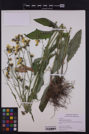
 | Asteraceae 27. Hieracium lachenalii SuterUnited States, Oregon, Clackamas: Bull Run. Elev. 4300 ft. 45.432°, -121.828°. Georeferenced by [automated process-OregonFlora/OSU Herb]. Coordinate Source: OrlookId: 125334, StateProvince: Oregon, County: Clackamas, LocName: Lat 45.432 Deg; Lon -121.828 Deg. OregonFlora 1994-2020 methodology. Open wooded slopes. https://oregonflora.org OSC-V-257783 George Kral 455Jun 19, 2014 |  OSC-V-257783_lg.jpg |
 | Asteraceae 28. Hieracium lachenalii SuterU.S.A., Washington, Pierce County: Forest Service Route 70, 5.6 air km SE of Huckleberry Mountain, Cascade Range. Elev. 710 m. 47.117° N, 121.539° W On dry partly shaded roadside, with Alnus rubra, Pseudotsuga menziesii, Crepis capillaris, Epilobium angustifolium, Heracleum. Rays yellow. Reproductive state: Flowers and Fruits. WTU: 394861 Peter F. Zika 26384Jul 29, 2013With E. R. Alverson |
 | Asteraceae 29. Hieracium lachenalii SuterU.S.A., Washington, King County: Federation Forest, 8.6 air km WSW of Huckleberry Mountain, Cascade Range. Elev. 500 m. 47.152° N, 121.688° W On dry partly shaded roadside, with Pseudotsuga menziesii, Gaultheira shallon, Aver circinatum. Rays yellow, occasional adventive. Reproductive state: Flowers and Fruits. WTU: 394862 Peter F. Zika 26361Jul 29, 2013With E. R. Alverson |
 | Asteraceae 30. Hieracium lachenalii SuterCanada, British Columbia: Metro Vancouver, West Vancouver, Capilano River, west shore, circa 80 meters south of Marine Drive bridge. Elev. 6 m. 49° 19\' 33.5" N, 123° 7\' 56.2" W Coordinate Source: Specimen Label. In the sandy, gravelly riverbed. Stems with stellate hairs and scattered long straight barbed hairs 2-3 millimeters; stem leaves mostly 3-5; phyllaries with stellate hairs and longer black-based hairs with amber glandular ball tips; frequent. Reproductive state: Flowers. Origin: Native. Frank Lomer 8448bJul 18, 2013WTU: 407633; WTU-V-020844 |  WTU-V-020844.jpg |
 | Asteraceae 31. Hieracium lachenalii C.C. Gmel.Canada, British Columbia: Metro Vancouver, North Vancouver, Capilano Road and Edgemont Boulevard, southeast side. Elev. 100 m 49.343611°, -123.1125°. Grassy roadside. Stems average ca. 4 leaves; stems with stellate hairs and long barbed white hairs; no glandular hairs until inflorescence; phyllaries ca. 1 cm long with stellate hairs and black gland-tipped hairs; abundant weed at site. UBC: V241520 Frank Lomer 8456bJul 18, 2013 |
 | Asteraceae 32. Hieracium lachenalii C.C. Gmel.Canada, British Columbia: Metro Vancouver, West Vancouver, Capilano River, west shore, ca. 80 m south of Marine Drive bridge. Elev. 6 m 49.325972°, -123.13227°. In the sandy, gravelly riverbed. Stems with stellate hairs and scattered long straight barbed hairs 2-3 mm; stem leaves mostly 3-5; phyllaries with stellate hairs and longer black-based hairs with amber glandular ball tips; frequent. UBC: V241521 Frank Lomer 8448bJul 18, 2013 |
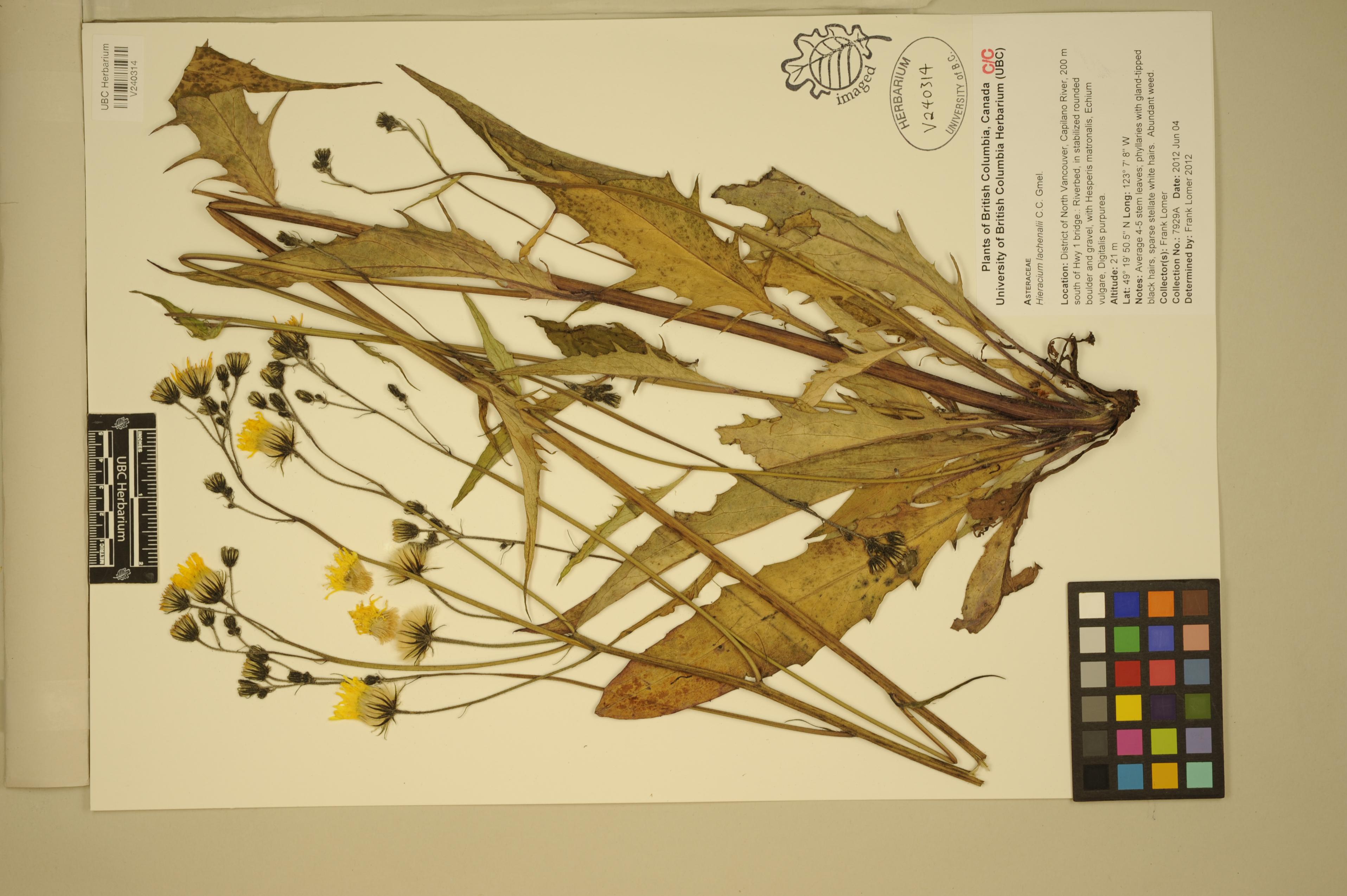
 | Asteraceae 33. Hieracium lachenalii C.C. Gmel.Canada, British Columbia: District of North Vancouver, Capilano River, 200 m south of Highway 1 bridge. Elev. 21 m 49.330694°, -123.11888°. Riverbed, in stabilized rounded boulder and gravel, with Hesperis matronalis, Echium vulgare, Digitalis purpurea. Average 4-5 stem leaves; phyllaries with gland-tipped black hairs, sparse stellate white hairs; abundant weed. UBC: V240314 Frank Lomer 7929AJun 4, 2012 |  V240314.jpg |
 | Asteraceae 34. Hieracium lachenalii K.C. Gmel.Canada, British Columbia: Town of Kitimat: edge of Chalet Motel parking lot. Elev. 40 m 54.053056°, -128.65086°. Coordinate Source: Source. Conservation Status:CDC: Not Listed. V208925 Kendrick Marr KM7537Aug 4, 2012 |
 | Asteraceae 35. Hieracium lachenalii SuterU.S.A., Washington, Stevens County: Near Rickey Point and Rickey Point Road, about 3 air miles southwest of mouth of Colville River in reservoir (Lake Roosevelt). Elev. 1312 ft. 48.54938° N, 118.13623° W Dry shade of Pinus ponderosa. Yellow rays, cespitose; common yard weed. Reproductive state: Flowers. Origin: Introduced. WTU: 377480 Sue Winterowd s.n.Jun 8, 2009 |
 | Asteraceae 36. Hieracium lachenalii K.C. Gmel.U.S.A., Washington, King County: Tolt River Watershed; along Road 73. T26N R9E S26 NE 47.7134°, -121.613°. Datum: NAD 27. Coordinate uncertainty: 805 meters. Georeferenced by Ben Legler. Coordinate Source: TRS2LL. Under conifer forest canopy. Reproductive state: Flowers. Origin: Introduced. WTU: 377231 Hans Smith Jul 29, 2008 |
 | Asteraceae 37. Hieracium lachenalii K.C. Gmel.U.S.A., Oregon, Multnomah County: Columbia River Gorge, south side of Interstate Highway 84, 5.1 miles southwest of Cascade Locks. Elev. 160 ft. UTM Zone 10, 579929E, 5052823N 45.624352°, -121.97467°. Datum: NAD 83. Georeferenced by Dan Post. Coordinate Source: Calc. from UTM. Weedy, rocky, and disturbed fill; with Leucanthemum vulgare, Plantago lanceolata, Rumex acetosella, Schedonorus arundinaceus. Reproductive state: Flowers. Origin: Introduced. WTU: 383813 R.E. Brainerd 1138Jun 17, 2008 |
 | Asteraceae 38. Hieracium lachenalii K.C. Gmel.U.S.A., Washington, Skamania County: Columbia River Gorge, State Highway 14, 0.25 miles south of milepost 42, 2.3 miles soutwest of Stevenson. Elev. 160 ft. UTM Zone 10, 585136E, 5057653N 45.667199°, -121.90704°. Datum: NAD 83. Georeferenced by Dan Post. Coordinate Source: Calc. from UTM. Shaded road cut bank in moist conifer forest; with Scedonorus arundinaceus, Dactylis glomerata, and Elymus glaucus. Common on roadsides. Reproductive state: Flowers. Origin: Introduced. WTU: 383820 R.E. Brainerd 1139Jun 17, 2008 |
 | Asteraceae 39. Hieracium lachenalii K.C. Gmel.Canada, British Columbia, Lower Mainland: Yale: Highway 1, 13 km N of town. Elev. 144 m 49.651111°, -121.40638°. Coordinate Source: Global Positioning System. Conservation Status:CDC: Not Listed. V204331 Kendrick Marr KM7408Jun 6, 2008 |
 | Asteraceae 40. Hieracium lachenalii C.C. Gmel.Canada, British Columbia: Greater Vancouver, Coquitlam, Woolridge Street, near King Edward Street, by roadway in back of store. Elev. 6 m 49.233444°, -122.86130°. In landscaping. A few plants; weed. UBC: V227446 Frank Lomer 6847Sep 23, 2008 |
 | Asteraceae 41. Hieracium lachenalii K.C. Gmel.Canada, British Columbia: Coquitlam, British Columbia: Greater Vancouver, Coquiltlam, Woolridge Street, near King Edward Street. Elev. 6 m 49.233444°, -122.86130°. A few plants. Conservation Status:CDC: Not Listed. V206552 Frank Lomer 6847Sep 23, 2008 |
 | Asteraceae 42. Hieracium lachenalii K.C. Gmel.U.S.A., Washington, King County: Cedar River Watershed. Elev. 680 ft. T22N R7E S18 47.3952°, -121.9635°. Datum: NAD 27. Coordinate uncertainty: 805 meters. Georeferenced by Ben Legler. Coordinate Source: TRS2LL. Yellow flowers; 10-25 heads; 40-110 centimeters tall. Reproductive state: Flowers & Fruits. Origin: Introduced. WTU: 367937 Hans Smith 0071Jul 24, 2007 |
 | Asteraceae 43. Hieracium lachenalii K.C. Gmel.U.S.A., Washington, King County: Cedar River Watershed. Elev. 2480 ft. T22N R8E S22 NW 1/4 47.3806°, -121.7726°. Datum: NAD 27. Coordinate uncertainty: 805 meters. Georeferenced by Ben Legler. Coordinate Source: TRS2LL. Yellow flowers; 10-25 heards; 40-110 centimeters tall. Reproductive state: Flowers & Fruits. Origin: Introduced. WTU: 367938 Hans Smith 0070Jul 31, 2007 |
 | Asteraceae 44. Hieracium lachenalii K.C. Gmel.U.S.A., Washington, King County: Cedar River Watershed; end of Road 860; approximately 3/4 mile west of north side of Chester Morse Lake. T22N R8E S14 NE 1/4 47.3952°, -121.7514°. Datum: NAD 27. Coordinate uncertainty: 805 meters. Georeferenced by Ben Legler. Coordinate Source: TRS2LL. Yellow flowers; 10-25 heads; 40-110 centimeters tall. Reproductive state: Flowers & Fruits. Origin: Introduced. WTU: 367940 Stewart Wechsler 0024Aug 2, 2007 |
 | Asteraceae 45. Hieracium lachenalii K.C. Gmel.U.S.A., Washington, King County: Cedar River Watershed; Rex Creek; Road 700. Elev. 3400 ft. T21N R9E S13 Center 47.3079°, -121.6029°. Datum: NAD 27. Coordinate uncertainty: 805 meters. Georeferenced by Ben Legler. Coordinate Source: TRS2LL. With: Anaphalis margaritacea, Hieracium albiflorum, Leucanthemum vulgare, Hypochaeris radicata. Yellow flowers; 10-25 heads; 40-110 centimeters tall. Reproductive state: Flowers & Fruits. Origin: Introduced. WTU: 367939 George Wooten 0021Aug 12, 2007 |
 | Asteraceae 46. Hieracium lachenalii K.C. Gmel.U.S.A., Washington, King County: Cedar River Watershed. Elev. 3680 ft. T22N R8E S15 NW 1/4 47.3952°, -121.7726°. Datum: NAD 27. Coordinate uncertainty: 805 meters. Georeferenced by Ben Legler. Coordinate Source: TRS2LL. Yellow flowers; 10-25 heads; 40-110 centimeters tall. Reproductive state: Flowers & Fruits. Origin: Introduced. WTU: 367941 Hans Smith 0068Aug 1, 2007 |
 | Asteraceae 47. Hieracium lachenalii K.C. Gmel.Canada, British Columbia: Terrace: mountain summit east of town of Terrace. Elev. 90 m 54.516111°, -128.6025°. Conservation Status:CDC: Not Listed. V196902 Kendrick Marr 06-0603Jul 18, 2006With Richard Hebda; William MacKenzie |
 | Asteraceae 48. Hieracium lachenalii C.C. Gmel.Canada, British Columbia: Greater Vancouver, Burnaby, Highway 1 and Cariboo Road, northeast side by overpass. Elev. 27 m 49.243056°, -122.915°. Shrubby margin of landscaped embankment. Several plants persisting several years. UBC: V232872 Frank Lomer 6033Jun 27, 2006 |
 | Asteraceae 49. Hieracium lachenalii C.C. Gmel.U.S.A., Oregon, Multnomah County: Bull Run Watershed, 13.7 miles up the 10 road. Elev. 1600 ft. 45.5032° N, 122.01484° W Datum: NAD 27. Weedy roadside in conifer forest, with Festuca arundinacea, Lotus uliginosus, Anthoxanthum odoratum, Leucanthemum vulgare, and Salix sitchensis. Flowers yellow. Reproductive state: Flowers. SRP: 33323 B. W. Wilson 11686Jun 12, 2006With Richard Brainerd |  SRP033323.jpg |
  | Asteraceae 50. Hieracium lachenalii C.C. Gmel.U.S.A., Oregon, Multnomah County: Bull Run Watershed, on the 12 road. 45.435833°, -121.81083°. Georeferenced by SRP Staff. Invalid coordinates (located outside county bounds). Weedy roadside in conifer forest. Flowers yellow. Reproductive state: Flowers. SRP: 33324 B. W. Wilson 11692Jun 12, 2006With Richard Brainerd |  SRP033324.jpg |


