Terrain
Road Map
Satellite
Hybrid
Terrain

 | Asteraceae 1. Erigeron strigosus Muhl. ex Willd.U.S.A., Massachusetts, Franklin County: City of Orange: near east-central part of city roughly east of Tully Mountain. Elev. 280 m. 42° 38\' 45" N, 72° 14\' 43" W Old field, margins of wood road and openings in forest of mostly Tsuga canadensis, Pinus strobus, Acer rubrum and Betula alleganiensis. Margins of wood road, shade for abouth half of day. Involucral bracts greenish, ray florets white, disc florets yellow. SRP: 82507 David E. Boufford 46237Aug 6, 2023 |  SRP082507.jpg |
 | Asteraceae 2. Erigeron strigosus Muhl. ex Willd. var. septentrionalis (Fern. & Wieg.) Fern.U.S.A., Montana, Carter County: Custer National Forest, Chalk Buttes. Approx. 9 miles SW of Ekalaka, MT. Elev. 3677 ft. 45.7561° N, 104.6535° W; T1S, R57E, S.15, NE1/4 Datum: WGS 84. Georeferenced by Trey Good. Coordinate Source: Specimen Label. Scattered plants with light pink flowers growing on a short ridge near pine trees with Carex filifolia and Artemisia ludoviciana. Flowering. Reproductive state: Flowers & Fruits. Kurt Hansen 1953Jun 16, 2023MONTU: 172207; MONTU000726 |  MONTU000726.jpg |
 | Asteraceae 3. Erigeron strigosus Muhl. ex Willd.U.S.A., Montana, Carter County: Above Devil\'s Canyon in the Long Pines. Elev. 3800 ft. T2S R60E S8 45.675493°, -104.34449°. Datum: WGS 84. Coordinate uncertainty: 1138 meters. Georeferenced by Peter Donati. Coordinate Source: Calc. from TRS. Common in sandy soil of grasslands on a southwest facing slope. With Oxytropis lambertii and Stipa comata. MONTU: 166754 Peter Lesica 11891Jun 13, 2020 |  MONTU_166754.jpg |
 | Asteraceae 4. Erigeron strigosus Muhl. var. strigosus U.S.A., Washington, Pierce County: JBLM TA 6 prairie 47.04108° N, 122.55112° W Datum: WGS84. Coordinate Source: GPS. One plant with several stems growing at edge of two-track in semi-native prairie. With Potentilla gracillis, Achillea millefolium, Festuca roemeri, Solidago missouriensis, Agrostis capillaris, and Anthoxanthum aristata. Rare, only one plant so only two stems collected. White rays about 4mm Reproductive state: Flower. Origin: Introduced. WTU Rod Gilbert RG-20-19Jul 17, 2020 |
 | Asteraceae 5. Erigeron strigosus Muhl. var. septentrionalis (Fern. & Wieg.) Fern.U.S.A., Oregon, Baker County: At outlet of Van Patten Lake. Elev. 2252 m. 44.95664° N, 118.184235° W Datum: WGS 84. Coordinate uncertainty: 10 meters. Coordinate Source: GPS. Old, small, earthen dam at lake nutlet; mesic soil, with Salix, Lonicera involucrata, Juncus balticus, Trifolium repen, among subalpine conifer forest. Ray flowers white; stems in loose clumps. Reproductive state: Flowers. Origin: Native. WTU Makaila Wood 2018-02Jul 13, 2018 |
 | Asteraceae 6. Erigeron strigosus Muhl. ex Willd. var. septentrionalis (Fernald & Wiegand) FernaldCanada, British Columbia: Metro Vancouver, Burnaby, Gaglardi Way entrance to Highway 1. Elev. 20 m 49.242667°, -122.916°. Shrubby area east of Burnaby Lake, in grassy clearing near highway, with Agrostis capillaris, Leucanthemum vulgare, Dianthus armeria, Tanacetum vulgare, Cytisus scoparius. About 100 plants scattered in the area, late blooming, rays of all plants pink, phyllaries with sparse flattened septate hairs, stem with sparse mostly appressed hairs. UBC: V253003 Frank Lomer 11508Nov 17, 2018 |
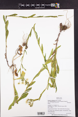
 | Asteraceae 7. Erigeron strigosus Muhl. ex Willd. ssp. septentrionalis (Fernald & Wiegand) Wagenitz= Erigeron strigosus Muhl. ex Willd. var. septentrionalis (Fernald & Wiegand) Fernald U.S.A., Idaho, Adams County: Payette National Forest. Trail number 203 at hot springs . Elev. 1359 m. 44.66937° N, 116.30541° W Datum: WGS 84. Coordinate uncertainty: 4 meters. Coordinate Source: GPS. Hot springs with Erythranthe guttata, Toxicodendron. Rays white, disk yellow. SRP: 62568 J. F. Smith 14447Jun 24, 2017 |  SRP062568.jpg |
 | Asteraceae 8. Erigeron strigosus Muhl. ex Willd.U.S.A., Idaho, Cassia County: Specimen collected 14 km south of Malta and 5 km east of the Jim Sage Mountains. Elev. 1659 m. 42.189101° N, 113.430061° W Datum: WGS 84. Coordinate uncertainty: 5230 meters. Georeferenced by Emilia Breitenbach. Coordinate Source: Digital Map. ID: 174724; ID180300 Hannah LeBlanc JISA-201715Jul 17, 2017 |  ID180300.jpg |
 | Asteraceae 9. Erigeron strigosus Muhl. var. strigosus U.S.A., Washington, Thurston County: Scatter Creek North Unit Elev. 200 m. 46.83795° N, 123.00017° W Datum: WGS 84. Coordinate Source: GPS. 6 plants in small swale, with Prunella vulgaris, Agrostis sp., Hypochaeris radicata Rays white with yellow disk flowers Reproductive state: Flowers. Origin: Native. Peter Dunwiddie PWD-17-506Jun 30, 2017With Etsuko Reistroffer WTU: 462508; WTU-V-120551 |  WTU-V-120551.jpg |
 | Asteraceae 10. Erigeron strigosus Muhl. ex Willd.Canada, British Columbia: Stewart Cassiar Highway, km 30.3 Moonlit Creek rest area. Elev. 459 m 55.32368°, -128.08957° Disturbed gravel with Populus balsamifera, Trifolium hybridum, Leucanthemum vulgare, Taraxacum officinale, and Achillea millefolium. Only place seen. Locally common. Flowering and in fruit. 2 duplicates. BABY-10270 B.A. Bennett 17-0518Aug 11, 2017With R.S. Mulder, K.L. Bennett, S.L. Bennett |  BABY-10270.jpg |
 | Asteraceae 11. Erigeron strigosus Muhl. ex Willd. ssp. septentrionalis (Fernald & Wiegand) Fernald= Erigeron strigosus Muhl. ex Willd. var. septentrionalis (Fernald & Wiegand) Fernald United States, Idaho, Adams: Payette National Forest. Trail number 203 at hot springs. Elev. 1,359 m 44.66937°, -116.30541°. Datum: WGS 84. Hot springs. Erythranthe guttata, Toxicodendron Rays white, disk yellow. https://oregonflora.org OSC-V-263906 J. F. Smith 14447Jun 24, 2017 |  OSC-V-263906_lg.jpg |
 | Asteraceae 12. Erigeron strigosus Muhl. ex Willd.U.S.A., Idaho, Idaho County: Payette National Forest, trail to Hazard Creek Falls, ~ 3 mile stretch of trail from Hazard Creek trailhead (trail 317). FS Rd 287, ~ 2 mi from junction with US Route 95; ~ 16 mi south of Riggins. Elev. 4385 ft. 45.20137° N, 116.24396° W Datum: WGS 84. Coordinate uncertainty: 3 meters. Coordinate Source: GPS. Woody trailside with patches of wet woodland communities along creek and seeps. Rays white. Reproductive state: Flowers. Origin: Introduced. ID: 174275; ID179663 Sara Winzer 2016-24Jul 8, 2016With Grahm M. Johnson |  ID179663.jpg |
 | Asteraceae 13. Erigeron strigosus Muhl. var. strigosus U.S.A., Idaho, Shoshone County: Coeur d\'Alene National Forest. Forest Road 207. Elev. 1000 m. 47.70881° N, 116.049° W; UTM Zone 11, 571245E, 5284151N Datum: WGS 84. Coordinate uncertainty: 50 meters. Coordinate Source: Digital map. South-facing, open slope with Holodiscus discolor abundant. Locally common; annual; rays white; uncommon; corollas blue-purple-pink. Leaf tissue was collected from this specimen for DNA extraction, by Joseph Kleinkopf of the UNM Herbarium, for a study on species relationships in Erigeron (Asteraceae: Astereae). July 2, 2024. Reproductive state: Flowers and Fruits. Origin: Native. Clayton Wiley 2016-54Jul 10, 2016WTU: 421576; WTU-V-053263 |  WTU-V-053263.jpg |
 | Asteraceae 14. Erigeron strigosus Muhl. ex Willd.Canada, New Brunswick: Moncton, Main Street and Harper Road. Elev. 12 m 46.09147°, -64.76992° Disturbed vacant lot, dominated by Tanacetum vulgare with Vicia cracca, Asclepias syriaca, and Galium mollugo. Common. Flowering. 3 duplicates. BABY-09834 B.A. Bennett 16-0393Jul 24, 2016 |  BABY-09834.jpg |
 | Asteraceae 15. Erigeron strigosus Muhl.U.S.A., Oregon, Multnomah County: W bank of Sandy River N of HWY 84. 45.5578° N, 122.3896° W Coordinate Source: Specimen Label. Muddy unimproved service road. Agrostis capillaris, Lolium, Dactylis, Rumex acetocella. Flowering. Appears to have been mown down and re-flowering. Several plants. Reproductive state: Flowers. Origin: Native. Dominic Maze 410Nov 14, 2016WTU: 417581; WTU-V-038062 |  WTU-V-038062.jpg |
 | Asteraceae 16. Erigeron strigosus Muhl. ex Willd. var. strigosus U.S.A., Idaho, Shoshone County: Coeur d\'Alene National Forest. Forest Road 207. Elev. 1000 m. 47.70881° N, 116.049° W; UTM Zone 11, 571245E, 5284151N Datum: WGS 84. Coordinate uncertainty: 50 meters. Coordinate Source: Digital Map. South-facing, open slope with Holodiscus discolor abundant. Locally common; annual; rays white; uncommon; corollas blue-purple-pink. SRP: 71458 Clayton Wiley 2016-54Jul 10, 2016 |  SRP071458.jpg |
 | Asteraceae 17. Erigeron strigosus Muhl. ex Willd. var. strigosus Canada, British Columbia: Kettle River (east bank), south of Christina Lake. Elev. 470 m 49.000625°, -118.192°. On old disturbed trails and roadways through riparian woodlands along Kettle River. Weedy. UBC: V249397 Jamie D. Fenneman 2016-289Jul 1, 2016 |
 | Asteraceae 18. Erigeron strigosus Muhl. ex Willd. var. strigosus Canada, British Columbia: East of Taylor, off Leahy Pit Road. Elev. 560 m 56.14°, -120.54°. On dry, steep, south-facing grassland slope; in somewhat disturbed soil beside track. Few plants. UBC: V249530 Jamie D. Fenneman | Terry McIntosh 2016-79Aug 13, 2016 |
 | Asteraceae 19. Erigeron strigosus Muhl. ex Willd.U.S.A., Idaho, Nez Perce County: Idaho. Nez Perce County. Culdesac-Reubens Road appr. 3 miles northwest of intersection with Gifford-Reubens highway. On bank beside roadway. With Spiranthe romanzoffiana Calochotus nitidus Pyrrocoma scaberula Trifolium plumosum var. amplifolium. 46.365889°, -116.58252°. Datum: WGS 84. Coordinate uncertainty: 306 meters. Georeferenced by blair. Coordinate Source: Digital Map. Common Name(s): Prairie Fleabane. NEZ: 01187; NEZ000213 Blair McClarin 16-0019Jul 20, 2016 |  NEZ000213.jpg |
 | Asteraceae 20. Erigeron strigosus Muhl. ex Willd.U.S.A., Montana, Fallon County: Locally common in grasslands on a gentle north-facing slope 2 miles northwest of Grassy Butte. Elev. 3400 ft. 46° 29\' 24.4" N, 104° 10\' 35.6" W Coordinate Source: Specimen Label. With Poa pratensis and Symphyotrichum oblongifolium. MONTU: 162804 Peter Lesica 11397Sep 12, 2015 |  MONTU_162804.jpg |
 | Asteraceae 21. Erigeron strigosus Muhl. ex Willd.U.S.A., South Dakota, Butte County: Along State Hwy 34, ca. 5.5 miles west of junction with US Hwy 85 at south end of Belle Fourche. Elev. 1011 m. 44.63914° N, 103.97343° W Coordinate Source: Specimen Label. Roadside ditch with Medicago sativa, Bromus inermis, Melilotus, Grindelia, Cirsium, Ratibida. Ray flowers white. SRP: 58320 Richard R. Halse 9561Jul 14, 2015 |  SRP058320.jpg |
 | Asteraceae 22. Erigeron strigosus Muhl. var. septentrionalis (Fern. & Wieg.) Fern.U.S.A., Idaho, Valley County: Shore of South Fork Salmon River circa 0.5 mile downstream from mouth of Secesh River; west of Yellow Pine. Elev. 1080 m. 45.02884° N, 115.70007° W Datum: WGS 84. Coordinate uncertainty: 4 meters. Coordinate Source: GPS. Vegetated, cobbly and sandy river bank backed by small flat with scattered shrubs and burned conifers. Ray flowers white; taprooted, scattered. Reproductive state: Flowers. Origin: Native. John Bassett 2015-09Jul 11, 2015With Veanna Willard, Mike Carlson, Ben Legler, Sara Legler WTU: 415515; WTU-V-033778 |  WTU-V-033778.jpg |
 | Asteraceae 23. Erigeron strigosus Muhl. ex Willd.Canada, Ontario, City of Kawartha Lakes: Carden Township, Alvar Road. 44.68023651°, -79.07093603° Alvar pavement. NAD 83. Waypoint 786 accuracy 10 m. Common. Flowering. 4 duplicates (TRT). BABY-09491 M.J. Oldham 42933Jun 23, 2015 |  BABY-09491.jpg |
 | Asteraceae 24. Erigeron strigosus Muhl. ex Willd. var. septentrionalis (Fernald & Wiegand) FernaldU.S.A., Idaho, Valley County: Shore of South Fork Salmon River ca. 0.5 mile downstream from mouth of Secesh River; west of Yellow Pine. Elev. 1080 m. 45.02884° N, 115.70007° W Datum: WGS 84. Coordinate uncertainty: 4 meters. Coordinate Source: Specimen Label. Vegetated, cobbly and sandy river bank backed by small flat with scattered shrubs and burned conifers. Ray flowers white; taprooted, scattered. SRP: 64929 John Bassett 2015-09Jul 11, 2015With V. Willard, M. Carlson, B. Legler, S. Legler |  SRP064929.jpg |
 | Asteraceae 25. Erigeron strigosus Muhl. ex Willd.U.S.A., Montana, Lincoln County: Sheldon Mountain Trailhead, Kootenai Nat\'l Forest, 5 mi N of Libby on Hwy 567; trailhead is at the entrance to Forest Service Rd #4753, Sheldon Mtn Rd. Elev. 2600 ft. 48° 27\' 58.572" N, 115° 31\' 48.108" W Pinus contorta- Pseudotsuga menziesii forest. MONTU: 160668 Tom Watson 2014-456Jul 31, 2014 |  MONTU_160668.jpg |
 | Asteraceae 26. Erigeron strigosus Muhl.U.S.A., Washington, Thurston County: Scatter Creek Wildlife Area South Unit, northwest of central oak woodland. Elev. 200 ft. 46° 49.767\' N, 123° 1.301\' W Coordinate Source: Specimen Label. Gravelly sandy loam. With Solidago canadensis, Erigeron speciosus, Festuca roemeri, Arrhenatherum elatius, Leucanthemum vulgaris. Mounded prairie. Petals white, disc yellow. Uncommon. Reproductive state: Flowers. Origin: Native. Regina Johnson 2013-135Sep 20, 2013WTU: 409154; WTU-V-023175 |  WTU-V-023175.jpg |
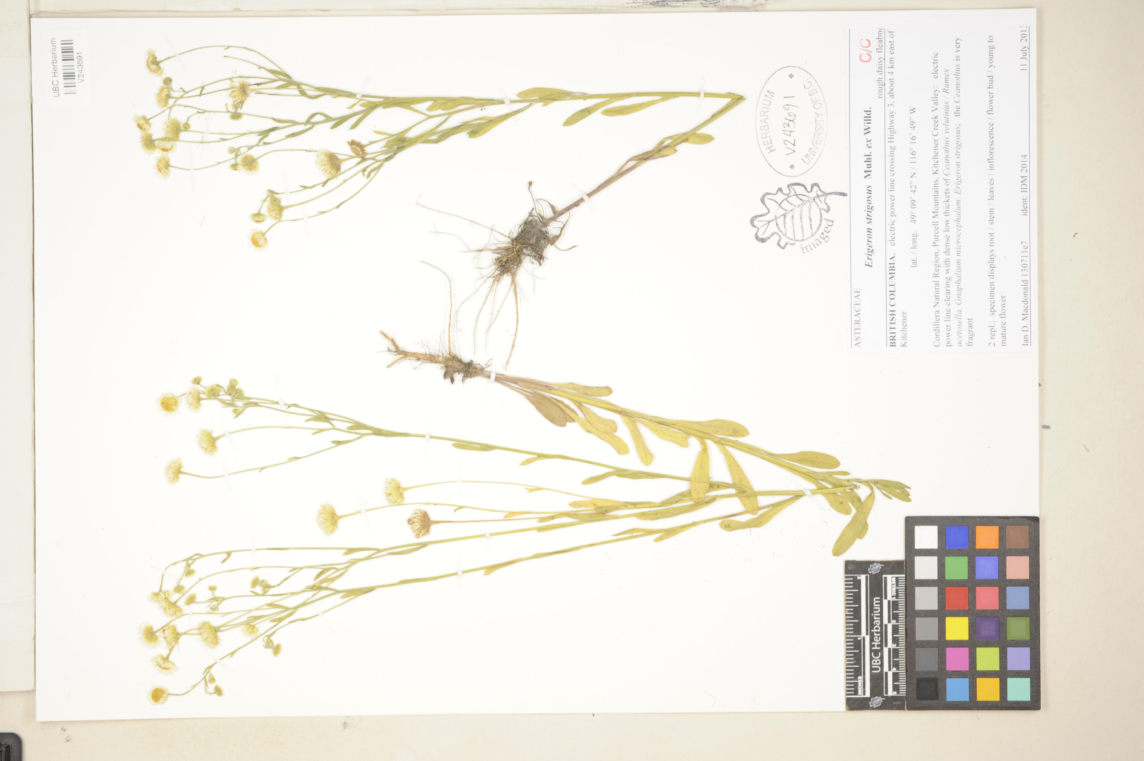
 | Asteraceae 27. Erigeron strigosus Muhl. ex Willd.Canada, British Columbia: Cordillera Natural Region, Purcell Mountains, Kitchener Creek Valley, electric power line crossing Highway 3, about 4 km east of Kitchener. 49.161667°, -116.28027°. Electric power line clearing with dense low thickets of Ceanothus velutinus, Rumex acetosella, Gnaphalium microcephalum, Erigeron strigosus. Rough daisy fleabane, the Ceanothus is very fragrant, 2 replicates; specimen displays root, stems, leaves, inflorescence, flower bud, young to mature flower. UBC: V243691 Ian D. Macdonald 1307110000000Jul 11, 2013 |  V243691.jpg |
 | Asteraceae 28. Erigeron strigosus Muhl. ex Willd. ssp. septentrionalis (Fernald & Wiegand) Wagenitz= Erigeron strigosus Muhl. ex Willd. var. septentrionalis (Fernald & Wiegand) Fernald U.S.A., Idaho, Idaho County: Nez Perce National Forest: Selway River Drainage: Forest Road 470/286 to Kooskia, ca 20 air mi ESE of Kooskia. Elev. 4417 ft. 46° 6.661\' N, 115° 39.616\' W Seep. ID: 191355; ID196893 Georgia G. Thomas 1987Aug 8, 2013 |  ID196893.jpg |
 | Asteraceae 29. Erigeron strigosus Muhl. ex Willd.U.S.A., Idaho, Idaho County: Clearwater National ForestL Selway-Bitterroot Wilderness: Lochsa River Drainage: Wilderness Gateway Trail Head: ca 3 mi on Pack Trail 211 to Stanley Hot Springs, ca 36 air mi ENE of Kooskia. Elev. 3238 ft. 46° 19.339\' N, 115° 16.78\' W Mixed conifer forest, hillside. ID: 191352; ID196890 Georgia G. Thomas 2214Aug 10, 2013 |  ID196890.jpg |
 | Asteraceae 30. Erigeron strigosus Muhl. ex Willd.United States, Washington, Thurston: Scatter Creek Wildlife Area South Unit, NW of central oak woodland. Gravelly sandy loam. 46.82945°, -123.02168°. Mounded prairie. Associated taxa: Solidago canadensis, Erigeron speciosus, Festuca roemeri, Arrhenatherum elatius, Leucanthemum vulgaris. Petals white, disc yellow. Uncommon. https://intermountainbiota.org WS: 388634 Regina Johnson 2013-135Sep 20, 2013 |
 | Asteraceae 31. Erigeron strigosus Muhl. var. septentrionalis (Fern. & Wieg.) Fern.U.S.A., Washington, Cowlitz County: Mount St. Helens National Monument. 46.206376°, -122.27667°. Datum: WGS 84. Coordinate uncertainty: 22300 meters. Georeferenced by Joseph Stormer. Coordinate Source: Digital Map. Roadside near tunnel. Slender, looks like chamomile or English daisy/aster. White/yellow disk flowers; small, narrow petals. Reproductive state: Flowers. Origin: Introduced. Angelica Velazquez 2012-020Aug 9, 2012WTU: 389222; WTU-V-045138 |  WTU-V-045138.jpg |
 | Asteraceae 32. Erigeron strigosus Muhl.U.S.A., Washington, Pend Oreille County: Colville National Forest. Dry Canyon Road. Approximately 3 kilometers from intersection with Sullivan Lake Road. Elev. 850 m. 48.74242° N, 117.337° W Datum: WGS 84. Coordinate uncertainty: 100 meters. Georeferenced by Maria Yousoufian. Coordinate Source: Digital map. Small pond surrounded by Pseudotsuga menziesii and Thuja plicata overstory. Reproductive state: Flowers. Origin: Native. John Bassett 12Jul 20, 2012WTU: 408037; WTU-V-021269 |  WTU-V-021269.jpg |
 | Asteraceae 33. Erigeron strigosus Muhl.U.S.A., Washington, Pend Oreille County: Colville National Forest. Slate Creek, 5 miles from State Route 31 along Forest Road 3155. At 5 mile marker. Elev. 3420 ft. 48.95624° N, 117.23444° W Datum: WGS 84. Coordinate uncertainty: 300 meters. Georeferenced by Jim Duemmel. Coordinate Source: Digital Map. Roadside, open slope and wooded slope meadow and mixed coniferous forest. Rays pink. Reproductive state: Flowers. Origin: Native. Laura Frost 24Jul 20, 2012WTU: 408034; WTU-V-021266 |  WTU-V-021266.jpg |
 | Asteraceae 34. Erigeron strigosus Muhl. ex Willd.United States, Washington, Pend Oreille: Colville National Forest. Dry Canyon Road. Approximately 3 kilometers from intersection with Sullivan Lake Road. 48.74242°, -117.337°. Small pond. Associated taxa: Pseudotsuga menziesii and Thuja plicata overstory. Datum: WGS 84; Source: Digital map. https://intermountainbiota.org WS: 391016 John Bassett 12Jul 20, 2012 |
 | Asteraceae 35. Erigeron strigosus Muhl. ex Willd.United States, Washington, Pend Oreille: Colville National Forest. Slate Creek, 5 miles from State Route 31 along Forest Road 3155. At 5 mile marker. 48.95624°, -117.23444°. Roadside, open slope and wooded slope meadow and mixed coniferous forest. Rays pink. https://intermountainbiota.org WS: 391014 Laura Frost 24Jul 20, 2012 |
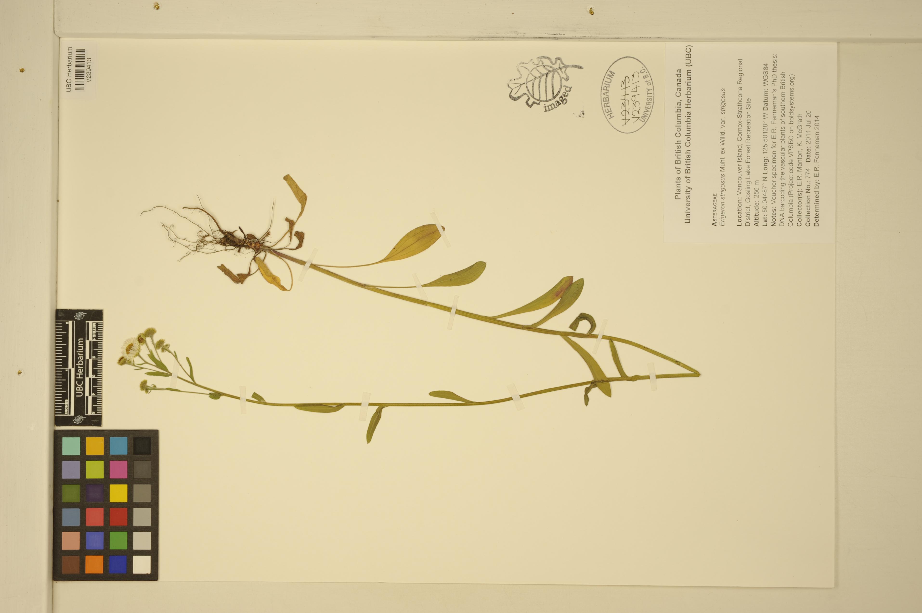
 | Asteraceae 36. Erigeron strigosus Muhl. ex Willd. var. strigosus Canada, British Columbia: Vancouver Island, Comox-Strathcona Regional District, Gosling Lake Forest Recreation Site. Elev. 256 m 50.04487°, -125.50128°. Voucher specimen for E.R. Fenneman\'s PhD thesis: DNA barcoding the vascular plants of southern British Columbia (Project code VPSBC on boldsystems.org) UBC: V239413 Erin R. Manton | K. McGrath 774Jul 20, 2011 |  V239413.jpg |
 | Asteraceae 37. Erigeron strigosus Muhl. ex Willd. var. strigosus U.S.A., Idaho, Power County: Massacre Rocks BLM land N of Snake River between parking area and All American Wall. Elev. 4440 ft. 42.67906° N, 113.01378° W; T 9 S, R 29 E, S 1 NW Sandy SW facing slope from valley bottom to basalt rim. Much loose, open sand. Scattered Juniper, big sage, and rabbitbrush, abundant cheatgrass. Numerous, narrow, pale purple rays. Heads ~solitary. Pappus of ray flowers lacking capillary bristles, a ring of short bristles only. Yellow disk flowers with capillary bristles slightly shorter than corolla, plus ring of short bristles at base. Common above rim on flats. Full bloom over past week. Reproductive state: Flowers. SRP: 32363 C.F. Williams 2010-0087Jun 13, 2010 |  SRP032363.jpg |
 | Asteraceae 38. Erigeron strigosus Muhl. ex Willd. var. strigosus U.S.A., Idaho, Power County: Massacre Rocks. BLM land N of Snake River between parking area and All American Wall. Elev. 4440 ft. 42.67906° N, 113.01378° W; T9S R29E S1 NW 1/4 Datum: WGS 84. Coordinate uncertainty: 100 meters. Coordinate Source: Garmin eTrex Vista. Sandy SW facing slope from valley bottom to basalt rim. Much loose, open sand. Scattered Juniper, big sage, and rabbitbrush, abundant cheatgrass. Numerous, narrow, pale purple rays. Heads ~solitary. Pappus of ray flowers lacking capillary bristles, a ring of short bristles only. Yellow disk flowers with capillary bristles slightly shorter than corolla, plus ring of short bristles at base. Full bloom over past week. Common above rim on flats. Reproductive state: Flowers. Charles F. Williams 2010-0087Jun 13, 2010IDS: 2012.005; IDS0068829 |  IDS0068829.jpg |
 | Asteraceae 39. Erigeron strigosus Muhl. var. septentrionalis (Fern. & Wieg.) Fern.U.S.A., Wisconsin, Waushara County: County Road V, east Hancock. 44.13383°, -89.449363°. Datum: WGS 84. Coordinate uncertainty: 3742 meters. Georeferenced by Maria Yousoufian. Coordinate Source: Digital Map. Roadside, sandy soil. Reproductive state: Flowers and Fruits. Origin: Native. Clayton Haberman s.n.Jul 6, 2010WTU: 402073; WTU-V-010093 |  WTU-V-010093.jpg |
 | Asteraceae 40. Erigeron strigosus Muhl. ex Willd.U.S.A., Oregon, Multnomah County: North Portland, Smith and Bybee Wetlands Natural Area; Sandy Waste Elev. 5 m. 45.62011° N, 122.731043° W Coordinate Source: Specimen Label. Sandy Waste Disk Flowers, Long Pappus, Ray Flowers, Pappus Wanting Reproductive state: Flowers. Origin: Introduced. HPSU: 15721 Erin Riggs 251Aug 2010 |  HPSU_015721.jpg |
 | Asteraceae 41. Erigeron strigosus Muhl. ex Willd.United States, South Dakota, Pennington: Black Hills: W of Pine Grove Road on east boundary of Black Hills National Forest, ca 3 miles SE of Rockerville. T1S R7E S31 SE4 NW4. Elev. 4160 ft 43.920421°, -103.33219°. Datum: WGS84. Georeferenced by Fertig. Limestone outcrop and cliffs in Quercus macrocarpa-Pinus ponderosa-Populus tremuloides forest with understory of Rubus idaeus & Solidago canadensis. HerbariumSpecimenDuplicate: Erigeron strigosus | herbariumSpecimenDuplicate: Pellaea gastonyi https://intermountainbiota.org WS: 407943; WS030792 Walter Fertig 26301Oct 13, 2010With Roger Hoverman |  WS030792.JPG |
 | Asteraceae 42. Erigeron strigosus Muhl. ex Willd.Poland, Opole, Nysa: Sidzina. ATPOL square: DF 79 Elev. 220 m. 50° N, 19° 51\' E Sandy grassland Reproductive state: Flowers. SRP: 44889 M. Wayda s.n.Jul 27, 2009 |  SRP044889.jpg |
 | Asteraceae 43. Erigeron strigosus Muhl. ex Willd.U.S.A., Idaho, Latah County: Rock Creek Road, 1.6 miles south from Davis Road intersection. Elev. 3540 ft. 46° 50\' 9.77" N, 116° 52\' 37.42" W Open field that was used as a pasture in the 1980s. Associated species: Pinus ponderosa, Rumex acetosella, Fragaria vesca, Cirsium, Phleum pratense, Verbascum thapsus. Reproductive state: Flowers. Origin: Native. ID: 151563; ID061074 Carolyn H. Ferguson 90Sep 7, 2008With Jeanne H. Hawley |  ID061074.jpg |
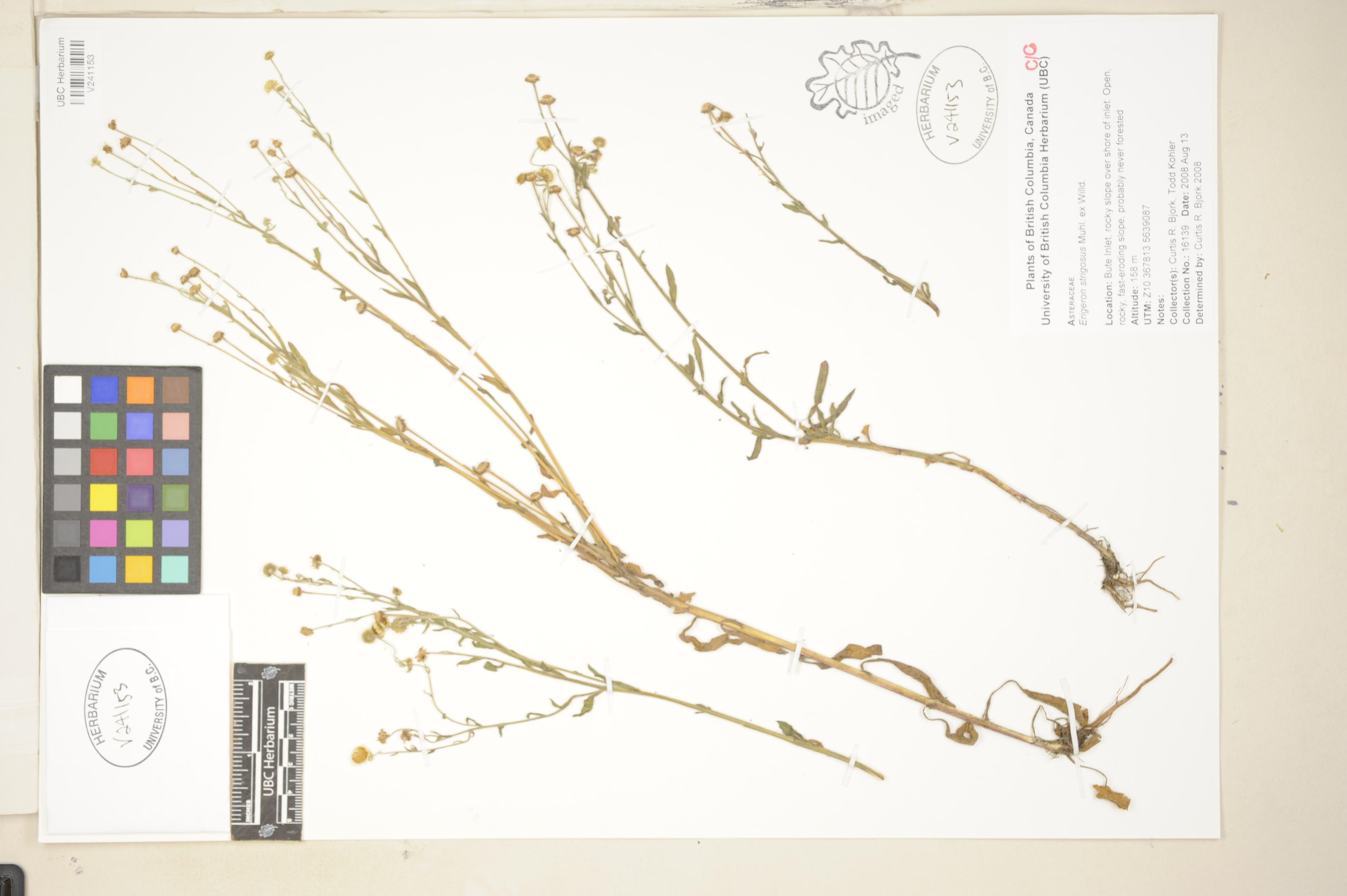
 | Asteraceae 44. Erigeron strigosus Muhl. ex Willd.Canada, British Columbia: Bute Inlet, rocky slope over shore of inlet. Elev. 158 m Open, rocky, fast-eroding slope, probably never forested. UBC: V241153 Curtis R. Bjork | Todd Kohler 16139Aug 13, 2008 |  V241153.jpg |
 | Asteraceae 45. Erigeron strigosus Muhl. ex Willd.U.S.A., Montana, Flathead County: Pleasant Valley, Lost Trail NWR. Elev. 3800 ft. 48.1892° N, 114.9677° W; T28N R27W S13 NE 1/4 Coordinate Source: USGS-website. Locally common in thin soil on a gentle south-facing slope on the north side of Pleasant Valley. With Danthonia unispicata and Eriogonum flavum. Plants of Montana Reproductive state: Flowers. MONTU: 131254 Peter Lesica 9356Jun 29, 2005 |  MONTU_131254.jpg |
 | Asteraceae 46. Erigeron strigosus Muhl. ex Willd.U.S.A., Montana, Flathead County: Dahl Lake, Lost Trail NWR; 1 mile northwest of. Elev. 3850 ft. 48.1892° N, 114.8634° W; T28N R26W S14 SE 1/4 Coordinate Source: TRS-website. One colony along a road in cut-over ponderosa pine forest. With Agropyron repens and Antennaria rosea. Reproductive state: Flowers. MONTU: 131096 Peter Lesica 9266Jun 27, 2005 |  MONTU_131096.jpg |
 | Asteraceae 47. Erigeron strigosus Muhl.U.S.A., Wisconsin, Waushara County: North shore Pine Lake, Hancock. 44.132544°, -89.509792°. Datum: WGS 84. Coordinate uncertainty: 667 meters. Georeferenced by Maria Yousoufian. Coordinate Source: Digital Map. Upper sandy beach. Reproductive state: Flowers. Origin: Native. Clayton Haberman s.n.Jul 3, 2005WTU: 402069; WTU-V-010089 |  WTU-V-010089.jpg |
 | Asteraceae 48. Erigeron strigosus Muhl. ex Willd.United States, Florida: Lee County, ca. 5 miles east of junction of highway 78 & 31 on highway 78, area between Highway. 78 (North River Road) and the Caloosahatchee River. Elev. 15 m 26.723056°, -81.680278°. In disturbed areas, sandy soil. Daisy Fleabane. Herb. etc. (see label) UBC: V219750 Helen Kennedy 5586Mar 12, 2003 |
 | Asteraceae 49. Erigeron strigosus Muhl. ex Willd.U.S.A., Washington, Chelan County: Meadow Creek at Lake Chelan. 48° 12\' 34" N, 120° 33\' 44" W; T31N R18E S2 South and southwest-facing slopes with annual grasses and Crupina vulgaris. Reproductive state: Flowers & Fruits. BLMMD: 767 C.T. Roche s.n.Jul 25, 2001With R.C. Korfhage |  BLMMD00767.jpg |
 | Asteraceae 50. Erigeron strigosus Muhl. ex Willd.U.S.A., Kentucky, Rowan County: Forest Twp. At old gravel quarry along Rt. 1274 across from T. McKinney Rd., west of Rt. 519. Common. Rays white, disks yellow. SRP: 66126 Michael A. Vincent 9567Jul 3, 2001With J. Thieret, W. Vincent |  SRP066126.jpg |


