Terrain
Road Map
Satellite
Hybrid
Terrain
 | Betulaceae 1. Alnus alnobetula (Ehrh.) K. Koch ssp. sinuata (Regel) RausU.S.A., Washington, Pierce County: Mount Rainier National Park. Glacier Basin area. Unnamed peak 6706 on ridge north of Mount Ruth. Elev. 2043 m. 46.88441° N, 121.69225° W Datum: WGS 84. Coordinate uncertainty: 100 meters. Coordinate Source: GPS. North-south running, narrow, exposed ridge with scattered Pinus albicaulis and with Eriogonum pyrolifolium, Carex phaeocephala, Carex scopulorum, and Penstemon davidsonii common. Uncommon along wind-swept ridgeline; shrubs to 1.5 m tall. Reproductive state: Cones. Origin: Native. David Giblin 10007Aug 27, 2024With Payton Danosky, Winston Hackett WTU: MORA-01332 MORA 30012 |
 | Betulaceae 2. Alnus alnobetula (Ehrh.) K. Koch ssp. sinuata (Regel) RausU.S.A., Washington, Pierce County: Mount Rainier National Park. Glacier Basin area. Unnamed peak 6706 on ridge north of Mount Ruth. Elev. 2043 m. 46.88441° N, 121.69225° W Datum: WGS 84. Coordinate uncertainty: 100 meters. Coordinate Source: GPS. North-south running, narrow, exposed ridge with scattered Pinus albicaulis and with Eriogonum pyrolifolium, Carex phaeocephala, Carex scopulorum, and Penstemon davidsonii common. Uncommon along wind-swept ridgeline; shrubs to 1.5 m tall. Reproductive state: Cones. Origin: Native. MORA-01332 MORA 30011 David Giblin 10007Aug 27, 2024With Payton Danosky, Winston Hackett |
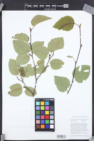
 | Betulaceae 3. Alnus alnobetula (Ehrh.) K. Koch ssp. sinuata (Regel) RausUnited States, Oregon, Union: Umatilla National Forest, Andies Prairie Sno-Park NF-3728. Elev. 1,610.3 m Datum: WGS84. Edge of wetland/bog in heavily wooded area. https://oregonflora.org OSC-V-271976 Makenna Lawson 14Jun 28, 2023 |  OSC-V-271976.jpg |
 | Betulaceae 4. Alnus alnobetula (Ehrh.) K. Koch ssp. sinuata (Regel) RausU.S.A., Washington, San Juan County: Blakely Island. 48.58737° N, 122.80942° W Datum: WGS84. Coordinate Source: GPS. Several trees along shoreline, with Pseudotsuga menziesii, Thuja plicata, Gaultheria shallon, Holodiscus discolor, Salix scouleriana. Reproductive state: Flowering. Origin: Native. Peter Dunwiddie PWD-21-50May 21, 2021With Peter Zika WTU: 461409; WTU-V-117897 |  WTU-V-117897.jpg |
 | Betulaceae 5. Alnus alnobetula (Ehrh.) K. Koch p.p.U.S.A., Montana, Powell County: West of MacDonald Pass, off of US Hwy 12, ca. 4 km east of Elliston, ca. 20 m south of Dog Creek. Elev. 1594 m. 46° 33.94\' N, 112° 22.452\' W Riparian. (Coordinates +-5 meters) Tree like shrub, ca. 3.5 m tall, grey stems; common. Rebecca Snow 7Jun 13, 2021With Neil Snow MONTU: 170252; MONTU000401 |  MONTU000401.jpg |
 | Betulaceae 6. = Alnus alnobetula (Ehrh.) K. Koch ssp. sinuata (Regel) RausU.S.A., Idaho, Adams County: Forest Road 593 from intersection with FR 206. Elev. 1917 m. 44.62654° N, 116.22128° W Datum: WGS 84. Coordinate uncertainty: 6 meters. Coordinate Source: GPS. Mixed conifer forest, Picea, Abies, Pinus contorta with open areas and thickets of Alnus, Prunus emarginata. Shrub to 3 m tall. Reproductive state: Flowers. IDS: 2019.17; IDS0074577 James F. Smith 16063Jun 18, 2019 |  IDS0074577.jpg |
 | Betulaceae 7. Alnus alnobetula (Ehrh.) K. Koch ssp. sinuata (Regel) RausUnited States, Idaho, Valley: Boise National Forest. 0.5 mile on small road north of Forest Service Road 579 toward Bernard Mt. Hike from road to Bernard Mt. Elev. 7248 ft. 44.43019°, -115.49877°. Datum: WGS 84. Coordinate Source: Specimen Label. HerbariumSpecimenDuplicate: Alnus alnobetula ssp. sinuata. https://oregonflora.org OSC-V-269512 Don H. Mansfield 17258Jul 7, 2017With B. Corbin, A. Simerlink |  OSC-V-269512.jpg |
 | Betulaceae 8. Alnus alnobetula (Ehrh.) K. KochUnited States, Washington, King: 124th Avenue NE, N of Main Street, 2.6 air km WNW of Larsen Lake, Bellevue. 47.6104 degrees N, 122.175 degrees W. Elev. 60 m 47.6104°, -122.175°. HerbariumSpecimenDuplicate: Alnus alnobetula ssp. sinuata. 4 m tall shrubs, leaves singly-serrate except at tips of vigorous sterile shoots, where doubly-serrate. https://oregonflora.org OSC-V-260338 Peter F. Zika 27854Jun 4, 2016With E. Alverson |  OSC-V-260338_lg.jpg |
 | Betulaceae 9. Alnus alnobetula (Ehrh.) K. Koch p.p.Canada, Newfoundland: L\'Anse-aux-Meadows. Reproductive state: Fruits. Origin: Native. WTU: 401162; WTU-V-8545 Clayton Haberman s.n.Sep 20, 2003 |  WTU-V-8545.jpg |
 | Betulaceae 10. Alnus alnobetula (Ehrh.) K. KochAustria, Steiermark: Sudostliches Alpenvorland, Oststeirisches Hugelland, ostliche Umgebung von Graz. Elev. 550-580 m Lucken und Rander von Fagus silvatica - Pinus sylvestris - Mischbestanden. Drescher A. 2002: Dupla plantarum vascularium (2002) - Fritschiana 34: 1-26. Herbarium of the Institute of Botany, Karl-Franzens University Graz. Quadr.-Nr. 8859/3 Syn: Alnus viridis (Chaix) DC. UBC: V218936 A. Drescher s.n.Jun 30, 1997 |
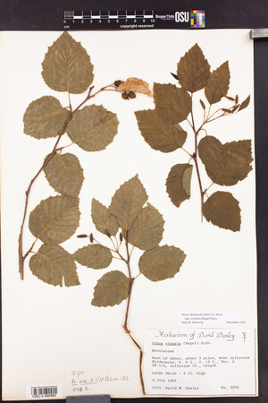
 | Betulaceae 11. Alnus alnobetula (Ehrh.) K. Koch ssp. sinuata (Regel) RausUnited States, Oregon, Jefferson: West of Abbot, about 3 miles, near Jefferson Wilderness. Large shrub - 5 ft. high. https://oregonflora.org OSC-V-265983 David M. Danley 3276Jul 3, 1991 |  OSC-V-265983_lg.jpg |
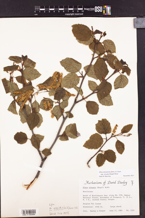
 | Betulaceae 12. Alnus alnobetula (Ehrh.) K. Koch ssp. sinuata (Regel) RausUnited States, Oregon, Jackson: North of Huckleberry Gap, along Rd. #30, Umpqua National Forest, Northwest of Prospect. Elev. 4740 ft. Douglas fir forest. Large shrub. https://oregonflora.org OSC-V-265984 David M. Danley 2351Jun 17, 1985With Cooper |  OSC-V-265984_lg.jpg |
 | Betulaceae 13. Alnus alnobetula (Ehrh.) K. Koch ssp. sinuata (Regel) RausU.S.A., Washington, Pierce County: North Side Of North Puyallup Bridge At North Puyallup Camp [Mount Rainier National Park] Elev. 3500 ft. 46.847066°, -121.86929°. Datum: WGS 84. Coordinate uncertainty: 200 meters. Georeferenced by Arnie Peterson. Coordinate Source: Digital Map. Woody Stem With Oval Serrated Leaves And Catkins; : Verbatim name provided: Alnus __ __sinuata. Reproductive state: Fruits. MORA-00299; MORA 22664 A.C. Rush Aug 27, 1977 |  MORA022664.jpg |
 | Betulaceae 14. Alnus alnobetula (Ehrh.) K. Koch ssp. sinuata (Regel) RausU.S.A., Washington, Lewis County: Head Of Stevens Canyon [Mount Rainier National Park] Elev. 4600 ft. 46.783279°, -121.70185°. Datum: WGS 84. Coordinate uncertainty: 800 meters. Georeferenced by Arnie Peterson. Coordinate Source: Digital Map. 2 Specimens: Stems, Leaves, 13 Immature Female Cones. Includes Collector\'s Original Notes On NPS Vegetative Type Map Label. : Verbatim name provided: Alnus __ __viridis __(Chaix) DC __ __sinuata __(Rogel) A Love & D Love. Reproductive state: Fruits. MORA-00047; MORA 4905 H.E. Bailey Aug 12, 1935 |  MORA004905.jpg |
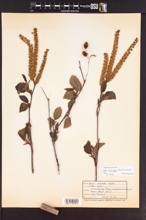
 | Betulaceae 15. Alnus alnobetula (Ehrh.) K. Koch ssp. sinuata (Regel) RausU.S.A., Washington, Pierce County: West River Trail [Longmire, Mount Rainier National Park] 46.752605°, -121.80548°. Datum: WGS 84. Coordinate uncertainty: 800 meters. Georeferenced by Arnie Peterson. Coordinate Source: Digital Map. West River Trail 1 Specimen: Stem, Leaf Buds, 3 Male Catkins. : Verbatim name provided: Alnus sinuata (Regel) Rydb.. Reproductive state: Flowers. MORA-00044; MORA 4903 C. Frank Brockman Apr 28, 1934 |  MORA004903.jpg |
 | Betulaceae 16. Alnus alnobetula (Ehrh.) K. Koch ssp. sinuata (Regel) RausU.S.A., Washington, Pierce County: West River Trail [Longmire, Mount Rainier National Park] 46.752605°, -121.80548°. Datum: WGS 84. Coordinate uncertainty: 800 meters. Georeferenced by Arnie Peterson. Coordinate Source: Digital Map. 1 Specimen: Stem, Leaf Buds, 3 Male Catkins. : Verbatim name provided: Alnus sinuata (Regel) Rydb.. Reproductive state: Flowers. MORA-00044; MORA 4904 C. Frank Brockman Apr 28, 1934 |  MORA004904.jpg |
 | Betulaceae 17. Alnus alnobetula (Ehrh.) K. Koch ssp. sinuata (Regel) RausU.S.A., Washington, Pierce County: West River Trail, Longmire [Mount Rainier National Park] Elev. 2700 ft. 46.751212°, -121.80655°. Datum: WGS 84. Coordinate uncertainty: 500 meters. Georeferenced by Arnie Peterson. Coordinate Source: Digital Map. 1 Specimen: Stem, Leaf Buds And Leaves, 2 Male Catkins. : Verbatim name provided: Alnus sinuata (Regel) Rydb.. Reproductive state: Flowers. MORA-00044; MORA 4907 C. Frank Brockman Apr 28, 1934 |  MORA004907.jpg |
 | Betulaceae 18. Alnus alnobetula (Ehrh.) K. Koch ssp. sinuata (Regel) RausU.S.A., Washington, Pierce County: (locality not given). Elev. 2000-4000 ft. Chiefly along streams and water courses 1 Specimen: Stem, Leaves, 3 Female Catkins. : Verbatim name provided: Alnus sinuata (Regel) Rydb.. Reproductive state: Flowers. MORA-00044; MORA 4901 C. Frank Brockman 1929 |  MORA004901.jpg |
 | Betulaceae 19. Alnus alnobetula (Ehrh.) K. Koch ssp. sinuata (Regel) RausU.S.A., Washington, Pierce County: (locality not given). Elev. 2000-4000 ft. Moist situations, generally along streams 1 Specimen: Stem, Leaves, 2 Male Catkins. : Verbatim name provided: Alnus sinuata (Regel) Rydb.. Reproductive state: Flowers. MORA-00044; MORA 4902 C. Frank Brockman 1929 |  MORA004902.jpg |
 | Betulaceae 20. Alnus alnobetula (Ehrh.) K. Koch ssp. sinuata (Regel) RausU.S.A., Washington, Pierce County: Near Glacier Bridge [Mount Rainier National Park] Elev. 4000 ft. 46.782166°, -121.76283°. Datum: WGS 84. Coordinate uncertainty: 1000 meters. Georeferenced by Arnie Peterson. Coordinate Source: Digital Map. 1 Specimen: Stem, Leaves, 2 Male Catkins. : Verbatim name provided: Alnus sinuata (Regel) Rydb.. Reproductive state: Flowers. MORA-00044; MORA 4906 C. Frank Brockman 1929 |  MORA004906.jpg |
 | Betulaceae 21. Alnus alnobetula (Ehrh.) K. Koch p.p. var. stenophylla H. Winkl.U.S.A., Montana: Emigrant Gulch. Elev. 2286 m. Syntype. Origin: N. NY: 00253876 P. A. Rydberg Aug 23, 1897With Ernst A. Bessey TYPE STATUS: syntype. |
 | Betulaceae 22. Alnus alnobetula (Ehrh.) K. Koch p.p. var. stenophylla H. Winkl.U.S.A., Washington: Cedar Mountains, Latah County. In gulches through which mountains streams flow. Isosyntype. Origin: N. NY: 00253875 A. D. E. Elmer May 1897TYPE STATUS: isosyntype. |
 | Betulaceae 23. Alnus alnobetula (Ehrh.) K. Koch p.p. var. stenophylla H. Winkl.U.S.A., Idaho: (locality not given). On streams. Isosyntype. Origin: N. NY: 00253877 A. D. E. Elmer Aug 8, 1896TYPE STATUS: isosyntype. |
 | Betulaceae 24. Alnus alnobetula (Ehrh.) K. Koch p.p. var. stenophylla H. Winkl.U.S.A., Idaho, Latah County: Cedar Mountain. In shady woods. Isosyntype. Origin: N. NY: 00253874 J. H. Sandberg Jul 17, 1892With D. T. MacDougal & A. A. Heller TYPE STATUS: isosyntype. |
 | Betulaceae 25. Alnus alnobetula (Ehrh.) K. KochUnited States, Oregon: (locality not given). https://oregonflora.org OSC-V-267919 |  OSC-V-267919_lg.jpg |


